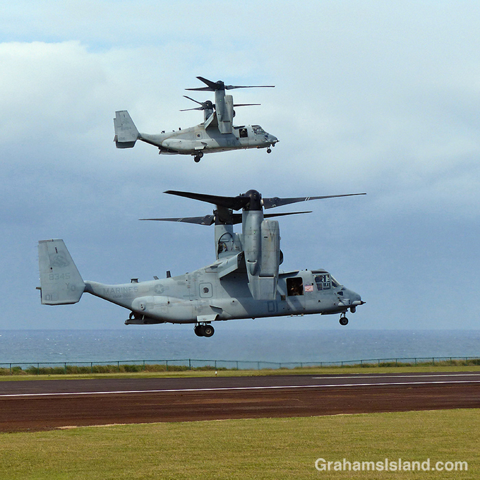
A pair of V-22 Ospreys practice takeoffs and landings at Upolu Airport.
Posted in response to Becky’s October Squares challenge theme of ‘Kind.’ See more responses here.

A pair of V-22 Ospreys practice takeoffs and landings at Upolu Airport.
Posted in response to Becky’s October Squares challenge theme of ‘Kind.’ See more responses here.
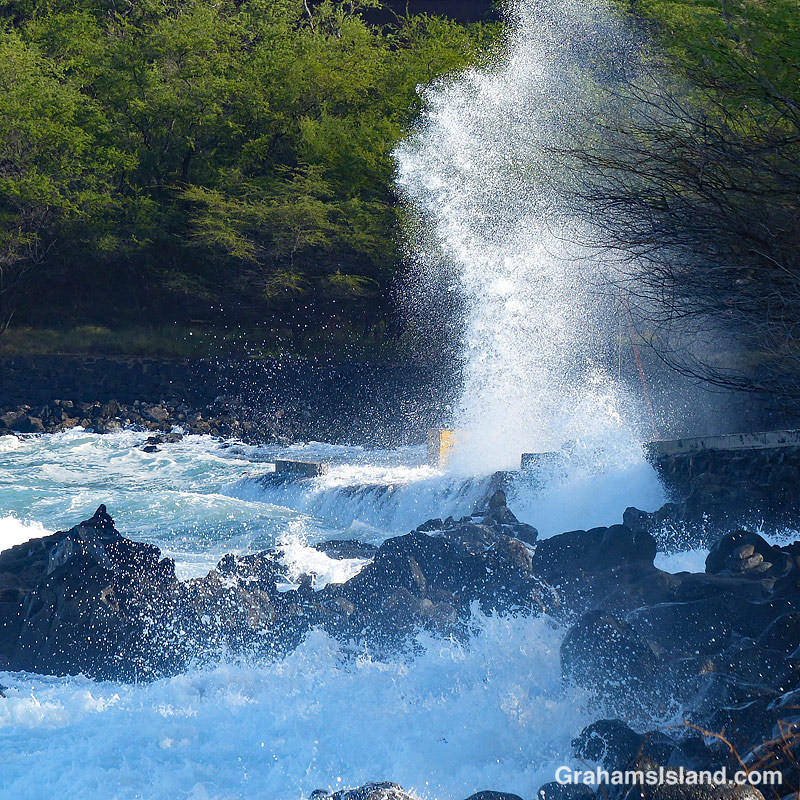
I like to go snorkeling whenever I get the opportunity, but there are some days when that’s not possible. This is a photo of my local snorkeling spot. That’s the parking area on the right, and the place where I generally park my car is right where that tower of spray is.
In other words, this was the kind of day to find something else to do, such as take photos from the shore.
Posted in response to Becky’s October Squares challenge theme of ‘Kind.’ See more responses here.

Ohelo ’Ai (Vaccinium reticulatum) is an endemic shrub also known as the Hawaiian blueberry. It’s one of several kinds of native plant adapted to the harsh environment of a volcanic island. This plant was growing on a lava flow off Saddle Road, which is typical here. It does well in disturbed ground above 2,000 feet.
The berries, which are edible, are a food source for nenes, but I really like the delicate flowers and the leaves, which start out as a matching red.
Posted in response to Becky’s October Squares challenge theme of ‘Kind.’ See more responses here.

This week’s Sunday Stills challenge theme is ‘Ochre.’ See more responses here. This is a fall color challenge, but Hawaii is short on fall colors so I’ve gone with this piece of street art in downtown Hawi. I like this kind of mosaic tile work and I’m pretty sure one of these colors must qualify as ochre.
Also posted in response to Becky’s October Squares challenge theme of ‘Kind.’ See more responses here.

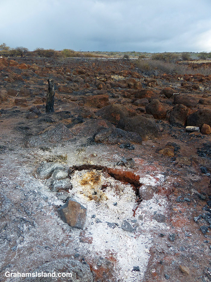
This week’s Sunday Stills challenge theme is ‘Dry.’ (See more responses here.) I posted a photo of one of the local cow pastures yesterday (here), which would have been fine for this topic, but this is another aspect of these unusually dry conditions. It makes the land susceptible to fires.
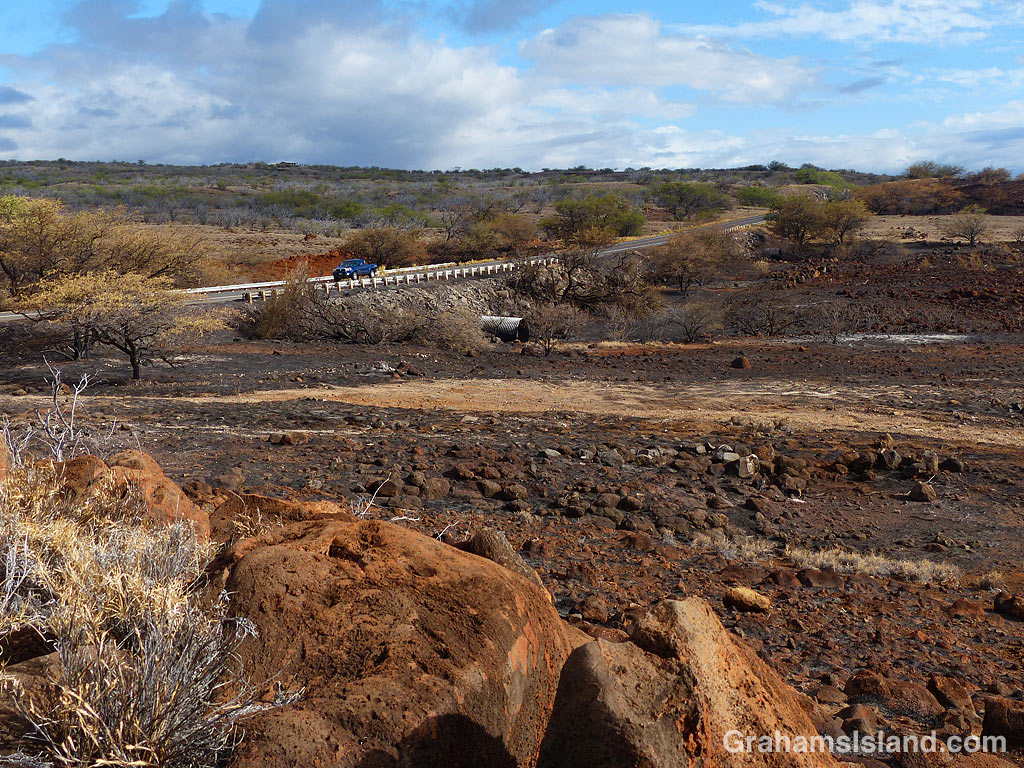
There have been a couple of fires in the area recently. The first of these was caused by someone setting fire to an abandoned vehicle, which is something of a local sport. These photos were from the aftermath of the second fire. The cause is currently unknown, but about 40 acres were burned. I took these photos a couple of days after the fire happened and there were still some small areas emitting smoke.
The top photo shows burned areas and lighter brown unburned grass. When I walked on this grass it crunched beneath my feet, it’s so dry. The second photo shows a hotspot that was still putting out puffs of smoke. The bottom photo shows burned land next to the highway. In the center of this photo, that large metal pipe is there to channel water beneath the highway. If this seems redundant in this very dry scene, bear in mind that rains in the Kohala Mountains can send flash floods down these gullies and, without pipes like this one, the road could easily be washed out.
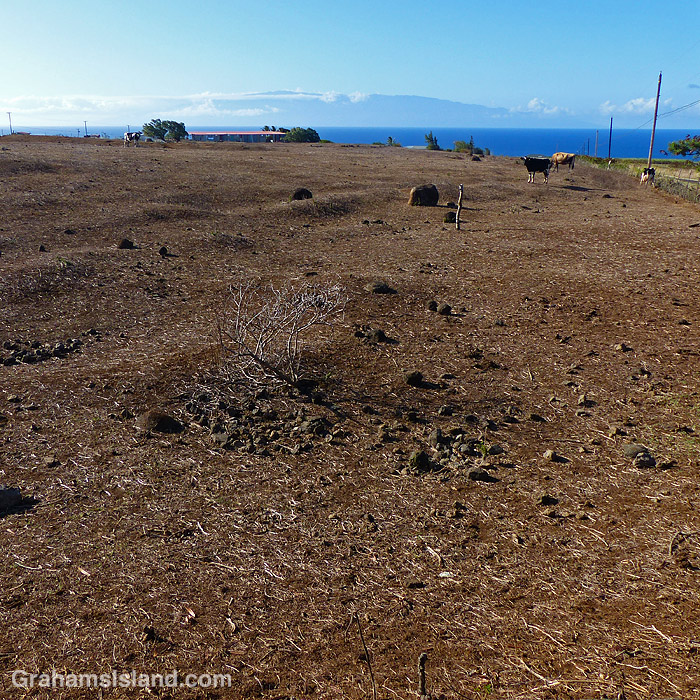
A couple of days ago I posted an image of an irrigation unit used in one of the local dairy’s fields (here). This is the same kind of field but without irrigation. There were more cows in this field than blades of grass because it’s been so dry in this part of the island.
Ironically, since I took this photo three days ago, we’ve had a couple of days of fairly solid rain and this field is already showing a tinge of green where new grass is coming through. However, the last time it was this dry, after it rained the first things to spring up were weeds which basically choked out the grass.
Posted in response to Becky’s October Squares challenge theme of ‘Kind.’ See more responses here.
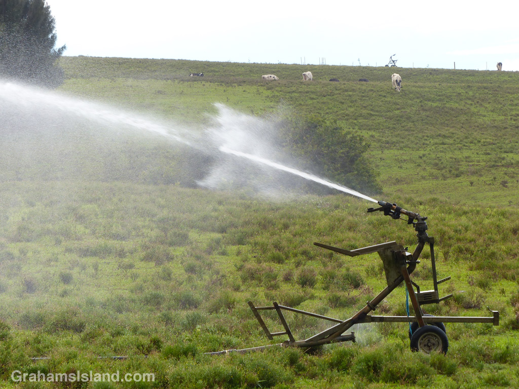
It’s been a very dry summer and fall in this part of the island. This is one of the greener fields in the area and that’s entirely due to irrigation of which this is one unit.
Posted in response to Bushboy’s Last on the Card photo challenge. See more responses here.


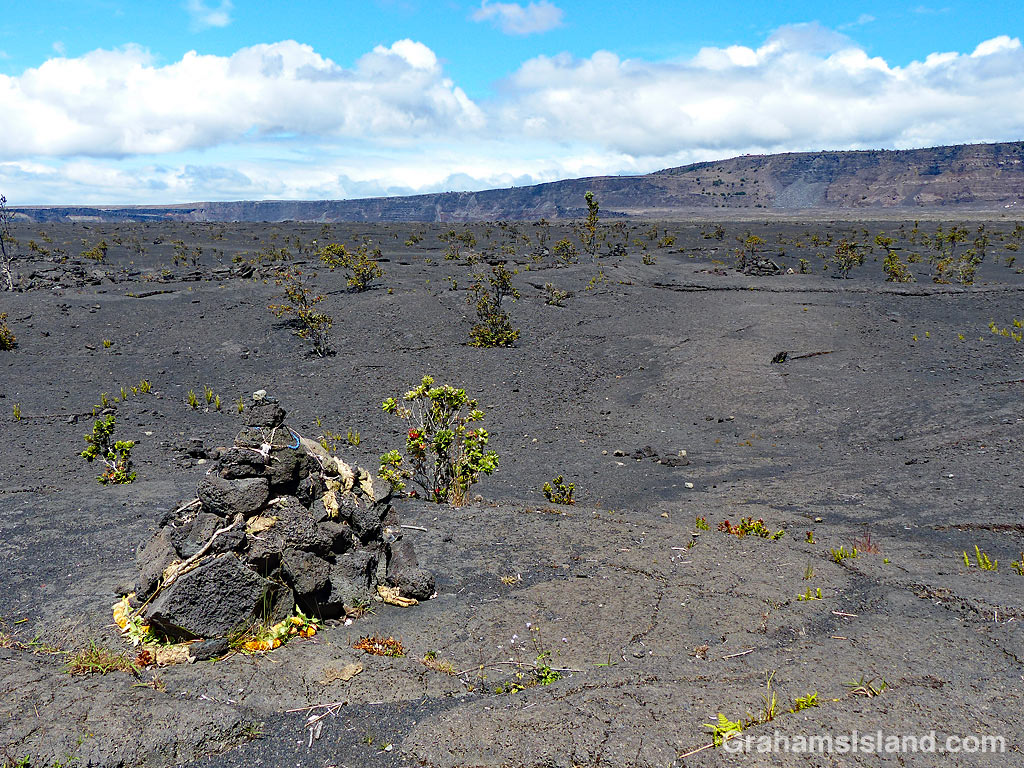
Recently, I posted a couple of photos (here) of a section of the Halema’uma’u Trail in Hawaii Volcanoes National Park. I thought I’d follow up with a few more photos of the trail, which runs from near the visitor center down to the edge of the summit caldera of Kilauea Volcano.
For more information about Hawaii Volcanoes National Park, go to nps.gov/havo/.