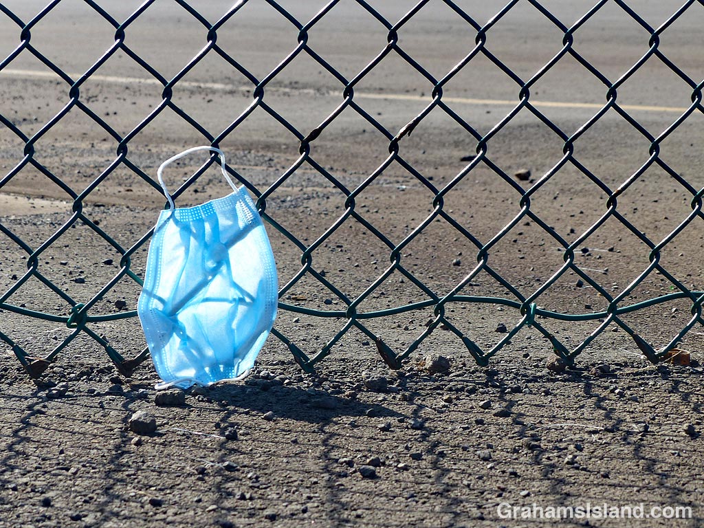
A discarded or dropped face mask is pinned to a fence by the wind, probably not an unusual sight these days.

A discarded or dropped face mask is pinned to a fence by the wind, probably not an unusual sight these days.
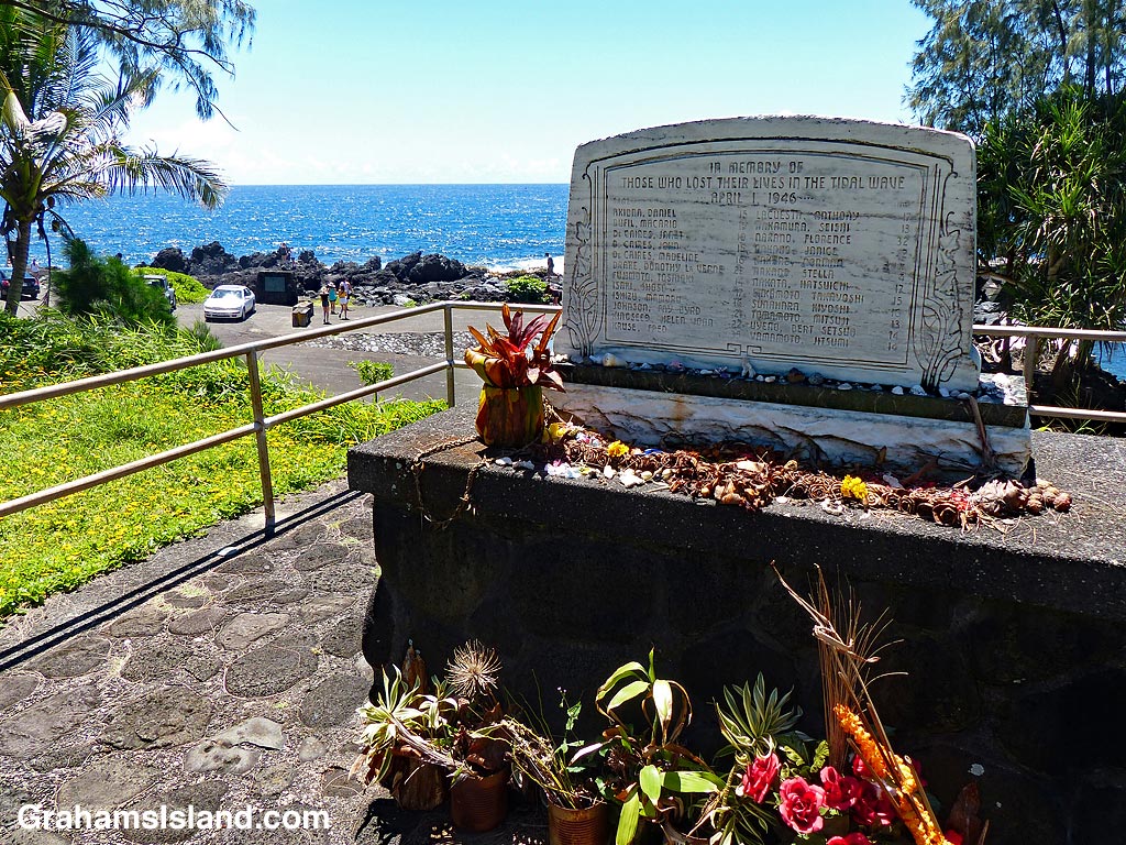
Laupahoehoe is a small community on the Hamakua Coast, 24 miles northwest of Hilo. The name means ‘leaf of lava’ and refers to the low, wedge-shaped cape of pahoehoe lava which juts into the ocean there. That cape is now the site of Laupahoehoe Point Beach Park, but in its early days, this low point of land was the thriving center of the community, with houses, shops, and a school.
On April 1, 1946, all that changed. In the early hours of the morning, there was an earthquake in the Aelutian Islands of Alaska. I’ve seen various reports of the size of that earthquake from 7.1 to 8.6. Some of these variances are due to differing scales in use. The higher numbers refer to the scale in use today, which is moment magnitude, and which more accurately reflects the energy of large earthquakes.
Regardless of the scale, the earthquake generated a huge tsunami, which roared across the Pacific at speeds up to 500 mph. The tsunami reached the east coast of the Big Island around 5 hours later and came ashore as a sequence of three giant waves. In Hilo, the receding water before the third wave, drained Hilo Bay. Then the largest, 55-foot-high wave, thundered ashore. It destroyed much of the town and killed more than a hundred people.
In Laupahoehoe, the same set of three waves occurred. The first two, somewhat smaller waves drenched people and threw fish out of the water. Students from the school were collecting these fish when the third wave struck. 21 students and three teachers were killed and the top photo shows the memorial plaque bearing their names. Only one of the bodies was recovered. Three students survived after being washed out to sea and drifting along the coast for more than a day. An account of their ordeal can be found here.
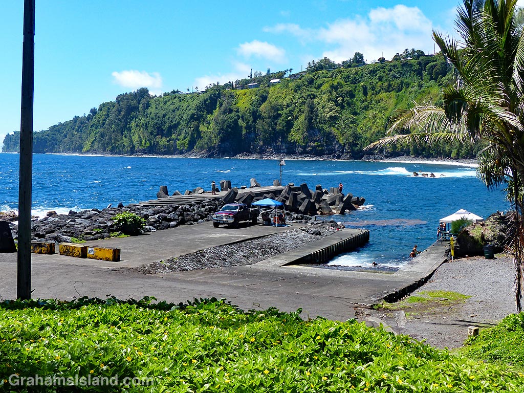
After the tsunami, the community was rebuilt up on the cliffs, which can be seen overlooking the park’s boat ramp and breakwater in the bottom photo. The park is now a peaceful spot with palm trees dotting the shoreline and an expanse of grass where kids can run. But if the tsunami siren sounds, this community has learned that there’s only one way to run, and that’s uphill.

This wild pig was rooting around in a pasture alongside old Saddle Road. I was particularly taken by the ridge of coarse hair running along her back.

The rather showy display of a heliconia colgantea at Hawaii Tropical Botanical Garden. For more information about Hawaii Tropical Botanical Garden, go to htbg.com.

This sign marks the border between Hualalai Resort and one of the public beaches there. It’s the equivalent of prescription drug warnings that taking them might turn you into a four-armed, paranoid psychopath.
Here, the dangers include man-o-wars, sharp coral, slippery rocks, sudden drop-off, dangerous shorebreak, high surf, and strong current. Oh, and there’s no lifeguard on duty. Well, no wonder, they’d have to be crazy to enter the water there.

This week’s Sunday Stills challenge theme is ‘Favorite Place.’ See more offerings here.
I could think of several places on the Big Island that would fall into the category of favorite place. Hawaii Tropical Botanical Garden, Hawaii Volcanoes National Park, Palila Forest Discovery Trail, the ocean – all these are places I return to. But the coast at Upolu is where I go for exercise and to enjoy the ever-changing scene there.
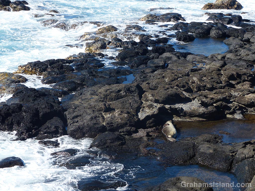
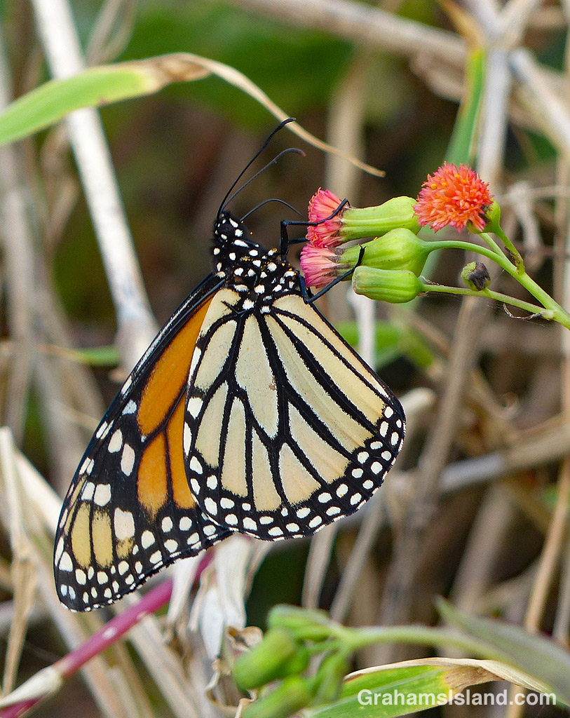
This stretch of coast features scenic high cliffs interspersed with lower areas where tide pools nestle among the rocks. Often, there’s a great view of Maui across the ʻAlenuihāhā Channel. In those waters I look for humpback whales, turtles, monk seals, and once, even a passing shark. Up in the air I might see anything from plovers to noddys to great frigatebirds. On land, there’s an assortment of birds, bugs and butterflies to be seen, as well as horses, cattle, and the occasional wild pig.
Sometimes, it’s hot and dry, but usually there’s a decent breeze, occasionally strong enough to make me lean into it while blown dirt sandblasts my legs. Sometimes, I get caught in the rain, but when I do, I’m usually dry again by the time I get back to my truck.
I’ve lived here seven years now and I never tire of going down there and looping around the fenced airstrip, wondering what I’ll see.


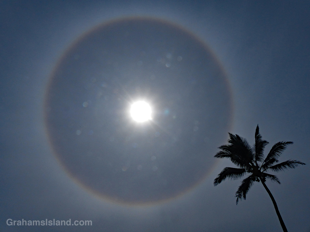
I was about to set out on one of my regular walks at Upolu, when I looked up and saw this halo around the sun. It’s the first I’ve seen here (which doesn’t mean there haven’t been others).
In days of yore, halos were considered a sign of impending bad weather. In this case, there’s some evidence to back that up. The ice crystals that cause halos are found in clouds, high in the troposphere, and these clouds are often a sign of an approaching weather front. Sure enough, the next day was fairly wet though, ironically, not in the area where I saw the halo.


I was on my way to work one morning when I noticed the sailboat in the top image. The array of white sails caught the early morning sun and stood out against the deep blue water. I pulled over, took this photo and headed on in to work.
I saw later that the boat had anchored in Kawaihae harbor, so on my way home I stopped by to check it out. The SSV Makani Olu is a three-masted staysail schooner (SSV stands for Sailing School Vessel), and is used as a training vessel for various programs run by Marimed Foundation. The boat is based at Kaneohe Bay, on the east coast of Oahu.
In the photo to the right, the boat appears to be four-masted, but that’s just because the mast of the boat behind it lined up perfectly.
For more information about SSV Makani Olu and Marimed Foundation, go to marimed.org.

