Category Archives: Places

Big Island bodies of water

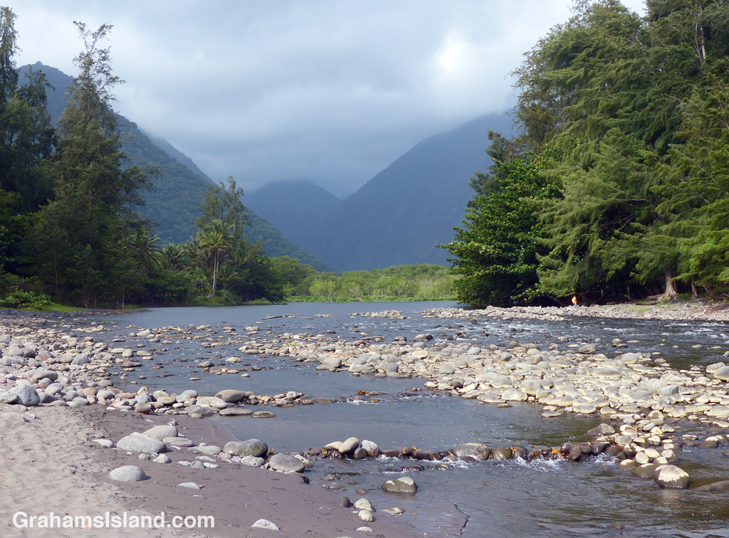
A view of Waipi'o Valley taken from the mouth of the river
Waipi’o Valley
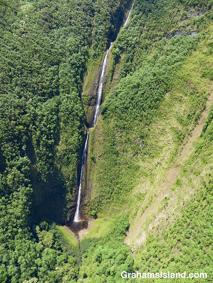
Kohala waterfall
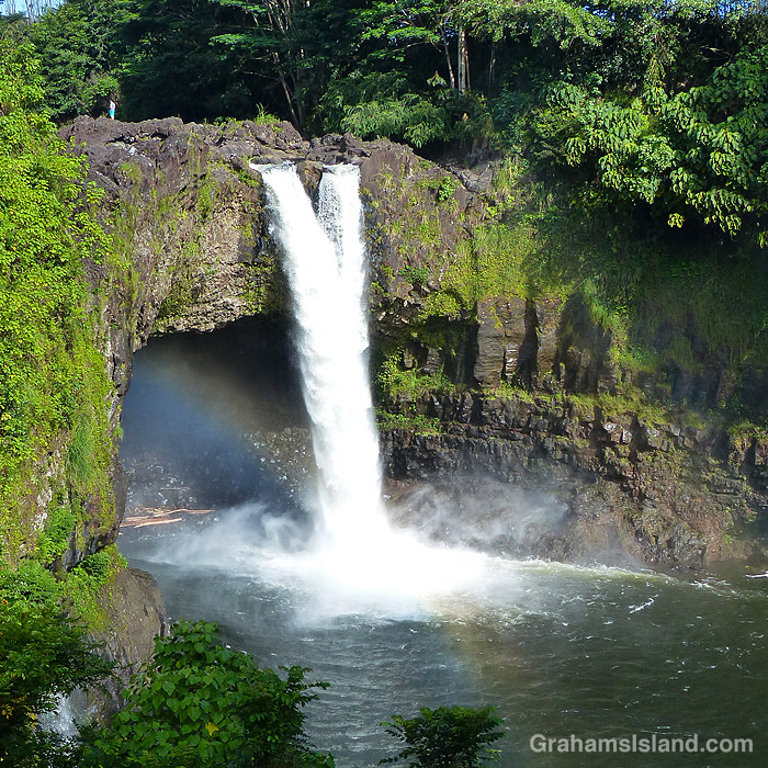
Rainbow Falls, Hilo
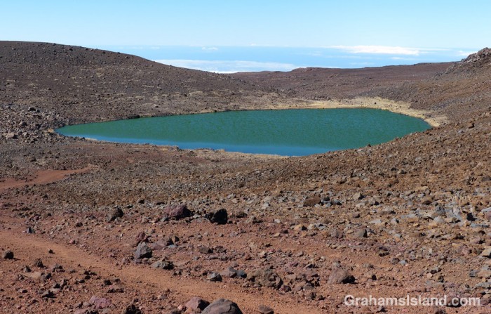
Lake Waiau.

This week’s Sunday Stills challenge theme is ‘Bodies of Water.’ (See more responses here.) Last Sunday, I posted photos of the Kohala valleys. This week, I’m posting a bit about what goes on in them and elsewhere on the island.

The top photo is shows the mouth of the Waipi’o River looking back toward the cloud shrouded Kohala hills. The river, is fed by water passing over Hi’ilawe Falls and other waterfalls deep in the fingers of the valley. Like all water courses on the Big Island, its flow is greatly increased by the often heavy rainfall.

The second photo shows a waterfall, farther down the coast, cascading into a pool at the bottom before flowing out to the ocean. Some of these waterfalls drop more than a thousand feet. Some cascade into valleys, some directly into the ocean. During dry spells, the water flows are greatly reduced and many falls, those that are entirely rain fed, disappear for a while. When rains are heavy, the water flow is so great that some falls blend together to form a sheet of falling water.

On the east side of the island is Wailuku River, the longest river on the island. This flows down to the ocean in Hilo, and on its way, tumbles over the aptly named Rainbow Falls (third photo). The falls and rainbows are best seen in the early morning. This stretch of the river is very dangerous with flash floods being common. People get swept away here every year.

Finally, the bottom photo shows the biggest lake on the island, which can be found at the top of Mauna Kea! Lake Waiau is fed by rainwater and snow melt, mostly in the winter. That it exists at all is something of a mystery. The ground on Mauna Kea is highly permeable, and it’s not fully understood what the layer is beneath Lake Waiau that enables it to retain water. Lake Waiau is not just the biggest lake on the island, it’s the only one. Green Lake, the biggest lake previously, disappeared during Kilauea’s 2018 eruption (photos and story here).

That’s a lot of bull

Recently, I stopped to take photos along Kohala Mountain Road. I was leaning against a gate when I glanced to the right and saw this rather large bull lying down in the enclosure. I took some photos, looked over again, and saw the bull stand up. It stared at me. I glanced down at the gate, wondering just how stout it was.

I finished my photo taking, snapped a couple of the bull, and retreated to my car. There’s no doubt in my mind that, should the bull feel like it, neither the fencing, nor the gate would keep it contained. Probably my car wouldn’t fare that well either.

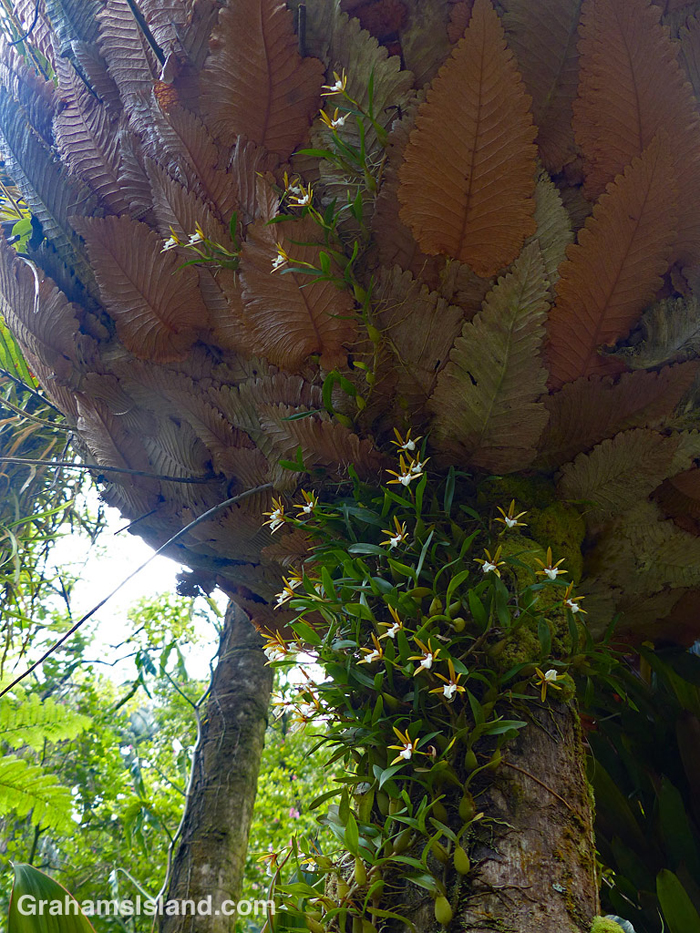
Basket fern and orchid

This drynaria rigidula ‘Whitei’ basket fern was growing on a tree trunk at Hawai’i Tropical Botanical Garden (which has since change its name). I like basket ferns, which look like upturned umbrellas. This fern was complemented by a dinema polybulbon orchid, a delicate and fragrant epiphytic orchid that was winding it’s way up into the fern.

For more information about Hawai’i Tropical Bioreserve & Garden (formerly Hawai’i Tropical Botanical Garden), go to htbg.com.

Kohala valleys

This week’s Sunday Stills challenge theme is ‘Mountains and Valleys.’ See more offerings here.

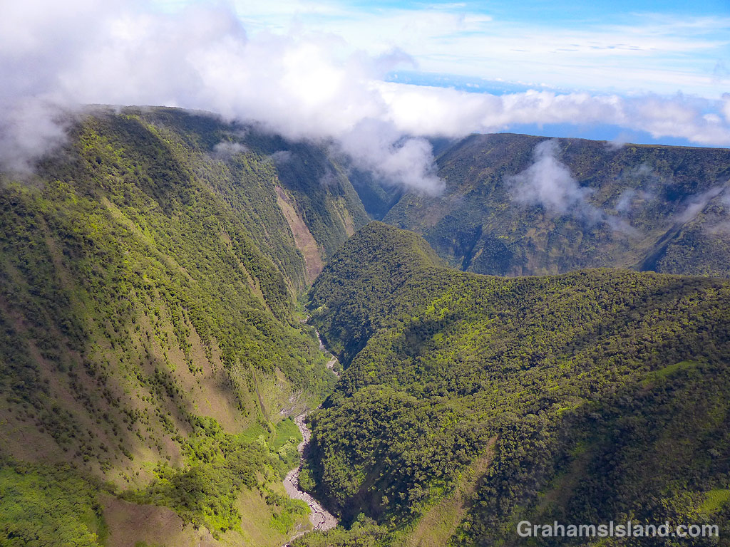
Kohala Volcano is the oldest volcano on the Big Island and has long been extinct, having last erupted around 120,000 years ago. Since then, the various processes of erosion, from rainfall to landslides, have carved deep valleys into the volcano. Waipio, the easternmost of these valleys, is accessible by vehicle (4-wheel drive only), horseback, or on foot. It has permanent inhabitants so access within the valley is restricted.

The other valleys are most easily seen from the air, along the Kohala coast. The top photo shows Waimanu Valley. This can be accessed by foot from Waipio, after a long and arduous hike, and permits are available for camping there. Waimanu River can be seen on the far side of the valley and is one last obstacle to be crossed to reach the camp site, which is in the strip of land between the river and the ocean. The steep sides are typical of these valleys and another consideration to keep in mind when thinking about hiking here.

The middle photo shows a fairly typical view directly into one of the valleys from the ocean. Again, notice the steep valley sides and the abundance of foliage, evidence that this is the wet side of the island.

The bottom photo shows valleys cutting through the mountain farther inland. There’s little or no water running in this view. A few valleys have spring-fed streams, but most depend on rain for water flow. However, when it does rain, it can rain long and hard. Flash floods are common. It’s not a shock when campers in Waimanu Valley are cut off and unable to make the return hike.

I’ll do another post about the water courses for next week’s Sunday Stills challenge.

For more information about Hawaii’s volcanoes, go to https://www.lovebigisland.com/hawaii-blog/hawaii-volcano-history/.

Yucca flowers

I see this stand of yuccas on the drive into Waimea and watch for it to bloom. When it does, late afternoons are the best time for photographs so I try to remember to stop on the way back from hiking off Saddle Road or at Hawaii Volcanoes National Park. In this instance, it was the latter, and I was passing by around 6 pm.

Look closely at the top photo and the telescopes of Mauna Kea can be seen in the distant background, which is a bit unusual for this time of day, morning being their time to shine.

Cliff ladder

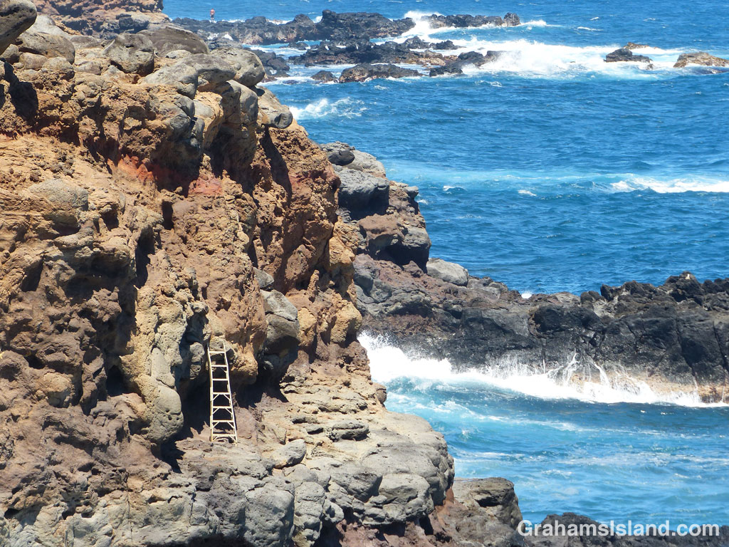
My regular walk around Upolu Airport almost always occurs in the afternoon when I walk along the coast towards the east. This usually puts the sun at my back and the wind in my face. Last Friday, I went out in the morning and so walked in the other direction with both the sun and wind at my back. I was surprised by how strange it felt to do this. Approaching spots where I tend to stop and look for things in the water felt weird. I guess it shows what a creature of habit I’ve become.

One other oddity was this ladder propped halfway down the cliff face. I’d never noticed it before. Now, it might be a recent addition, but it’s also possible it’s been there for years because it is somewhat hidden when walking in the opposite direction.

The ladder was probably put there by someone who goes down onto the rocks to harvest opihi. The opihi is an edible limpet that is something of a delicacy in Hawaii. It can be eaten raw or cooked. Some people eat them right after they pry them from a rock. It’s a dangerous business though. They’re found on rocks right at the water’s edge and an opihi picker can easily slip or be swept into the ocean by big, breaking waves.

When I got home, I noticed the figure at the top of the photo. I hadn’t seen him at the time, but he’s an opihi picker who I ran into a little later on my walk.

Posted in response to Bushboy’s Last on the Card challenge. See more responses here.

Sulphur Banks Trail

One of the trails I took on my last visit to Hawaii Volcanoes National Park was the Sulphur Banks Trail, otherwise known as Ha’akulamanu Trail. It’s not far from the visitor center and so is usually popular with visitors because it’s an easy walk, about 1.2 miles roundtrip, and pretty level the whole way. But with few visitors around currently, I had the trail to myself.

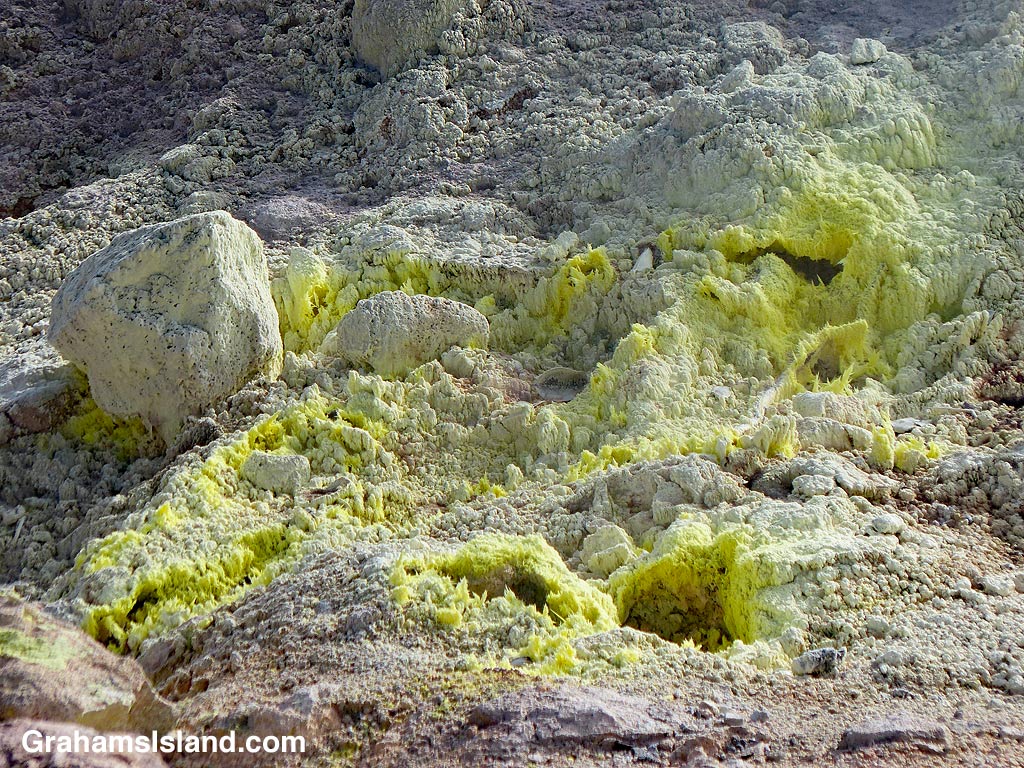
This trail is one of several areas in the park where signs of volcanic heat can be seen even when there’s not an active eruption. Steam swirls upwards. The smell of rotten eggs indicates the presence of hydrogen sulfide in the air, one of the volcanic gases leaking from the ground along with sulphur dioxide and carbon dioxide.

The yellow tint of the ground is due to the sulphurous gases and close examination reveals the sulphur crystals that have been deposited there. The crystals photo was taken at one of the displays along the trail. It wouldn’t be wise to thrust one’s camera too close to one of the active vents, such as those in the bottom photo.

For more information about Hawaii Volcanoes National Park, go to nps.gov/havo/.

Posted in response to this week’s Friendly Friday challenge theme of ‘Close Examination.’ See more responses here.

ʻAnaehoʻomalu Bay beach

This week’s Sunday Stills challenge theme is ‘Beautiful Beaches.’ See more offerings here.

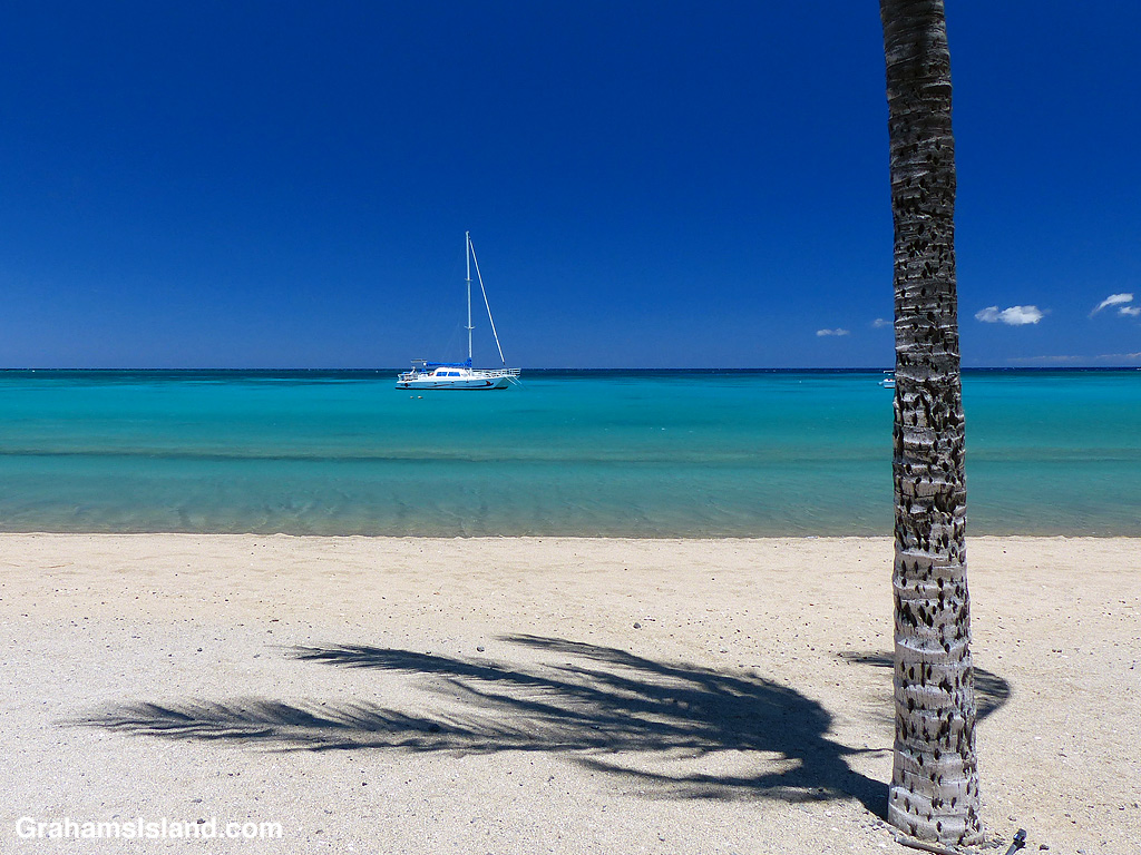
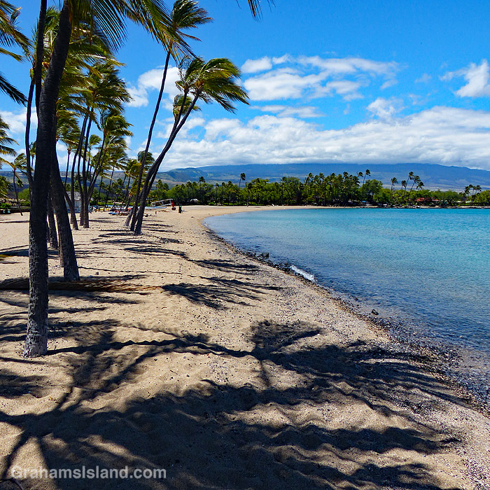
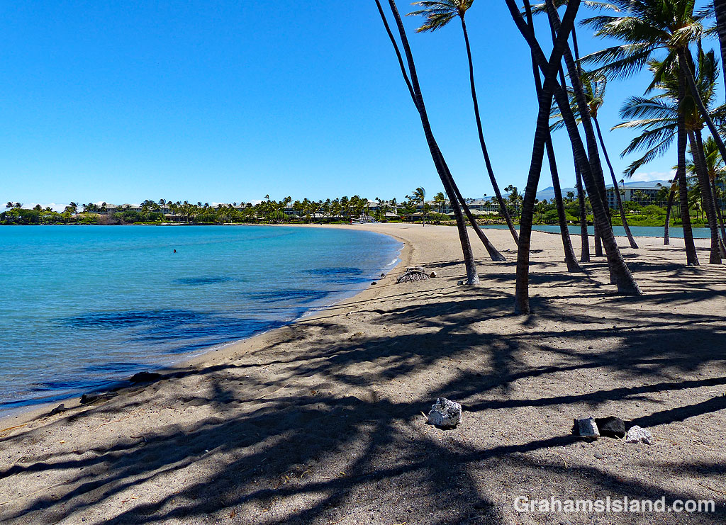
ʻAnaehoʻomalu Bay, at Waikoloa Resort, is often referred to as A Bay for reasons that aren’t hard to figure out. In normal times this is a very popular spot. The beach is a long curve of pale sand with palms at either end. It’s popular with sunbathers, swimmers and snorkelers. There’s also a restaurant and bar at one end of the beach, facilities nearby, and shops not far away. And Ocean Sports operates various cruises out of the bay on a catamaran or glass-bottomed boat.

There’s a hike I like to do, which goes south from A Bay, and on previous visits I’ve skirted the crowds which are usually found there. However, these are not normal times. On my last visit I headed north. There was one person in the water, two on the beach. The ocean lapped gently against the shore. An offshore breeze rustled the palm fronds. Usually when I hike places like this, I’m an aberration with shoes and a fanny pack, marching through swathes of bikinis and board shorts and roasting flesh. On this occasion, I was an aberration just by being there.