Category Archives: Places

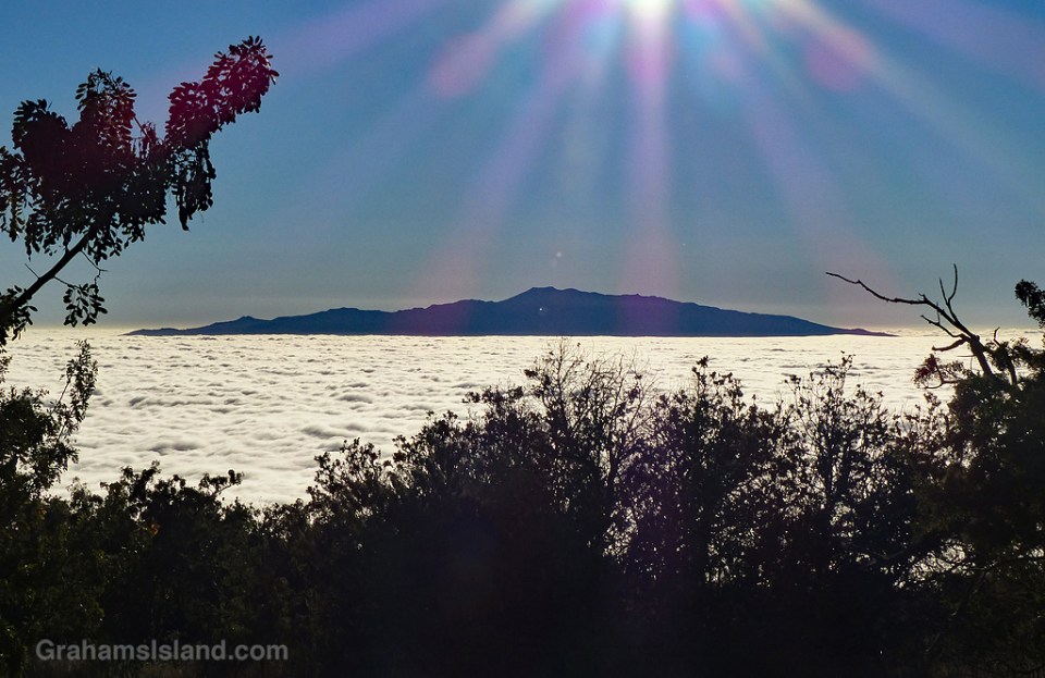
Hualalai and clouds

Hualalai and clouds

I’ve spent a fair amount of time in my life looking up at clouds, often as they poured water in my direction, so it’s nice to look down on them once in a while. Airplanes are probably the most common place to enjoy this view, but here on the Big Island, the upper reaches of Mauna Kea and Mauna Loa also offer this perspective.

In this case, the clouds were low enough that, when I was visiting the Palila Forest Discovery Trail at around 7,000 feet, the clouds blanketed the landscape below. Here, Hualalai pokes through the cloud layer in the late afternoon.

For more information about Palila Forest Discovery Trail, go to dlnr.hawaii.gov/restoremaunakea/palila-forest-discovery-trail/.

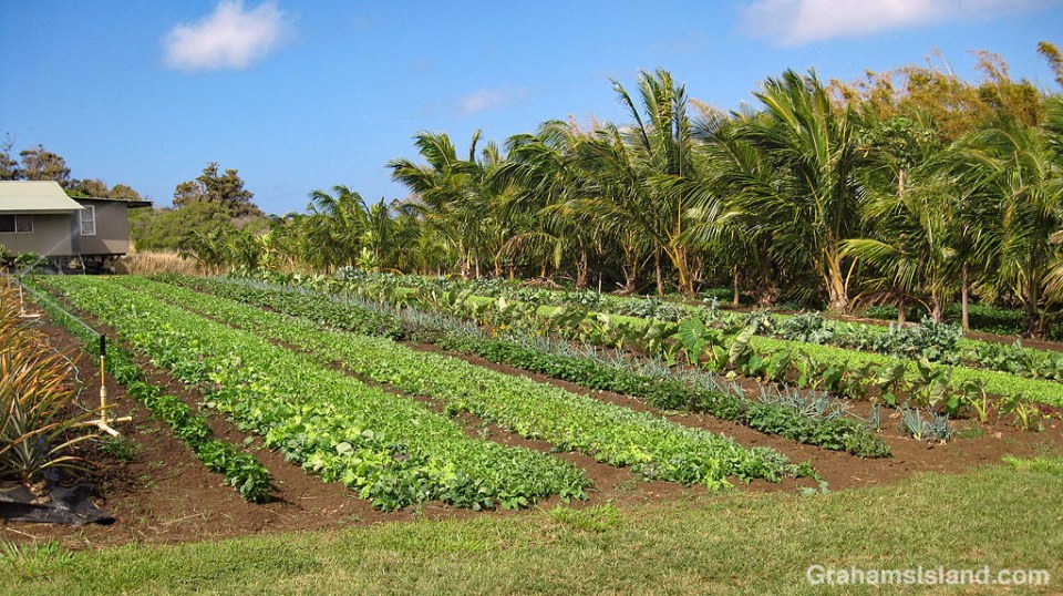
Fresh produce

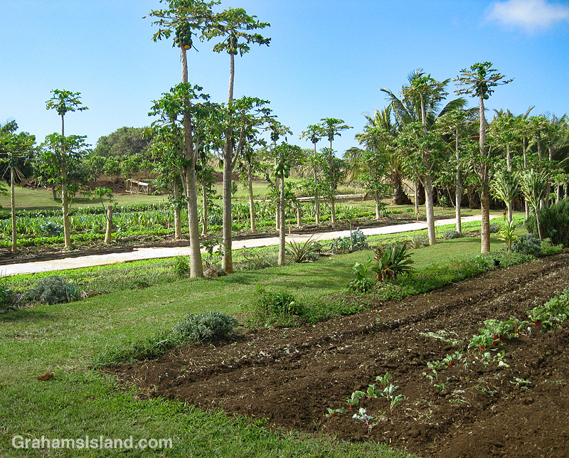
Sage Farms greens

Sage FarmsOne of the vulnerabilities of living in the middle of the Pacific Ocean is that any big disruption of commerce, here or on the mainland, due to natural disaster or otherwise, could result in shortages here. Toilet paper and Spam would likely be the first things to be snapped up, but basic foodstuffs would soon follow. Having a variety of productive farms on the island would be a big help in such a situation.

Sage Farms, an organic farm that’s been in business here for 20 years, is one such enterprise. Their fruits and produce are available in local stores and farmers’ markets. The farm is one of a network of small growers in the area whose goal is to make the Big Island less dependent on imports from the mainland.

It might seem like farming would be easy in Hawaii. Most things grow readily, but that also includes weeds. In addition, pests also thrive and can be voracious. Currently, rat lungworm is a big concern. Recently, students at Kohala Middle School showed that a slug which carries rat lungworm parasites is now established in this area. This slug is just the latest challenge to the farmers of the area and the island in general.

Posted in response to this week’s Sunday Stills challenge on the theme of ‘Fresh.’ See more offerings here.

Brown water

Brown water

After something of a dry spell, during which I was able to drive my truck out of the yard without sliding about, there’s been a lot of rain lately. My truck is back to sliding, but that’s a minor issue compared with what happens to all that rainfall.

What happens is that the rain hits the land and runs downhill. It channels into dry gullies. If the rain is heavy enough, flash floods occur and wash all before them – dirt, rocks, trees. But any kind of heavy or prolonged rain will wash earth and debris down the gullies. All those gullies lead to the ocean, channeled under roads by culverts (bottom photo).

When the runoff reaches the ocean, it forms a distinct area of dirty brown water in the blue Pacific Ocean (top photo). The contrast is striking and easily visible from miles away. Over time, the brown and blue water will begin to mix until the delineation is gone, but part of that process is the dirt from the brown water settling to the ocean floor.

This kind of runoff is one of many threats to coral reefs around the Big Island. It’s not just dirt in the runoff, but also pesticides and other chemicals that can be washed down into the reefs, damaging the coral. There are hundreds of gullies and only a few places have erosion prevention measures to help mitigate this pollution.

So while Hawaii may be considered paradise, it has its share of challenges. And the problems associated with runoff and pollution are more visible and obvious than most.

Posted in response to this week’s Friendly Friday challenge on the theme of ‘Contrasts.’ See more responses here.

Brown water and culvert

Tug and barge lights

tug and barge lights

tug with starboard light showingOnce upon a time, I used to know the International Regulations for Preventing Collisions at Sea, also known as the rules of the road for shipping. Like those for automobiles, the rules are designed to keep traffic flowing safely. They govern such things as which vessel has the right of way, what sounds signals they should make, and what lights they should show.

Most of that knowledge has faded from my memory, like a ship into a fog bank, but every so often something brings bits back into view. These photos illustrate one such event.

At night, ships and small boats display lights, the idea being that people on other vessels will be able to identify those lights, interpret what they’re looking at, and avoid running into them. In the top photo, the red lights on the tug and barge indicate that’s the port (left) side of the vessel. In the second photo, the green light indicates that’s the starboard (right) side of the vessel. Seeing these lights and how they move in relation to your own position gives a good indication of how close the other vessel will pass. For example, is you can see both the red and green lights, that means the vessels is coming directly towards you and the likelihood of a collision is high. In this case one or both vessels should change course.

As an aside here, I was on the bridge of an oil tanker in the Strait of Malacca, near Singapore, when a ship traveling in the opposite direction suddenly turned 90°, heading directly across our path. This occurred during the day, so the correct action for our ship was to sound the horn for five short blasts, which is the nautical way of expressing ‘What the *&%# are you doing?’ The officer on the bridge duly pounded the horn button to send this message, except that after three short blasts it wheezed into silence (it was an older ship). Three short blasts mean ‘my engines are going astern,’ which was the exact opposite of what was actually going on. About three seconds later, the captain shot through the door and wanted to know why the hell we were going in reverse. We all lived through the experience, but I’m never surprised when ships collide or run aground; there are a lot of factors involved.

Back to the photos and what prompted this post. On the tug’s mast are three white lights. That means it’s a power-driven vessel engaged in towing – it’s a tug after all – but, and I remembered this, the three lights mean the length of the tow is greater than 200 meters. Granted, in the photo, the length of the tow is less than 200 meters, but that’s because they’re arriving in port and the barge has, deliberately, been allowed to ease up close to the tug, prior to maneuvering it alongside the jetty.

Having unburdened myself, I can now slip the lines on that pearl of nautical wisdom and let it drift back out into the gigantic, floating garbage patch that is my memory.

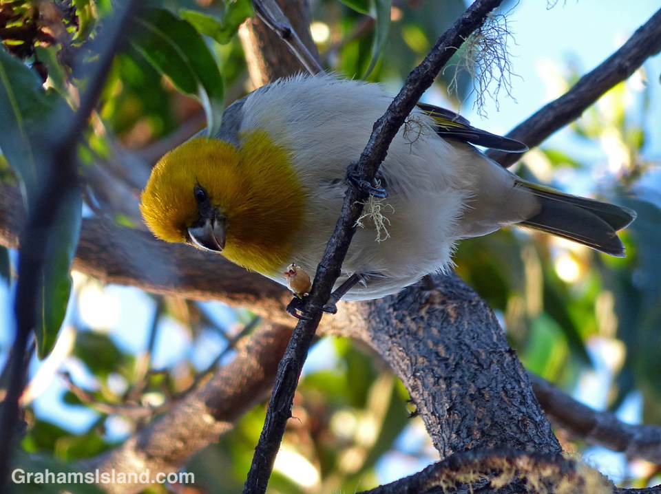
Palila feeding

palila

I’ve made a couple of recent visits to the Palila Forest Discovery Trail, on the slopes of Mauna Kea, in search of palilas, an endangered Hawaiian honeycreeper. On one of those visits I was lucky enough to see this bird.

I wrote here about the first time I saw palilas, in late 2017. Those birds were feeding on immature mamane seed pods, one of their main foods. But the bird in this photo has what I think is a naio flower in its grip. The fruits and flowers of naio, otherwise known as false sandalwood, are the other main foods of the palila.

For more information about palila and the Palila Forest Discovery Trail, go to dlnr.hawaii.gov/restoremaunakea/palila-forest-discovery-trail/.

Pohoiki fires

Pohoiki bench and lava

Yesterday I posted here about revisiting Pohoiki, also known as Isaac Hale Beach Park. Today, in response to this week’s Sunday Stills challenge on the theme of ‘Fire,’ (more responses here) I’m posting a couple more photos from that visit. Being perverse, I’ve chosen photos with no fire in them.

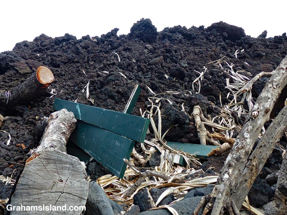
The top photo shows where the flow from the 2018 Kilauea eruption came to a halt, in the park’s picnic area. It has swallowed up one of the picnic tables, as well as some surrounding trees. What I find interesting about this is that neither the table, nor the trees, caught fire. I think this is because, by this time, the supply of lava had already stopped reaching the extremities of the flow and, consequently, those areas had already cooled considerably to below the temperature needed to cause combustion.

The bottom photo has a simpler, fire-related appeal. It could easily be captioned, ‘the barbecue pit meets the mother of all barbecues.’

Pohoiki barbecue pit and lava

Pohoiki revisited

Pohoiki boatramp

Pohoiki breakwater markerIt’s been a while since I was last at Pohoiki, also known as Isaac Hale Beach Park. One reason for this is that it’s about as far away from where I live as is possible on the island. But back in July 2016, I went down there at an ungodly hour to board a boat and go see lava flowing into the ocean. I wrote about that trip here and here. At the park were restrooms, picnic tables, and a boat launch ramp protected by a small breakwater.

Last year, Pohoiki was in the news because it was where the flow from the 2018 Kilauea eruption finally ground to a halt, about 100 yards short of the boat ramp. A few days ago, I decided to revisit the park and see the changes that had taken place.

Driving into the park, the cooled lava flow could be seen, stretching down the side of the grassy picnic area (bottom photo). But what I really wanted to see was the boat ramp and the black sand beach at the bottom of the park. They did not disappoint.

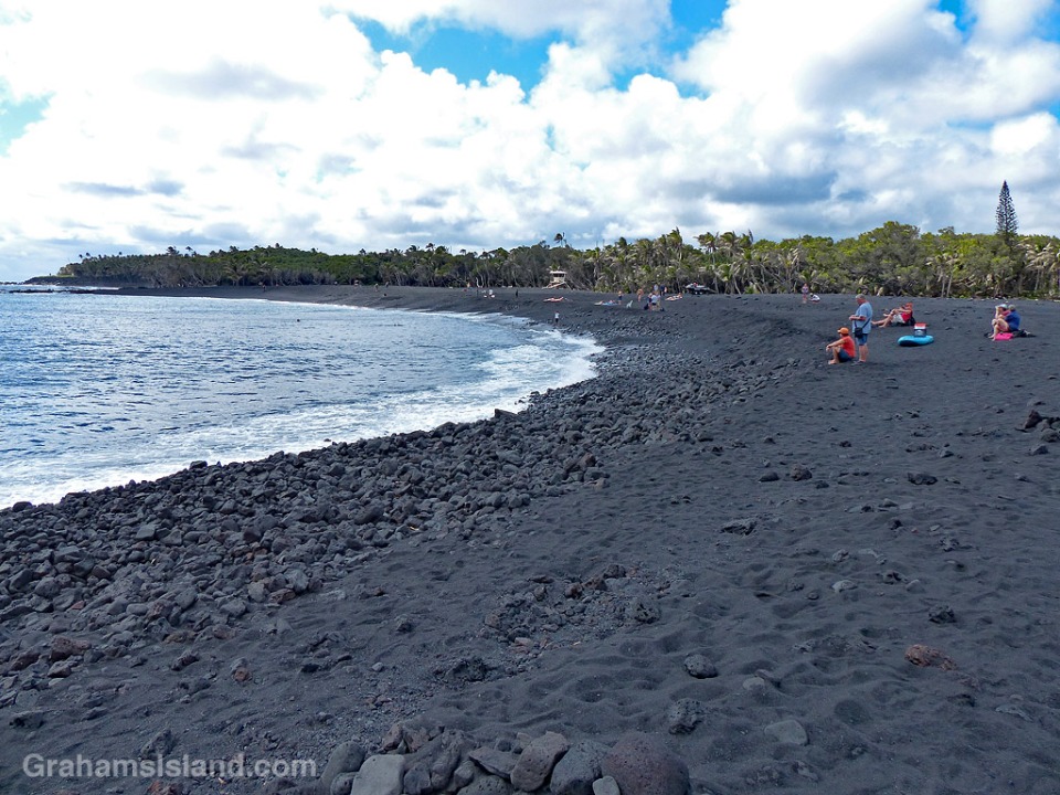
The boat ramp, previously used to launch quite large boats, including the lava tour catamaran of 2016, now leads to a small lagoon (top photo). (Note the signs on the left of the photo.) This lagoon is perfect for swimming or sailing model boats, but as a boat launch ramp it has one big drawback. There’s now a long, deep, curve of black sand separating the ramp from the ocean (photo below). This beach began forming during the eruption, but I was surprised by how substantial it was. It’s rocky in places and the sand is quite coarse, but it is unquestionably a beach and it looks like it’s here to stay.

An indication of the beach’s substance can be seen in the second photo. The red triangle on a pole marked the end of the breakwater. Now it’s deep in sand. The breakwater is still there, but almost entirely buried.

The beach was formed by lava pouring into the ocean. Some of it solidified into large chunks, but a lot was quickly broken into smaller pieces and fine sand. (In the postings about my 2016 trip, one of the photos shows a black sand beach forming at the base of the flow.) A good deal of this sand was carried a short way down the coast to form this new beach.

I don’t have a good photo of the park before these changes, but the local newspaper has an aerial view here that shows the features I’ve mentioned. In that photo, the boat ramp, breakwater, and rocky shore can be seen at the bottom. Top left is the restrooms building that is also top left in the bottom photo here. The paths and picnic tables can also be seen.

I’d expect that on my next visit, all these new features that I’ve mentioned will still be there, but there is one caveat. If there’s a new eruption in this area, then everything could change. It’s one of the facts of life of living near an active volcano.

Posted in response to this week’s Friendly Friday challenge on the theme of ‘Revisited.’ See more responses here. Tomorrow, I’ll post a few more photos in response to the Sunday Stills photo challenge.
Pohoiki beach

Pohoiki picnic area

A delicate shade

underwater shade

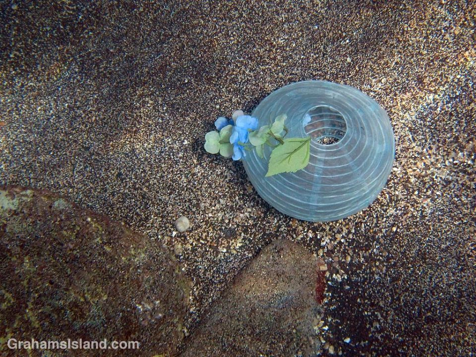
This photo makes it look like someone has placed this delicate shade on a beach. In fact, I found it in 10 feet of water in an area that is often buffeted by large swells, making it’s perfect appearance all the more unlikely. How or why the shade got there is unknown, but for me, that adds to the mystery of the scene.