This week’s Friendly Friday challenge theme is ‘Shadows.’ See more responses here.
This view was taken near the summit of Mauna Kea. Pu’us – little volcanic cinder cones – dot the landscape here, giving the area an otherworldly look. As the sun sets, the pu’us cast shadows on one another accentuating the slopes and craters.
This week’s Sunday Stills challenge theme is ‘Danger.’ (See more offerings here.) It seemed a suitable opportunity to post some photos reviewing on Kilauea Volcano’s last eruption, which began in May of last year.
The bottom photo, taken from the Jaggar Museum overlook, shows the scene on the morning of April 25, 2018. Lava in the active vent in Halema’uma’u Crater, at Kilauea’s summit, was just below the crater floor and had been overflowing into the crater in previous days. The overflow is the large dark area to the right of the glowing lava.
By early May, the lava level in the vent had dropped around 1,000 feet. This drop occurred at the same time that lava disappeared from Pu’u O’o vent. Not long afterwards, cracks opened in the ground at Leilani Estates, a housing subdivision in the southeastern part of the island. By the end of May, 24 fissures had opened in the area. The most prolific lava flow emanated from Fissure 8, which flowed to the ocean and created more than 800 acres of new land. However, more than 700 homes were destroyed by this eruption.
Meanwhile, back at the summit, the absence of lava in the vent in Halema’uma’u Crater resulted in a series of collapses of the crater floor. Each collapse triggered earthquakes and shot clouds of ash and toxic gas thousands of feet into the air.
The top photo shows Halema’uma’u Crater as it looks today. The crater is twice the size it was the year before and the floor, which was mostly flat, is now a huge cascading pit. In the upper left of the photo, the Jaggar Museum, where I stood to take the bottom photo, can just be seen. It was heavily damaged by the earthquakes, as were the parking lot and access road. It’s also much closer to the crater edge than it was. (Technically the crater edge is closer to it, since the museum hasn’t moved!)
The museum, along with the rest of the park, closed in May 2018, because of the eruption. While much of the rest of the park reopened in September, Jaggar Museum did not. There’s a good possibility it never will and that its fate will be the same as the portion of Crater Rim Drive in the middle photo. A significant length of that road, which used to encircle the whole summit caldera, was destroyed, including the section in the photo which slid, intact, into the crater.
Things have settled down since September 2018 and there has been no volcanic activity anywhere on the island since then. But Kilauea remains an active volcano and will undoubtedly erupt again. It’s just that no one knows exactly when or where that will happen.
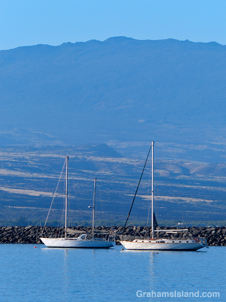
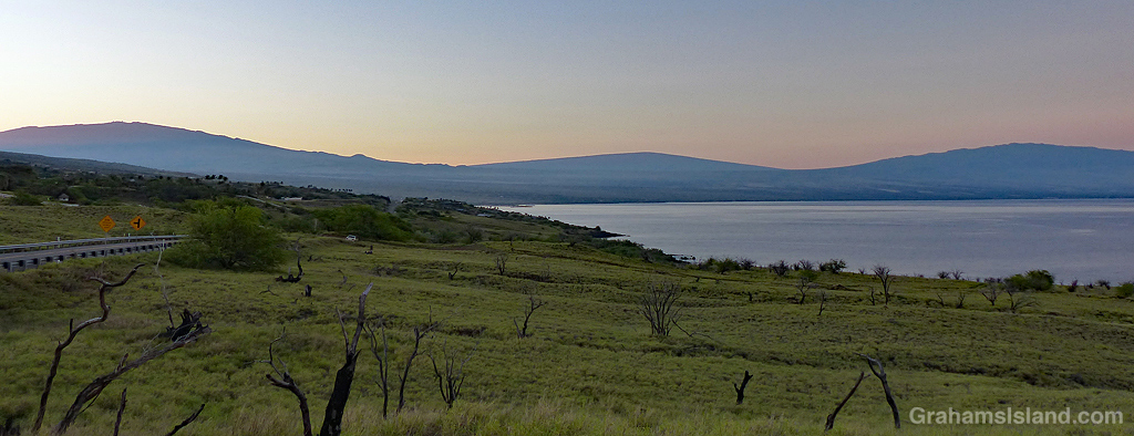
These sailboats were moored in Kawaihae Harbor, with Hualalai volcano in the background.
There is a small boat harbor on the other side of that rock breakwater. It opened in 2014 built after 20-plus years of studies and considerations and general hand-wringing. But since it only has room for a limited number of boats, some still retain their moorages in the port’s main harbor.
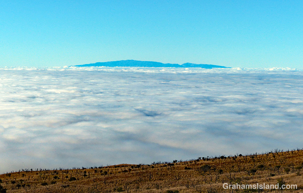
A sea of clouds separates Maui and the Big Island, as seen from the slopes of Mauna Kea. Somewhere under there is Kohala Mountain, which is 5,480 feet high.
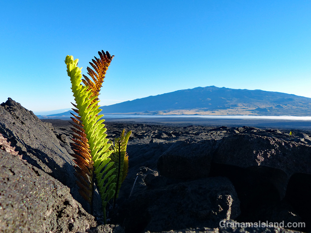
Ferns are one of the first plants to establish a foothold in lava flows. These ferns are on the northeast slope of Mauna Loa with Mauna Kea in the background.
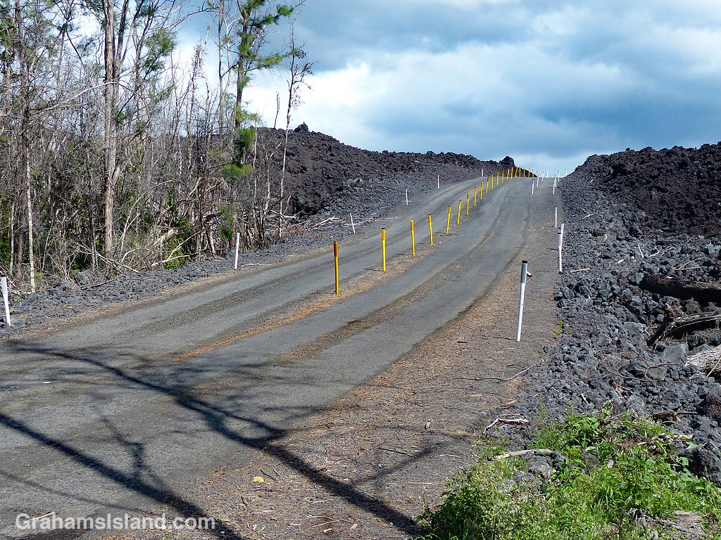
I’ve posted about my January visit to Pohoiki here, here, and here. The reason I was able to make that visit is because the county finally put a temporary road over one of the flows that cut off that part of the island.
One of the features of lava flows is that they don’t uniformly erase everything in their path. Sometimes they flow around areas. Sometimes they stop and a new flow emerges to one side. Sometimes a flow blocks one side of an area and a different flow blocks the other side.
The 2018 Kilauea eruption was no different in this regard. Some houses escaped destruction, but became inaccessible by road. Pohoiki was one of those places, until the new road was completed.
Things move at a leisurely pace in Hawaii and one might think the delay in building the road was due to this, but in this case, the county had good reason to wait. The simple reason is that they had to wait for the lava to cool down. It took several months for the lava to cool enough to make it practical to build a road over the flow. Even then it would not have been safe to cut through the flow and build the road at its former level.
How quickly the lava cools depends on many things including hot hot it was to begin with and how deep the flow is. It can take many months before the lava at the heart of a flow cools down enough to solidify and not present a danger.
For those interested in what happened during that 2018 eruption, the PBS show, NOVA, broadcast an episode titled ‘Kīlauea: Hawaiʻi on Fire.’ It’s about 50 minutes long and has a bit of a dramatic ‘will anyone survive’ tone in places, but I found it very informative. It might be available at https://www.pbs.org/wgbh/nova/, but if not you can see it here.