The rising sun begins to illuminate scrubby terrain on the dry side of the Kohala Mountains.

The rising sun begins to illuminate scrubby terrain on the dry side of the Kohala Mountains.

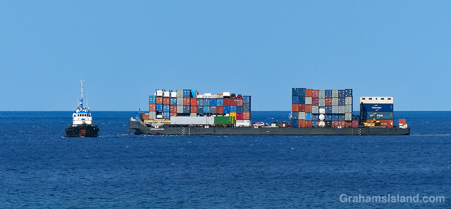
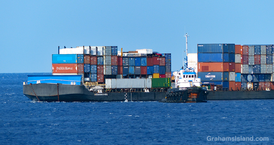

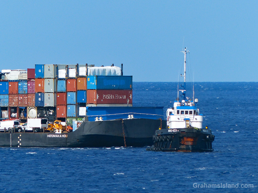
Driving towards Kawaihae, I noticed the inter-island barge a mile or two short of the harbor entrance. But instead of heading in, it was stooging around, going in circles or possibly figure eights. Clearly the harbor wasn’t ready to receive it. Still, there are many worse things that can happen than being obliged to make gentle loops off the coast of the Big Island on a beautiful sunny morning.
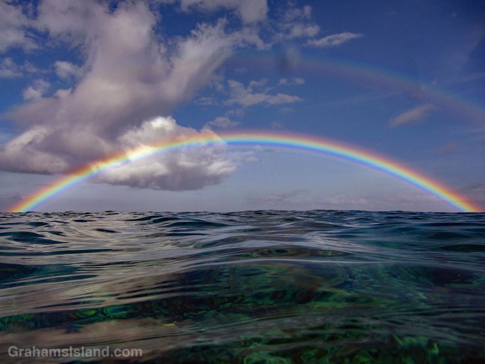
During a recent swim, I was lucky enough to see this gorgeous double rainbow. I took several photos and this one is actually a composite. In the best rainbow photo the water looked a bit flat, but in photos that gave a glimpse below the water’s surface the rainbow wasn’t as good. So I combined the best of both and it came out pretty good I think, especially given my rudimentary skills in my Photoshop Elements.

This week’s Sunday Stills challenge is ‘Drunk with .…’ I thought about a photo of my liquor cabinet, but settled instead for ‘Drunk with Power,’ a reasonable choice in these turbulent times.
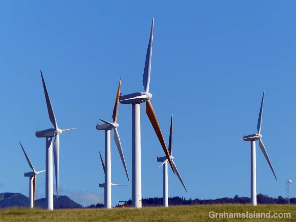
Hawi Wind Farm began operations in 2006 and has 16 turbines churning out 10.56 MW. This power is supplied to Hawaii Electric Light Company, which runs the power grid on the island.
My interest in the wind farm is mostly visual. I like the patterns that the turbines make, and every once in a while the telescopes of Mauna Kea can be seen in the distance.
See more Sunday Stills responses here.

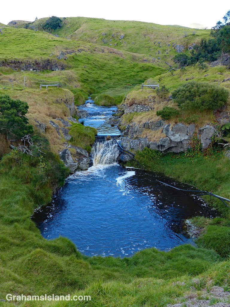 The Kohala Mountain Road passes over the dry southwest side of Kohala Mountain. There are several streams running down the side of the mountain toward Kawaihae and the Kohala Coast and they can run anything from dry to flash flood. It all depends on the rain.
This stream, just below the road’s high point around 3,500 feet, is running somewhere in the middle of the flow range. The top photo shows the stream tumbling through a series of pools on its way to the coast. And those black pipes? The photo to the left shows a small dam, built into the stream. Those pipes gather water from behind the dam and carry it to ponds where it’s stored for use during dry times.

There are seasons in Hawaii. Summer is hotter, and wetter on the dry side of the Big Island. But let’s be honest, there are many people who live through freezing winters and boiling summers, sun-free winters and sun-seared summers. They believe Hawaii has summer year-round, and not just any summer, but a pleasant summer where it’s warm and sunny but not inhospitably so.
For those people, and in response to this week’s Sunday Stills challenge on the theme of ‘Summer,’ I give you a typical summer shot of people getting ready to go snorkeling, or just exiting the water. The photo was taken at Two Step, next door to Pu’uhonua o Hōnaunau National Historical Park — in February. Bwahahahahahaha.
For more information about Pu’uhonua o Hōnaunau National Historical Park, visit https://www.nps.gov/puho/index.htm.
See more Sunday Stills responses here.

 Over the last few weeks, several people have asked me how I’ve been affected by Kilauea Volcano’s latest eruption in a subdivision in Puna. I’ve been happy to respond that, where I live, I’ve hardly been affected at all.
I live near the northern tip of the Big Island and the current eruption is taking place in the southeast corner of the island. This eruption is also not like the recent one in Guatemala, with a deadly explosive element. Instead, it has settled into a steady, if prolific stream of molten lava, burning buildings in its path on the way to the coast. This behavior makes the direct impact of the eruption a more localized affair. If a person lived in the vicinity of the lava flow path, they’ve probably been forced to leave their home with no indication of when they might be able to return. But for the rest of the island, the lava itself poses no threat. What does affect, not only this island, but also others in the Hawaiian chain, is vog.
Vog, a blend of the words ‘volcanic,’ ‘smog,’ and ‘fog,’ is the result of gases from an eruption reacting with moisture and sunlight. It varies in intensity depending on the output of the volcano and it varies in who it affects depending on the wind.
Vog has been around a while, since the volcano has been erupting, pretty much continuously, since 1983. That 1983 eruption was at the Pu’u O’o vent. Then, in 2008, a new vent opened in Halemaʻumaʻu Crater, within the summit caldera. With two active vents, the vog got noticeably worse. This year’s new eruption has added to the output and also thrown in some ash deposits on areas within range.
The northeast trades are the dominant winds here and when they blow, the vog is blown along the south coast of the Big Island and then up along the west coast. Typically it will reach Kailua Kona, about halfway up, or a little farther north.
Up here on the northern tip the trades blow strong, too strong for many people who find it too windy. But the advantage of those winds is that they keep the vog at bay. Ironically, this past winter, the winds were more variable and we had more vog up here than usual. But since this current vent opened, the trades have been fairly consistent and have kept this part of the island mostly vog free.
Yesterday was an exception. The winds weakened and the vog crept north, which is what the photos are about. The top one, I’ve run before. It shows Hualalai Volcano seen from the water off the north Kohala coast. The bottom photo was taken yesterday from roughly the same area (though without zooming in). Hualalai is gone! That headland is about 400 yards away and I’d estimate that visibility was around 2 miles. I couldn’t even see the horizon. The water just faded away into the vog.
Even when it’s voggy, it doesn’t bother me too much, but some people are more affected. The air becomes acrid and sore throats and noses are common. Luckily, the winds picked up during the day and conditions improved, so we’ll see what happens.
 A final response to the last edition of the WordPress photo challenge with a theme of ‘All time favorites.’
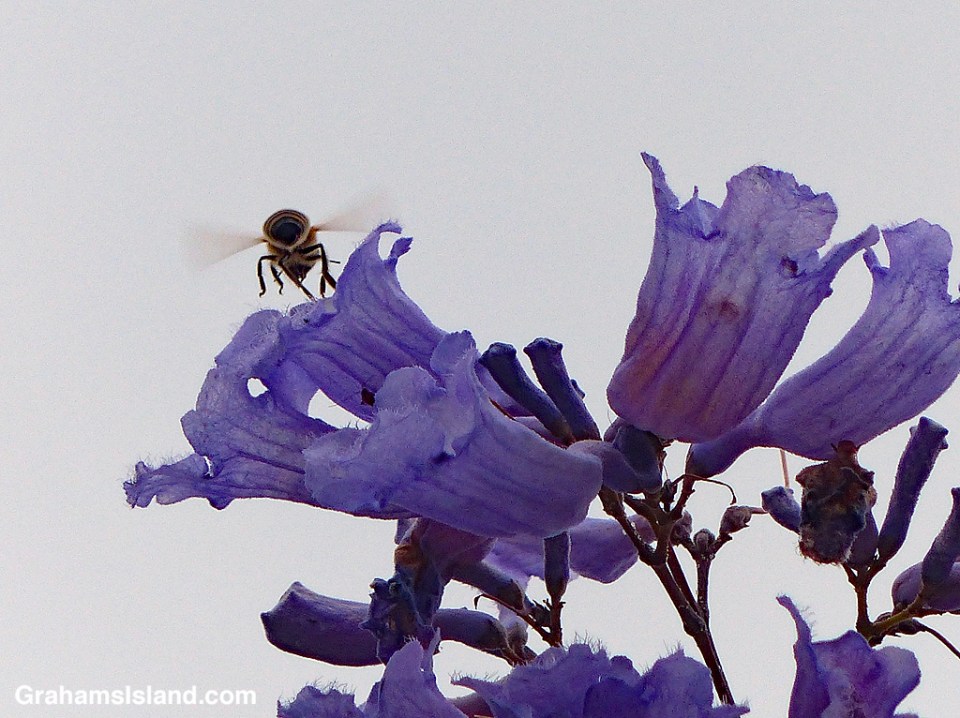
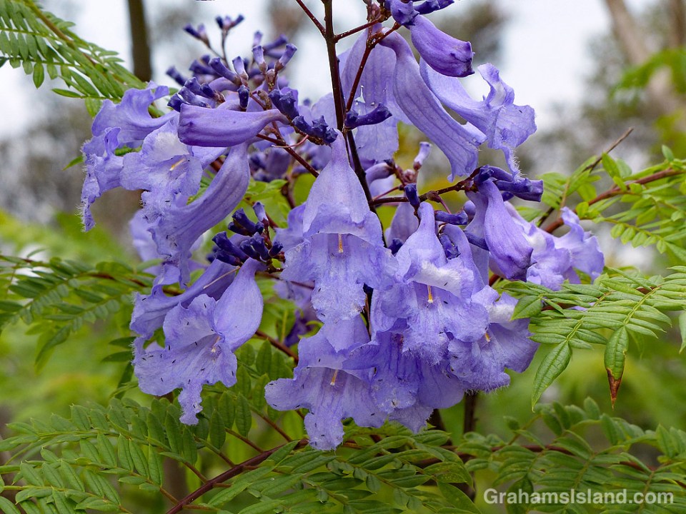
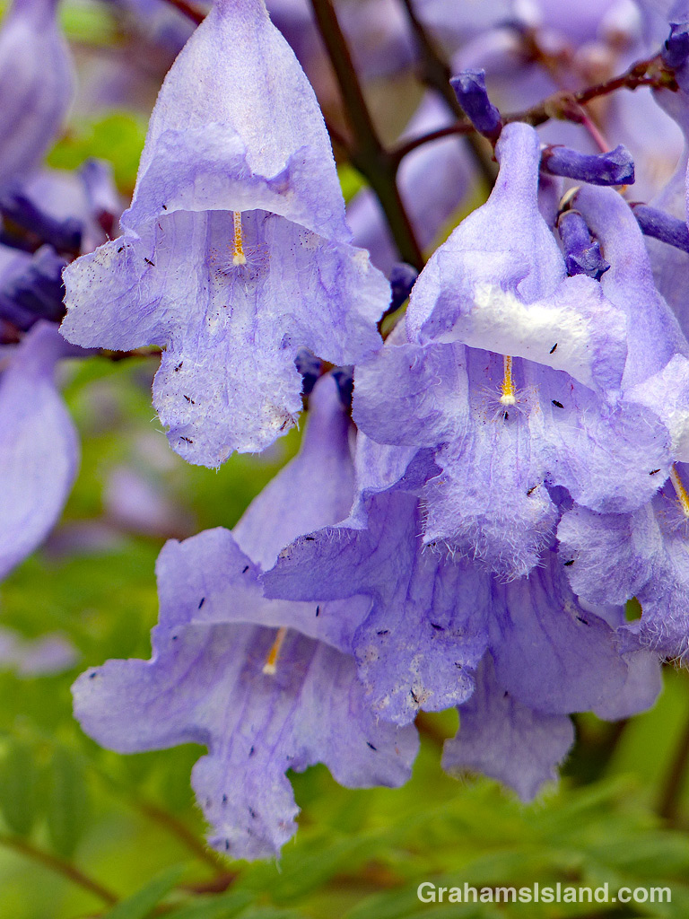
I headed back to Pu’u Wa’awa’a last week, because this is the time of year when several kinds of trees are in bloom. One of those trees is the jacaranda, which blooms from April to June, and produces masses of blue to lavender flowers. Jacarandas prefer cooler elevations so the lower areas of Pu’u Wa’awa’a are right in their zone.
I wasn’t disappointed. Several trees were covered with these delicate flowers, which somewhat made up for the fact that the entire hill was shrouded in thick vog, exacerbated by the ongoing eruption down in Puna.