Tag Archives: Hiking

Kilauea trails

Kilauea Iki Trail in Hawaii Volcanoes National Park

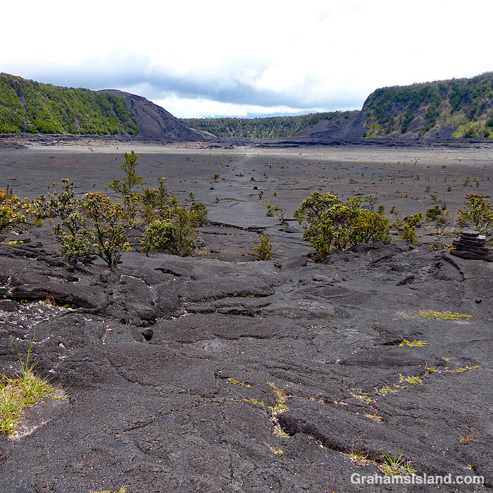
Hawaii Volcanoes National Park recently opened up more areas of the park that had been closed because of the Covid-19 virus pandemic. I thought this was a good opportunity to hike some of the summit trails that I usually avoid because they’re more accessible and popular with tourists. I put together a loop hike that would have been great had all the trails listed as open actually been open.

Despite this glitch, I had a good time and enjoyed the variety of landscapes the park has to offer. The top photo shows the part of the Kilauea Iki Trail that traverses that crater. The crater floor is a little under a mile across. This crater used to be much deeper before an eruption in 1959 filled it up another 400 feet. There is some vegetation, but the crater floor is mostly bare lava and steam can often be seen rising in various places.

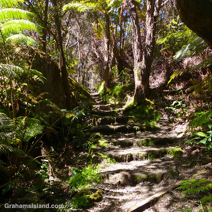
The middle photo was taken on the Halema‛uma‛u Trail, which winds down from the summit into Halema‛uma‛u Crater. Despite the trail’s proximity to the vent in the crater, which was active until May 2018, vegetation thrives here as it does on many trails in the park.

The bottom photo shows a section of active steam vents alongside the Crater Rim Trail. This section of the trail is paved because the area normally sees very heavy use. When I was there, it was mostly deserted because of the lack of tourists on the island. The buildings on the horizon are the Volcano House Hotel which recently reopened for business, though the restaurant is still closed.

For more information about Hawaii Volcanoes National Park, go to nps.gov/havo/. For more information about Volcano House Hotel, go to hawaiivolcanohouse.com/.

Posted in response to Becky’s July Squares challenge theme of ‘Perspective.’ See more responses here.
Amaumau fern

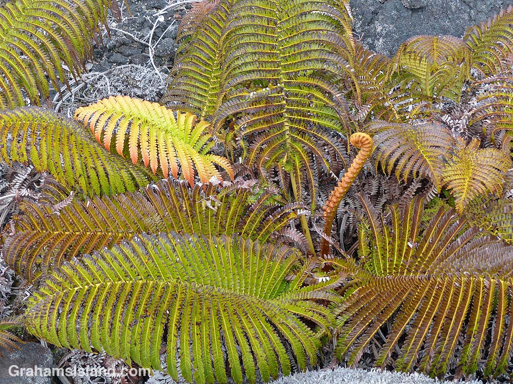
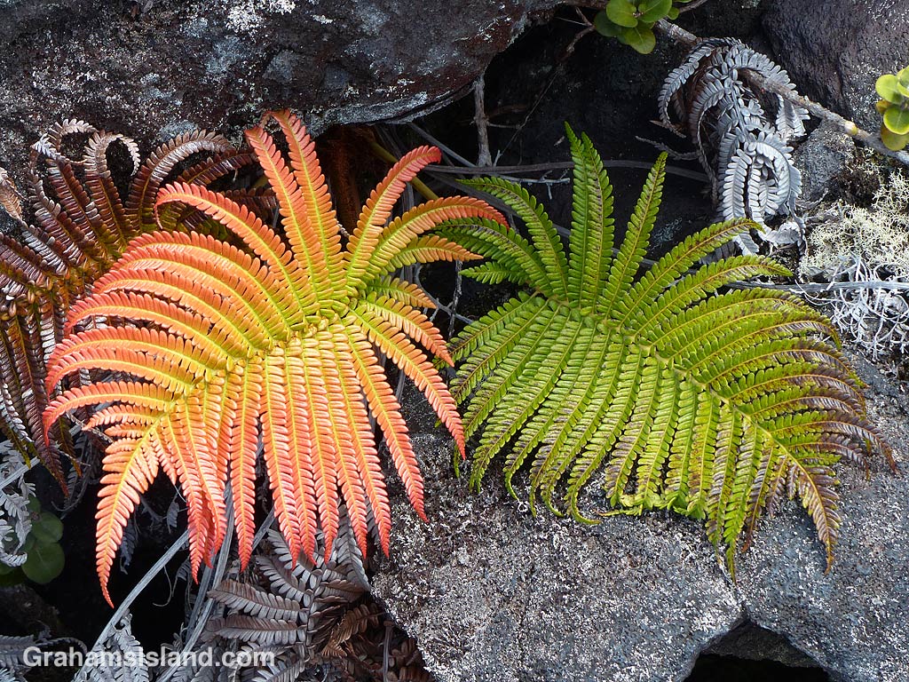
The amaumau fern (Sadleria cyatheoides) is endemic to Hawaii and grows in a variety of areas from wet forests to recent lava flows. I saw these on the Powerline Trail, off of Saddle Road, where the elevation is above 5,000 feet.

These ferns are quite common, but on this day, the color of the new growth really caught my eye. New fiddles are orange to red, changing to green with age. In these photos, the various stages of growth can be seen. These ferns were low growing, but they can also take the form of a tree fern with an upright, trunk-like appearance.

Pu’u Wa’awa’a bench

One of the nice things about the hike up Pu’u Wa’awa’a is the selection of benches available for rest and contemplation, on the way up and at the top. This bench sits halfway up the steep slope that accesses the top of the hill. It gives a good view of Mauna Loa and the pastures on and around Pu’u Wa’awa’a. If you’re lucky, you might even see a dung beetle or three doing what they do.

Powerline Trail

This week’s Sunday Stills challenge theme is ‘Straight.’ See more offerings here.

Last week, I revisited the Powerline Trail off of Saddle Road. This trail, when combined with the Pu’u O’o Trail, makes a good long loop hike. I like hiking the Pu’u O’o Trail because it passes through several kipukas (patches of old forest that have been spared by lava flows) and those kipukas have lots of birds living in them.

The Powerline Trail is a bit less interesting. There are fewer kipukas and it’s a long, exposed hike in a straight line across the lava. The reason for this can be found in the name. It follows an old 4-wheel drive road that serviced a power line that ran across the lava fields. The line is gone, but the sawn-off stumps of power poles can be seen alongside the trail (to the right of the trail in the top photo, to the left in the bottom photo).

One advantage the Powerline Trail has over the Pu’u O’o Trail can be seen in the bottom photo. This was near the end of my hike in the mid-afternoon as clouds closed in. It’s not unusual for this part of the saddle to be shrouded in thick fog and, if you happen to be out hiking in those conditions, the straight and clear Powerline Trail is much easier to follow than the Pu’u O’o Trail which, crossing the lava fields, can be hard to follow when you can’t see the cairns that mark its route.

The trail, of course, isn’t perfectly straight (though I suspect the power line was). It bumps around lava upwellings and collapsed tubes. But most of the time, one just needs to look up to see, straight ahead in the distance, the faint pale thread of the trail topping a hill or emerging from a dip in the landscape.

Pu’uanahulu jacarandas

Pu’uanahulu is a small community midway between Kailua Kona and Waimea, on the upper road between those two communities. I don’t drive that highway much, except when I go to hike up Pu’u Wa’awa’a. Last time I did this, driving through Pu’uanahulu, I noticed that the jacaranda trees were in bloom alongside the road. What I hadn’t realized is just how many jacaranda trees there are in this area.

These photos are taken from the northern slopes of Pu’u Wa’awa’a. The bottom photo shows the general area with the purple jacaranda flowers of Pu’uanahulu clearly visible. The top photo shows a closer view of part of the community and the abundance of flowering jacaranda trees.