A red-billed leiothrix perched on a branch in a kipuka on the Pu’u O’o trail off Saddle Road. A kipuka is an area of land that has been surrounded by a lava flow. Kipukas often contain older trees and other plants that are a haven for native and non-native birds and other creatures.
This leiothrix had an exceptionally red bill because it was carrying a bit of ripe thimbleberry, presumably to young birds in a nest nearby.
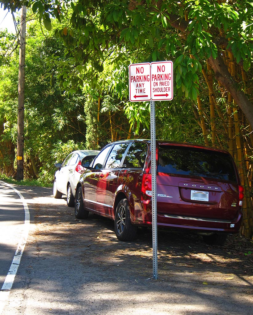
I was going to title this, ‘Unclear on the concept,’ but decided not to comment in that way. It’s possible the two drivers didn’t see the sign, or saw it and didn’t care. Either way, they have a reasonable chance of getting away with it. This isn’t a heavily policed area, and even if a cop goes by, there’s a fair chance they’d simply ignore the transgression. The most likely case for something happening is if one of the people who lives in the vicinity complains.
The sign is at the top of a busy trail down to the Captain Cook Monument. A redesign of the road junction nearby created new parking opportunities and this has resulted in a surge in people using the trail. With more use, word gets out and soon the trail will be overused, the shoreline around the monument littered with trash, and the waters and coral in the bay damaged and degraded.
Not that this is the fault of these two drivers, but since they’re clearly breaking the law, let’s blame them for everything anyway.
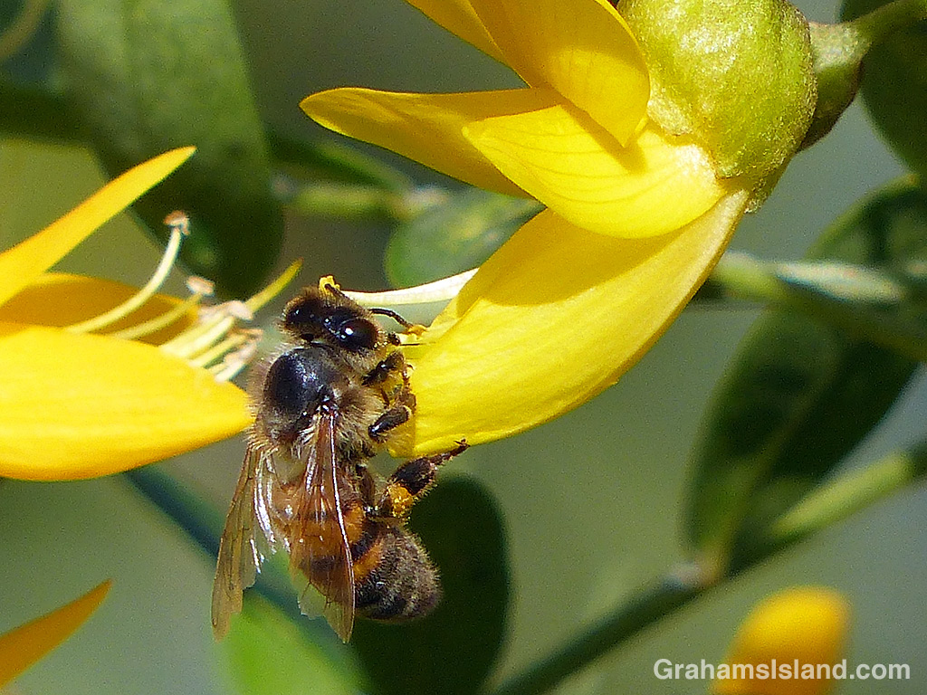
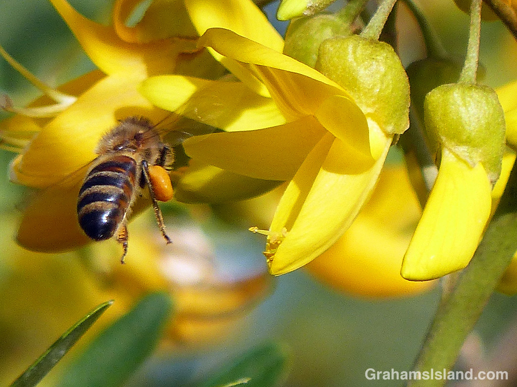
Bright yellow mamane flowers are not only a cheerful sight, but also very popular with bees. They were all over these mamane flowers on the upper slopes of Pu’u Wa’awa’a.
This week’s Sunday Stills challenge theme is ‘Great Outdoors.’ (See more responses here.) When I think of the great outdoors, I think of hiking, and one of my favorite hikes on the Big Island is up Pu’u Wa’awa’a. It’s an 8-mile round trip and tops out at just under 4,000 feet. On a good day, the hike offers great views, not only from the top, but also on the way up and down. And there are several benches where a person can rest and take in those views, including a couple on the summit.
The top photo shows the view north from around 3,500-feet elevation, with Tamaki Coral in the foreground and Kohala Mountain in the background. The bottom photo is a view from 100 feet or so below the summit looking east toward Mauna Kea.
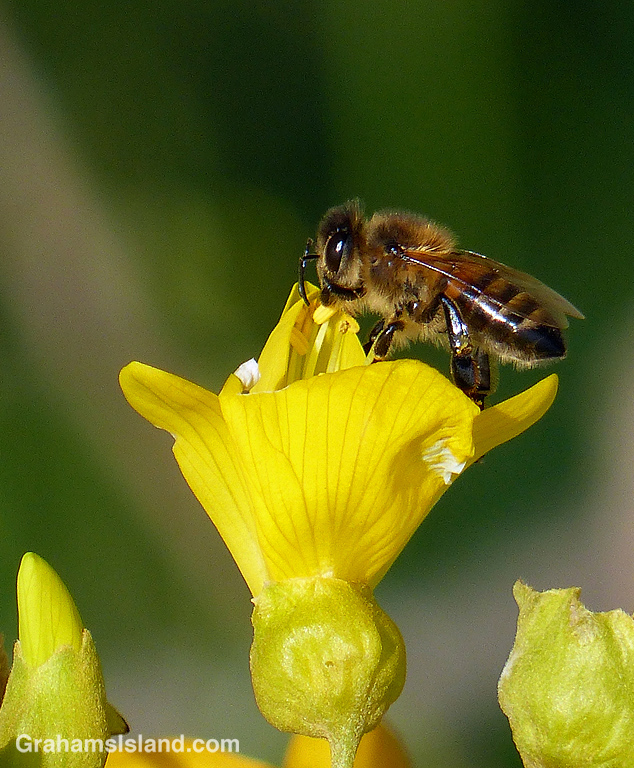
The hike can also include many native trees and plants as well as a variety of wildlife. There are domestic sheep, cattle, and horses, as well as wild pigs and goats. When the trees are in bloom, they’re rich with insects and birds including several native varieties.
To top it off, most of the times I’ve visited, usually in the early morning, I’ve had the place to myself.
For more information about Pu’u Wa’awa’a and its trails, go to puuwaawaa.org.
This week’s Sunday Stills challenge theme is ‘Paths.’ (See more offerings here.)
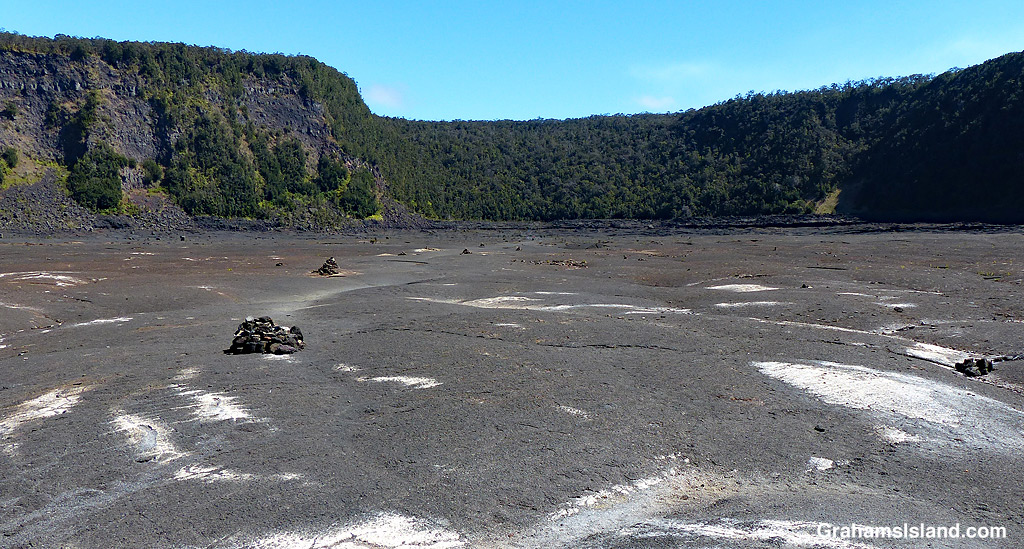
Kilauea Iki Trail is one of the more popular trails in Hawaii Volcanoes National Park. But last year’s volcanic activity, with numerous earthquakes, resulted in the park being closed for several months. Even after it reopened in September 2018, many parts of the park remained closed because the areas were too unstable to be opened to the public.
The Kilauea Iki Trail was one of those areas along with Thurston Lava Tube and Jaggar Museum. The latter two locations are still closed and Jagger Museum may never be reopened, but the Kilauea Iki Trail is currently listed as mostly open. Given that this is a loop trail, it would be wise to check ahead and find out what ‘mostly open’ means.
These photos were taken during a hike I took a couple of years back. The top photo shows the view from the part of the trail that follows the rim of the crater before it descends to the crater floor. The second photo shows two hikers heading out across the crater floor. The dark hill in the background is Pu‘u Pua‘i where a 1959 eruption poured lava out into the crater. The third photo shows hikers near the center of the crater where the path winds through broken areas of the crater floor. Below, cairns mark the trail across a flat area of the crater that leads to the switchback trail which takes hikers back up to the crater rim.
For more information about Hawaii Volcanoes National Park, go to nps.gov/havo/.
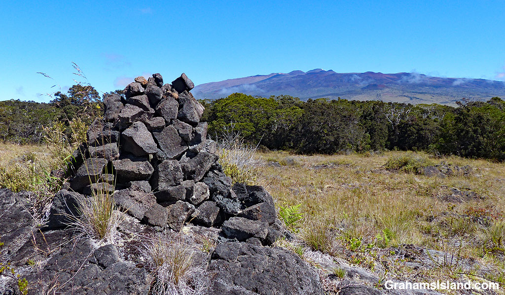
This cairn is one of many that mark the path of the Pu’u O’o Trail, off Saddle Road. At various spots, the trail offers good views of Mauna Kea such as this one.
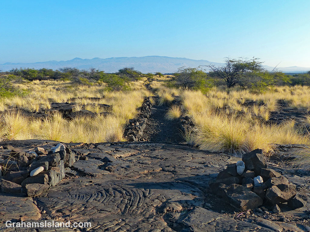
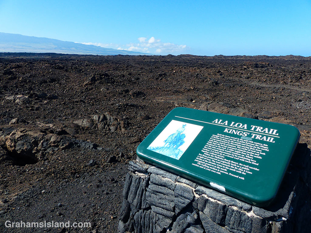
The Kings’ Trail, is more properly known as the Ala Kahakai Trail (shoreline trail) or the Ala Loa Trail (long trail). The trail was created in the 1800s and stretched 175 miles from Upolu, at the northern tip of the island, down the west coast and up the south coast, to Kalapana in the southeast corner.
It passed through 220 ahupuaʽa, which were land divisions stretching from the ocean to the mountains. This meant that each ahupuaʽa contained the necessary resources to sustain its inhabitants.
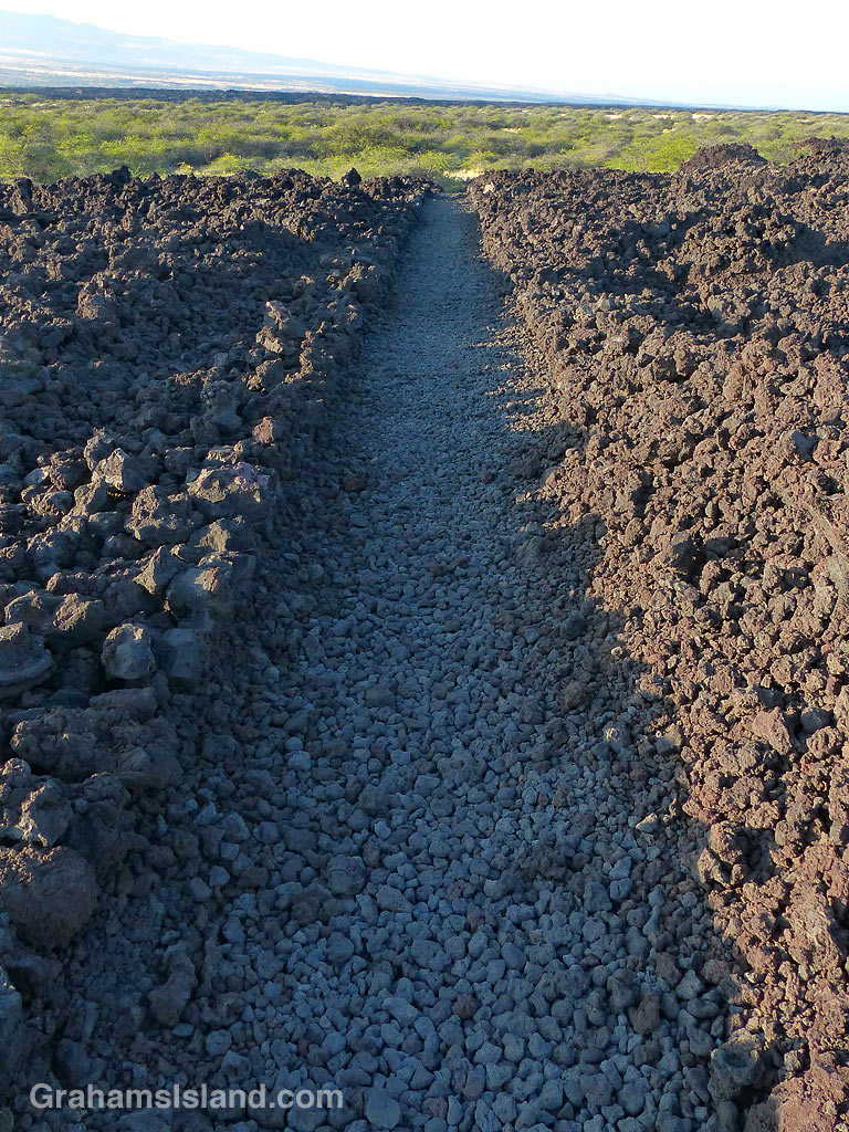
These days, some sections of the trail are open for hiking, but others cross private land. The goal is to reopen as much of the trail as possible to public use. These photos are of parts of the trail passing down the Kohala coast. In many places the trail is ramrod straight to make passage easier, though the surface is often uneven.
Posted in response to this week’s Friendly Friday challenge on the theme of ‘Pathways.’ See more responses here.


 The Kings’ Trail, is more properly known as the Ala Kahakai Trail (shoreline trail) or the Ala Loa Trail (long trail). The trail was created in the 1800s and stretched 175 miles from Upolu, at the northern tip of the island, down the west coast and up the south coast, to Kalapana in the southeast corner.