Tag Archives: Kohala

NEXRAD radar facility

NEXRAD radar (golfball)

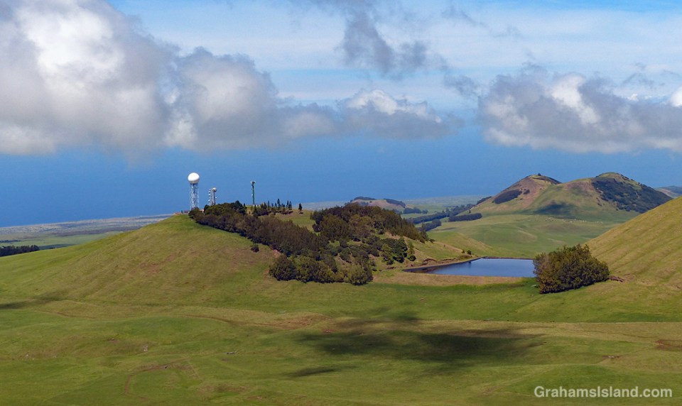
NEXRAD is the Next Generation Weather Radar operated by the National Weather Service, Air Force Weather Agency, and Federal Aviation Administration. There are 160 sites, most of which are spread across the United States. Four of the sites are in Hawaii, two of which are on the Big Island. This site is on Kohala Mountain, northwest of the summit. It’s known to local pilots as the golfball, for obvious reasons.

This weather radar network is a staple of online news and weather sites and shows the location and movement of rain and clouds. The Kohala radar features a pie-slice area of permanently clear weather to the northeast, which I assume is caused by the nearby topography.

I use the weather radar quite a bit and find it fairly helpful, though the weather here is quick to change. Weather forecasts, on the other hand, I find are more of a 50-50 proposition – they’re either fairly right (not too hard to figure out when the trades are blowing) or wildly wrong (all other situations). However, since it’s almost always warm here, I can’t complain too much.

For more information about NEXRAD radar, go to https://www.ncdc.noaa.gov/data-access/radar-data/nexrad.

Ironman 2018

Ironman winner Patrick Lange
Ironman cyclist leaving Hawi
Ironman cyclists
Ironman cyclist in blue

Saturday saw the running of the 40th edition of the Ironman World Championships in Kailua Kona. This is the event featuring a swim of 2.4 miles, a bike ride of 112 miles, and a run of 26.2 miles. As in previous years, I participated in this event by walking out to the main road and taking photos, whenever possible from a nice shady spot.

Actually, this year’s race was run in prime conditions for the athletes. It was overcast with occasional light rain and only a gentle breeze from time to time. Consequently many records were set, including new course records for both men and women.

The top photo shows men’s winner and defending champion, Patrick Lange of Germany, zipping by on his way back towards Kona. Second photo, Great Britain’s Susie Cheetham heads out of Hawi. Third photo, Dan Plews of NewZealand (1685) leads Robin Schneider of Germany (2310), and Neil Eddy of Great Britain (2070). These three finished the bike leg in fairly close proximity, but after the marathon run, Plews finished 21 minutes ahead of Eddy and 45 minutes ahead of Schneider. Fourth photo, Jodie Robertson of the U.S.A demonstrates the importance of color coordination while cycling. Bottom, a large group of riders roll into Hawi, the turnaround point of the bike leg.

For more information about Ironman, go to Ironman.com.

Ironman group

Better Days: Wrecked bomber

Better-Days-Wrecked Bomber in trees

Better-Days-Wrecked Bomber in ravine
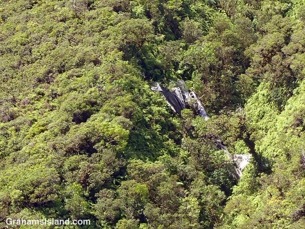
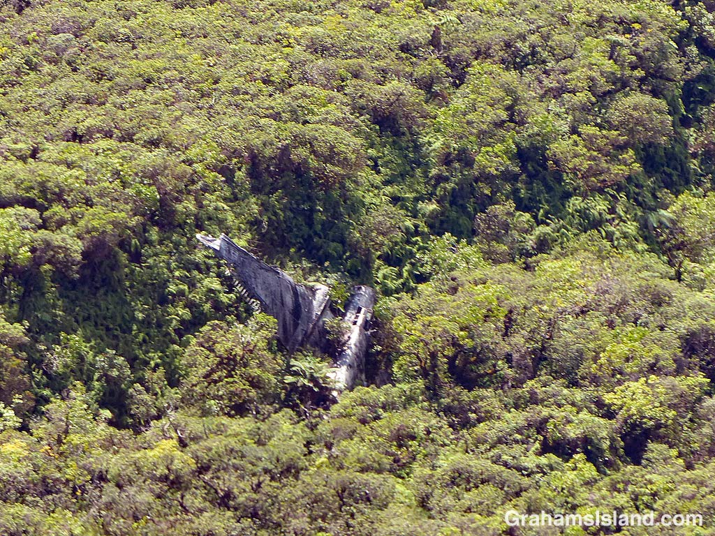
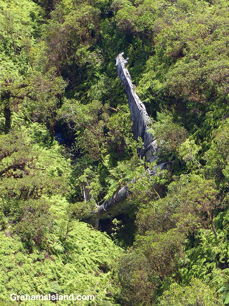
On the evening of Tuesday, February 25, 1941 this twin-engined B-18 bomber was part of a group of four aircraft on a night training mission. They had started out from Hickam Field on Oahu. Not far from Hilo the plane lost its port engine when a bearing failed. The pilot decided to try and reach Suiter Field (now known as Upolu Airport) at the island’s northern tip. It was not to be. Flying on only one engine, the plane lost altitude. The crew thought they were over the sea, but suddenly a mountain appeared in front of them. The pilot yanked on the flight yoke wheel and the plane stalled and flopped into the trees around 10 p.m.. Incredibly only one crewman was slightly injured.

Search aircraft from Hickam Field found the plane the next morning around 9 a.m.. The nose of the plane was hanging over a 75-foot deep ravine about 3,500 feet up on the northern side of Kohala Mountain. It was one of the most inaccessible places on the island. A rescue operation was started, but it was Thursday noon before it reached the crew.

Over the years, the aircraft has slid into the ravine which is where it rests today. As these photos show, the plane’s condition has deteriorated and it is increasingly being engulfed by trees. But it is still quite easily spotted from the air. On the ground, it remains one of the most inaccessible spots on the island.

It’s also worth noting that just nine months after this crash, almost all the B-18 bombers based at Hickam Field were destroyed on the ground during the attack on Pearl Harbor. 77 years on, this B-18, in its remote resting place, is one of only a handful remaining in existence.

For more information about this aircraft and the crash, search online for Big Island Bomber – hiavps.com or go to pacificwrecks.com/aircraft/b-18/36-446.html.

Better-Days-Wrecked Bomber

Kohala Ranch

Kohala Ranch

This is an aerial view of Kohala Ranch on the left and Kohala Estates on the right. The main road, Akoni Pule Highway, runs across the photo just above the coastline. The dark strip running across near the top of the land is Kohala Mountain Road, the darkness being the trees which line much of the road.

Kohala Ranch is a gated community which spans the space between these two roads. Near the bottom, houses are built on lots of one to three acres. Midway up the hill are five acre lots, and toward the top are bigger lots of 10 and 20 acres. The community has access to both roads. The top of the community gets more rainfall, and more wind, than the lower sections. Kohala Estates connects only to the bottom road.

Communities such as these are fairly common on the Big Island. Some are gated, some not, but most cater to people moving to the island from elsewhere since the property prices tend toward the upper end of the market.


Horses with a view

Horses and the ocean

I used to see these four horses frequently when I went for walks. They’re still around, but not as accessible as before. This pasture has been sold and is now used to grow Hawaiian heirloom sugarcane for use by a rum micro-distillery.

Another thing that’s changed is that the brown grass has been greened up by the last two hurricanes, both of which have dumped a good deal of rain, but generated very little in terms of wind, at least around here.

Egrets and turbines

Egrets and turbines

Today marks the 1,000th post on this blog. To mark the occasion I looked for a suitably appropriate subject and couldn’t find anything! So instead I chose this photo since it featured a couple of subjects I must have seen a thousand times.

I pass the turbines at Hawi Wind Farm on my way to the part of the coast where I regularly walk. And I’ve seen an awful lot of cattle/horse/sheep/goat/lawn mower egrets since they are omnipresent. Plus I have a soft spot for them.

In this photo, a flock of egrets is on a mission to get from one pasture to another one. They aren’t the most graceful of flyers, but en masse I find they make a very pleasing sight.

Bench overlooking Honokane Nui Valley

Bench overlooking Honokane Nui Valley

I’ve posted a photo of this bench and view before, but when I took this walk beyond Pololu a few months ago the bench was in bad shape. One of the legs had rotted out and if I wanted to sit, it had to be on one end and with care.

So last time I hiked up that way I took a tape measure, planning to assess the damage and work out what was needed to fix the bench. However, when I got there I found someone had beaten me to it. And unlike my repair idea, they had wisely decided to discard the previous bench frame and replace it with a plastic one.

While it might be somewhat less aesthetically pleasing, the plastic frame should last a lot longer than its predecessor. It’s also securely anchored with metal rods so the bench should be around for a good long time. Something to look forward to next time I make the hike.