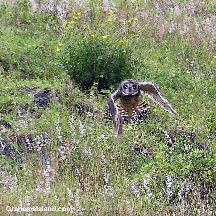
I was driving the mountain road back to Hawi, when I saw this Pueo flying. I pulled over, but didn’t see it again, until I realized it was perched on a rock on the hillside above. It was watching me.
I took some photos and was lucky enough to catch the bird taking off, before heading over a ridge and out of sight.
The final posted for this month’s Becky’s Squares: Seven. See more responses here. I had some left over and couldn’t decide what to leave out, so I put them all in. Captions on photos.
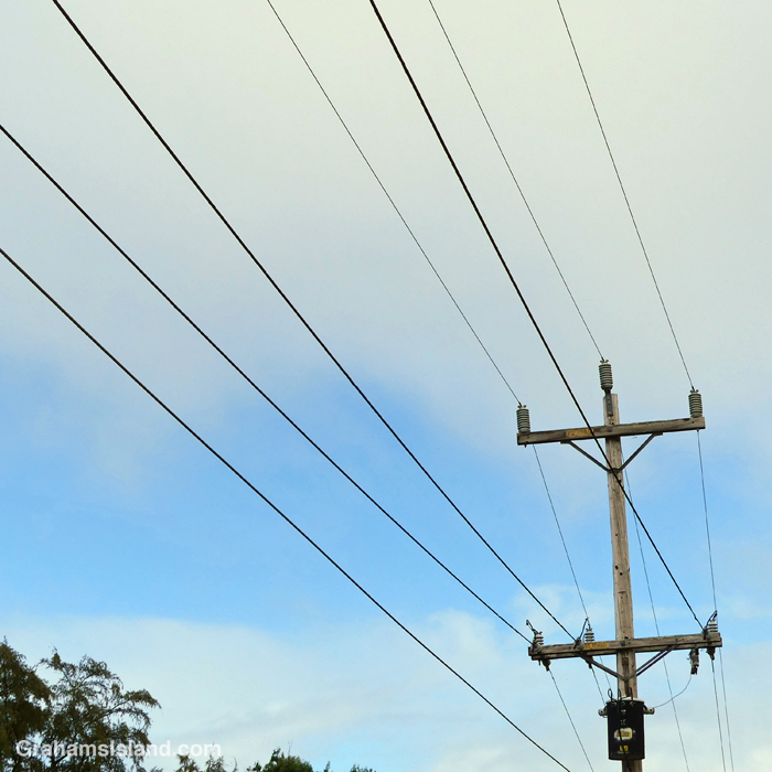
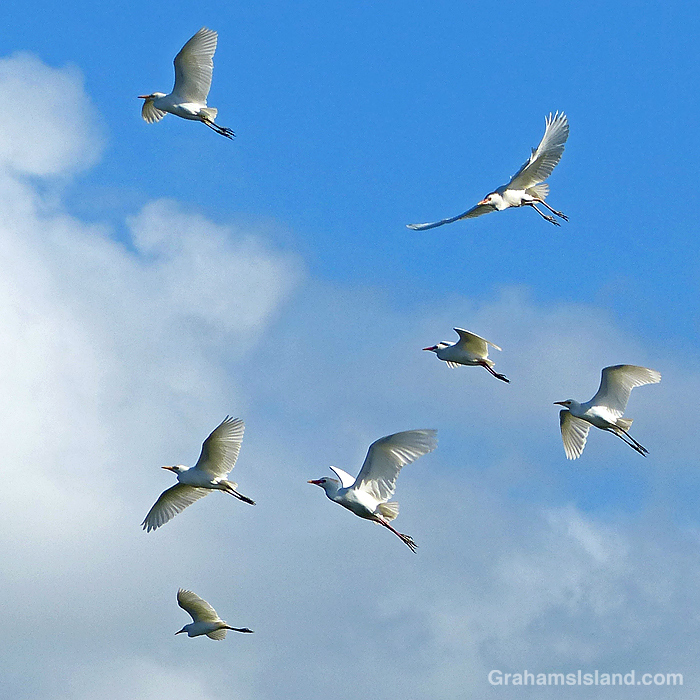
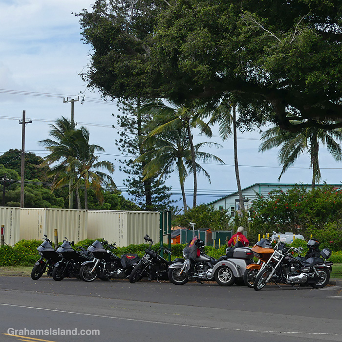
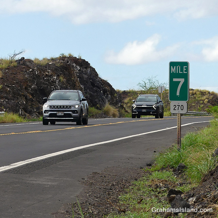
Power to the people.Seven turbines at Hawi Wind Farm.Cattle egrets take wing.I saw these, parked under the banyans, on my way to the post office.Highway 270 is Akoni Pule Highway, my drive to work. The high bank on the left, at Mile Marker Seven, is a prime whale watching spot in season.Regal looking, but really the back stairs to some offices!
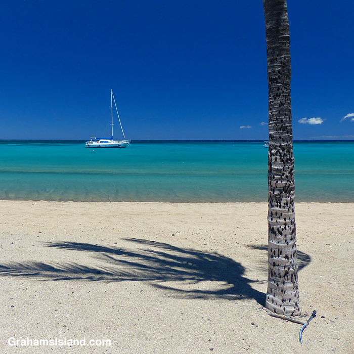
A Covid-year photo of a sailboat anchored off a deserted Anaeho’omalu Bay beach.
The idea of The Numbers Game is to enter a number into the search bar of your computer and then post a selection of the photos that turn up. This week’s number is 161. Captions are on the photos. You can see more responses here.
Also, seven photos posted for Becky’s Squares: Seven. See more responses here.
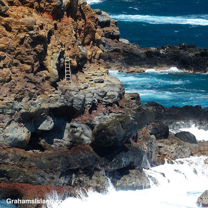
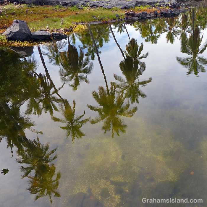
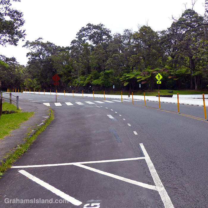
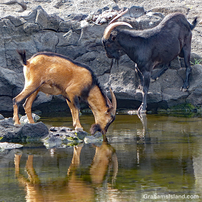
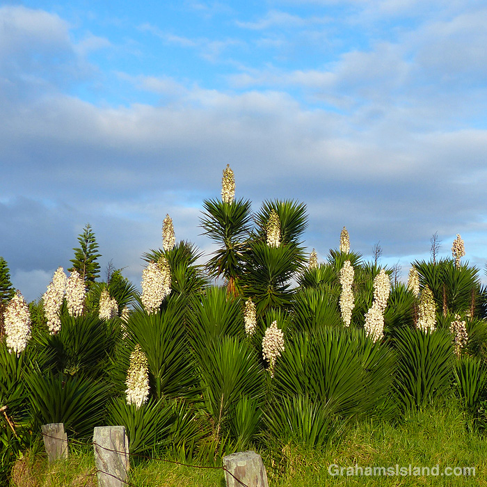
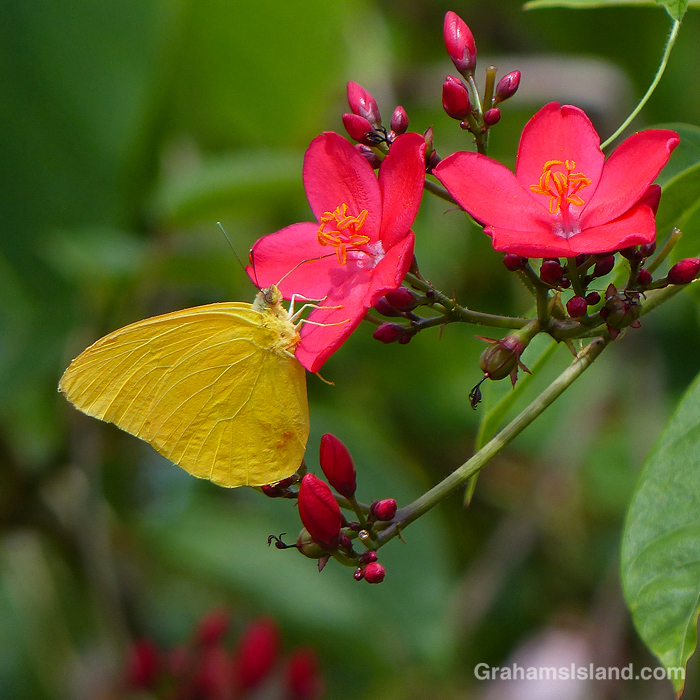
A ladder used by people fishing, to access a rugged shore.Palm trees reflect in one of the ponds at Puʻuhonua o Hōnaunau National Historical Park.Another Covid-year shot, this time of the deserted road and parking area between Kilauea Iki trail and Nāhuku (Thurston Lava Tube), two of the most popular places in the Hawaii Volcanoes National Park. Goats take a drink at a pond in Puʻuhonua o Hōnaunau National Historical Park.Yucca flowers blooming in Waimea.A Large Orange Sulphur Butterfly feeding on Rose Jatropha flowers.
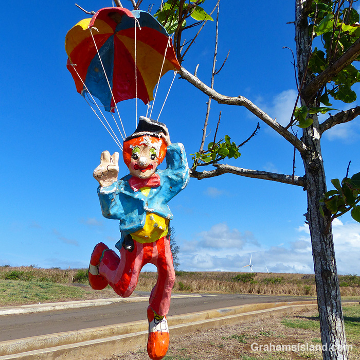
A clown with a parachute hangs on a tree. For a while it was a marker for the local skydiving company.
The idea of The Numbers Game is to enter a number into the search bar of your computer and then post a selection of the photos that turn up. This week’s number is 159. Captions are on the photos. You can see more responses here.
Also, seven photos posted for Becky’s Squares: Seven. See more responses here.
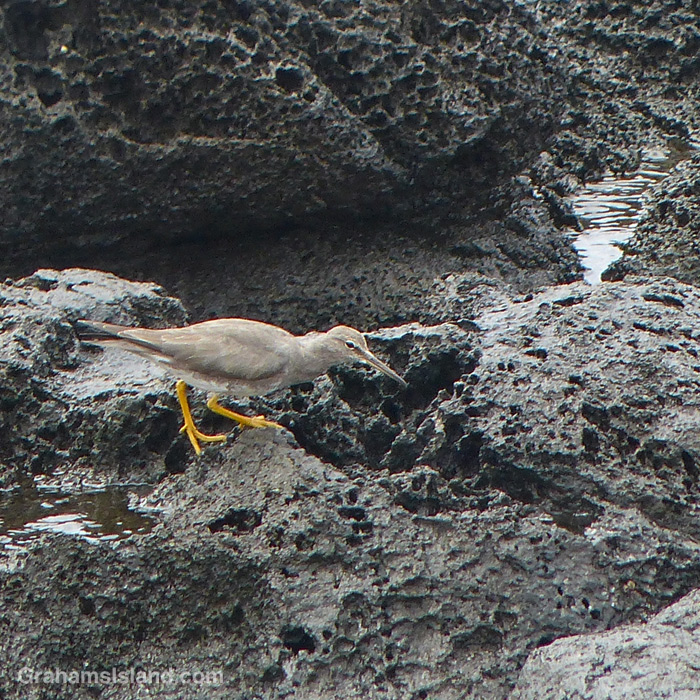
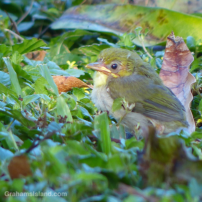
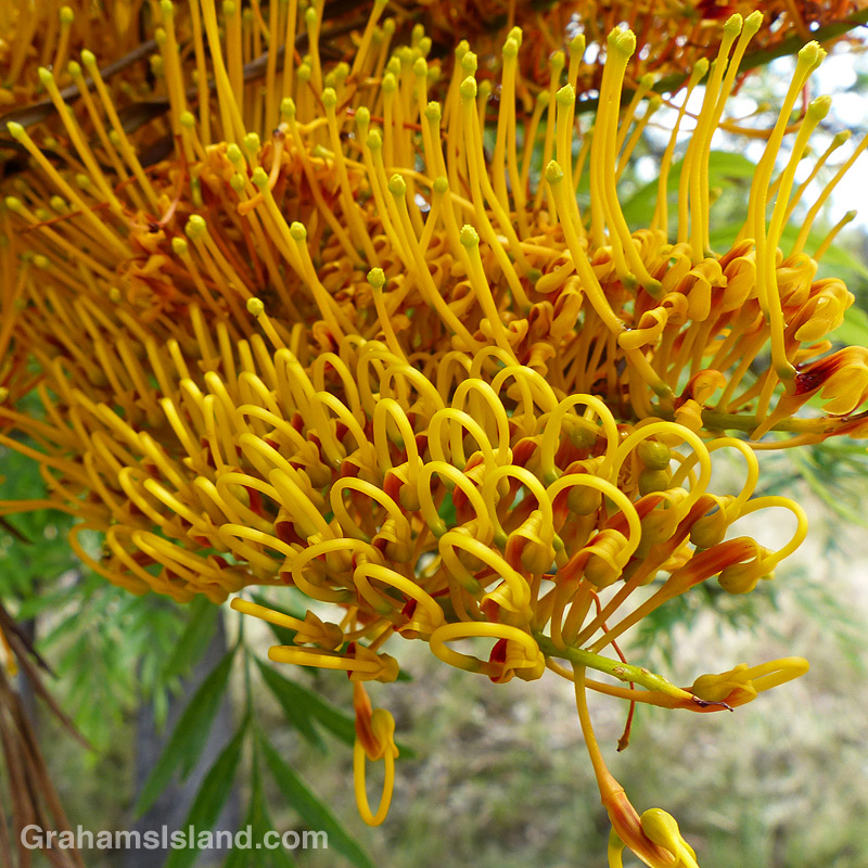
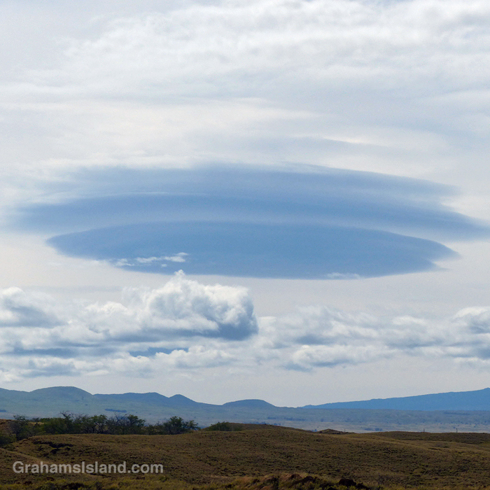
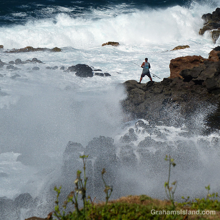
A Wandering Tattler probes along a rocky shore.A Japanese White-eye chick waits for its parents to help it out.The intricate flowers of a Silk Oak tree.A lenticular cloud.A halo around the sun.A fisherman on the coast waits for the water to settle.
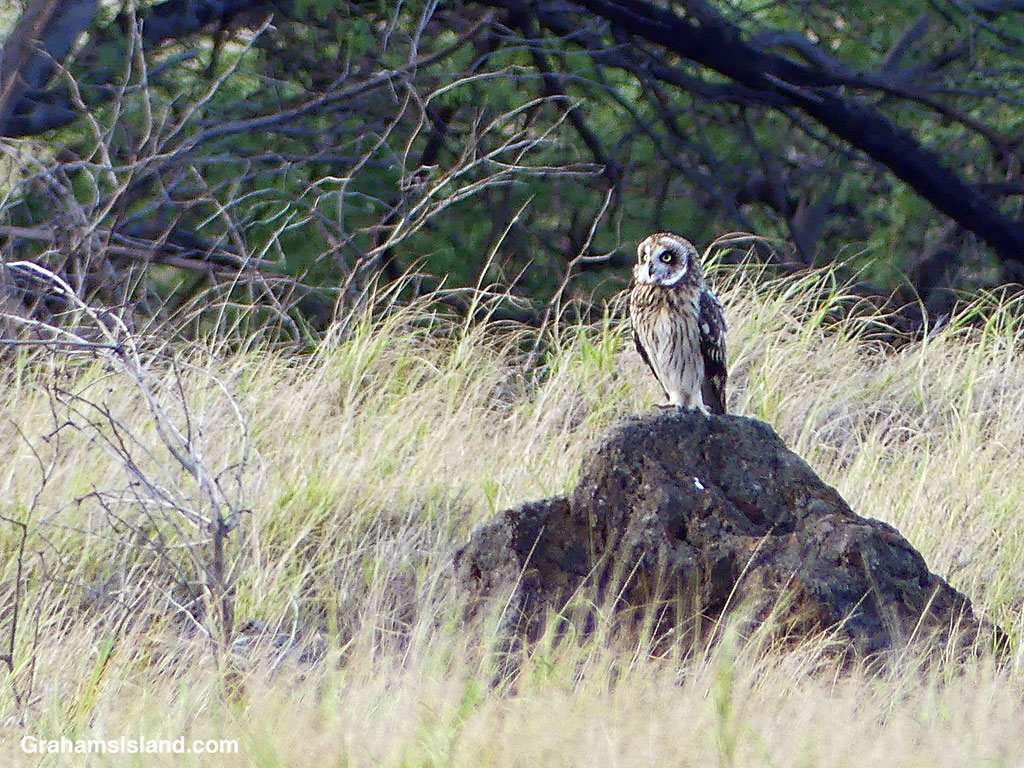
I was on my way to work yesterday, whizzing along only a smidge over the speed limit, when I noticed a familiar image out of the corner of my eye. ‘That’s a Pueo,’ I thought. It was standing on a rock alongside the highway. By the time the thought registered, I was past it, so I drove on a bit until I could turn around and head back.
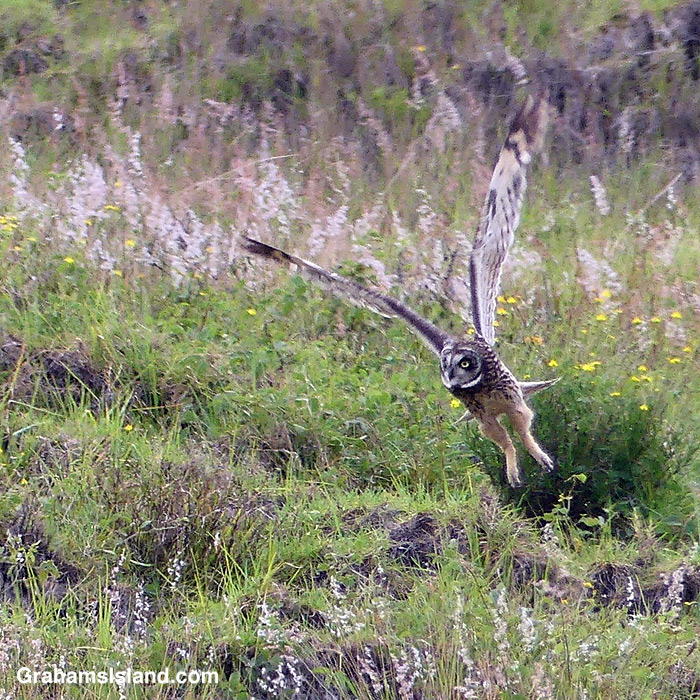
Sure enough, on my return, the bird was standing in the same place. I stopped a little way beyond it, got out, and snapped the photo above. The Pueo started watching me the moment I got out of the car and, as I edged towards it, it took off and disappeared toward the ocean.
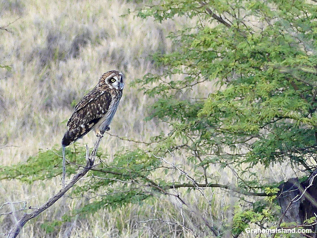
I crossed the road to the spot where it had been perched, then walked a bit farther to get a view down the gully it had disappeared into. I didn’t really expect to see it again, but then I spotted it, clamped to a tree branch, head swiveling 360° as it searched for breakfast. It spotted something, took off in pursuit, and glided from view behind some trees.
I see Pueos occasionally on this stretch of road, but always in flight, usually passing in front of my car at windshield level, which makes me cringe. This is the first time I’ve seen one perched here as this one was.
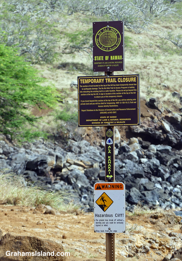
This sign has been in place, near the Old Coastguard Station in North Kohala, since I moved here. That was 12 years ago. But the sign was put in place six years earlier than that, after an earthquake caused the cliff, traversed by the trail, to slide into the sea.
The trail is the Ala Kahakai trail, a modern rendition of the network of trails used by the early Hawaiians. 175 miles long, it stretches from the northern tip of the island, down the west coast, and along the south coast through Hawaiʻi Volcanoes National Park. Segments of the trail are open to the public; other parts cross private property and are not yet accessible.
This ‘temporarily closed’ segment crosses the cliff frontage of a gated community. Rerouting the trail will require the cooperation of community residents impacted by moving the trail. This hasn’t happened yet.
I reckon the most likely change in this situation, that I might see in my lifetime, is that the sign will fall down. Replacing it could take several years!