
Cutting through the lava between Mauna Kea and Mauna Loa are these two roads. The lower one is Saddle Road, the upper one a road leading to the military base at Pōhakuloa Training Area.

Cutting through the lava between Mauna Kea and Mauna Loa are these two roads. The lower one is Saddle Road, the upper one a road leading to the military base at Pōhakuloa Training Area.
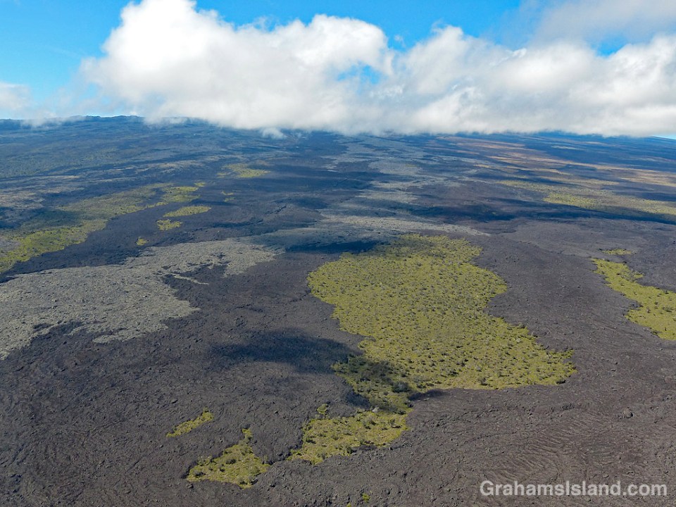
These lava flows, on the northeast slopes of Mauna Loa, show some of the colors lava takes. Together with the untouched islands of vegetation and cloud shadows, I think they make an interesting patterned landscape.
 This week’s Sunday Stills challenge theme is ‘Time.’ (See more responses here.) I had a couple of thoughts about this. The first is that the state of Hawaii is a kind of geologic timepiece. The Hawaiian islands exist because a magma source known as the Hawaii hotspot generates volcanic activity. This creates underwater seamounts that eventually break the surface to form new islands. Such a process is currently taking place with Lōʻihi Seamount, off the southeast coast of the Big Island. It’s about 3,000 feet below the surface but, if it continues its present activity, it will rise above sea level in another 10,000 to 100,000 years.
But if Hawaii is on a volcanic hotspot, why doesn’t it produce one volcano that just gets bigger and bigger? Well, the tectonic plate on which Hawaii sits is in constant motion to the northwest. So the volcanic activity generates an island, but as the plate moves, that island edges away from its creative source and the volcanic activity ceases. What happens then is that the winds and waves begin a long process of erosion until that island is reduced to an atoll and finally disappears below the ocean’s surface. We’re not talking months here. We’re talking millions of years for this process to take place.
Look at a map and you’ll see this chain of Hawaiian Islands stretching away to the northwest, the islands or atolls becoming progressively smaller until they disappear and return to being below-surface seamounts. And while I say this is a slow process, it can also be speedy. In October of this year, Hurricane Walaka ripped through the French Frigate Shoals, part of the northwest Hawaiian chain. Its passage completely removed the second largest island in the group, East Island, from the map. Researchers had been working there before the hurricane struck. After its passage, it was gone (more info here).
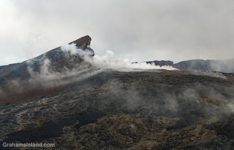
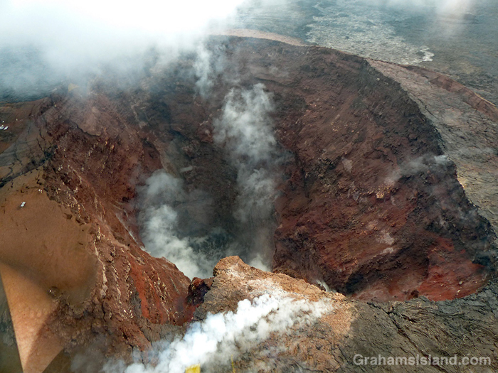
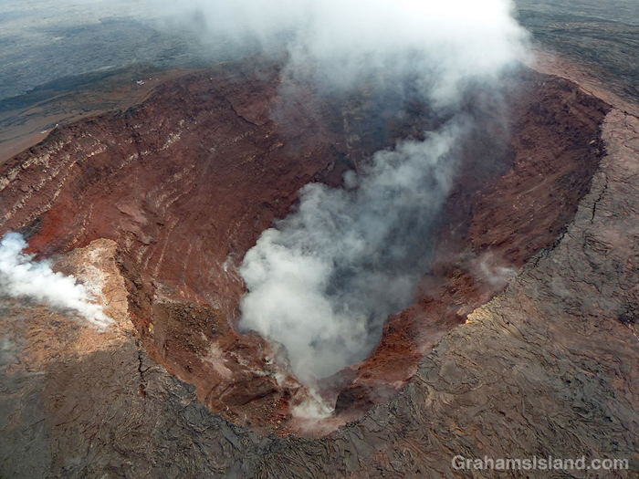
So Hawaii is an example of the geologic passage of time. But there’s another aspect of our view of time that is illustrated here. The photos are of Kilauea’s Pu’u O’o vent. Kilauea is one of the planet’s most active volcanoes and the Pu’u O’o vent had been more-or-less continuously active since 1983. Then, in May of this year, the activity in this vent, and in the summit vent at Halema’uma’u Crater, ceased. The magma drained from these places and traveled down the east rift zone of the volcano before emerging in a residential subdivision, Leilani Estates, in the southeast corner of the island. This new eruption produced a lava flow that reached the ocean, destroying more than 700 structures en route, but adding hundreds of acres to the Big Island coastline.
What’s the time aspect of this? Well, it’s part of the geologic time process noted above. But there’s another way of looking at it. Kilauea has been erupting so long and so regularly that it’s been a little bit taken for granted. “Oh, lava’s flowing into the ocean? You know, I’m really busy right now. I’ll catch it later.” “The summit vent is spilling onto Halema’uma’u Crater’s floor? I’ll check that out next time I’m down that way.”
I consider myself fortunate that I got to see the firehose of lava entering the sea after a cliff collapse (here). Next day, following another cliff collapse, it was no longer visible. And in April of this year I went down to see the summit lava lake (here) bubbling up to the crater floor and visible from Jagger Museum. Two weeks later, the level had dropped a thousand feet. It continued to fall.
I might never see these things again in my lifetime, but at the time, there seemed to be lots of time to visit. But even events happening in a long, geologic timeframe might occur in the space of a week, a day, even an hour. It’s a reminder to me that each moment is something fleeting, perhaps something special, something to pay attention to.
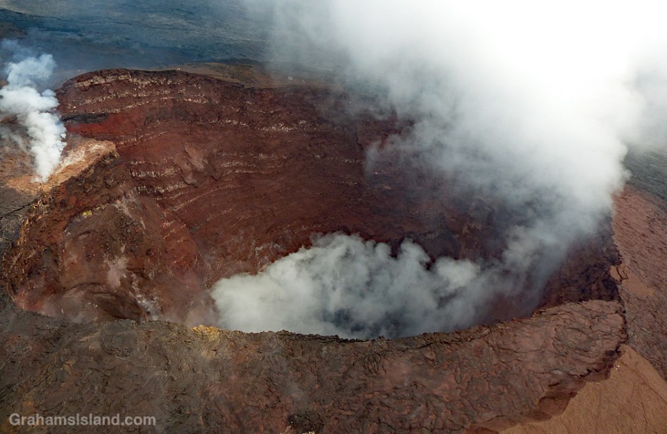
These photos are of Pu’u O’o vent in late September of this year. No lava is visible in the vent, but it’s still hot enough that rainfall generates steam, which is what’s visible here. It was quite dramatic to pass over this vent, which for 35 years has pumped lava out onto the surrounding landscape.
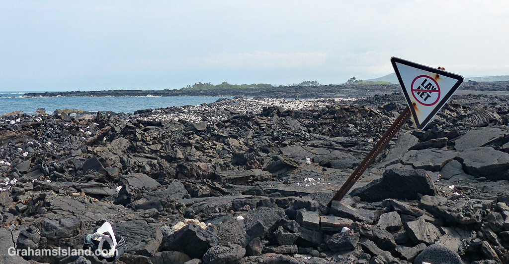
Lay nets are also known as gill nets. They can be hundreds of feet long and many feet deep with floats on the top edge and weights on the bottom. The problem with them is that, rather than targeting specific food fish, they can catch anything swimming by including turtles and monk seals. Because of this, they’re banned in certain areas, though not everywhere in Hawaii.
To me, this photo represents how the ban works. This section of the Kona coast is one of those areas where lay nets are banned. Someone has gone so far as to erect a sign in the lava near the coast. But that’s about it. In due course, the sign will fall down. It probably won’t be replaced. In the meantime, enforcement of the ban is spotty at best. Even when a violation is called in, chances are no one will be out to check on the situation until long after the net has been hauled and the netters gone home.
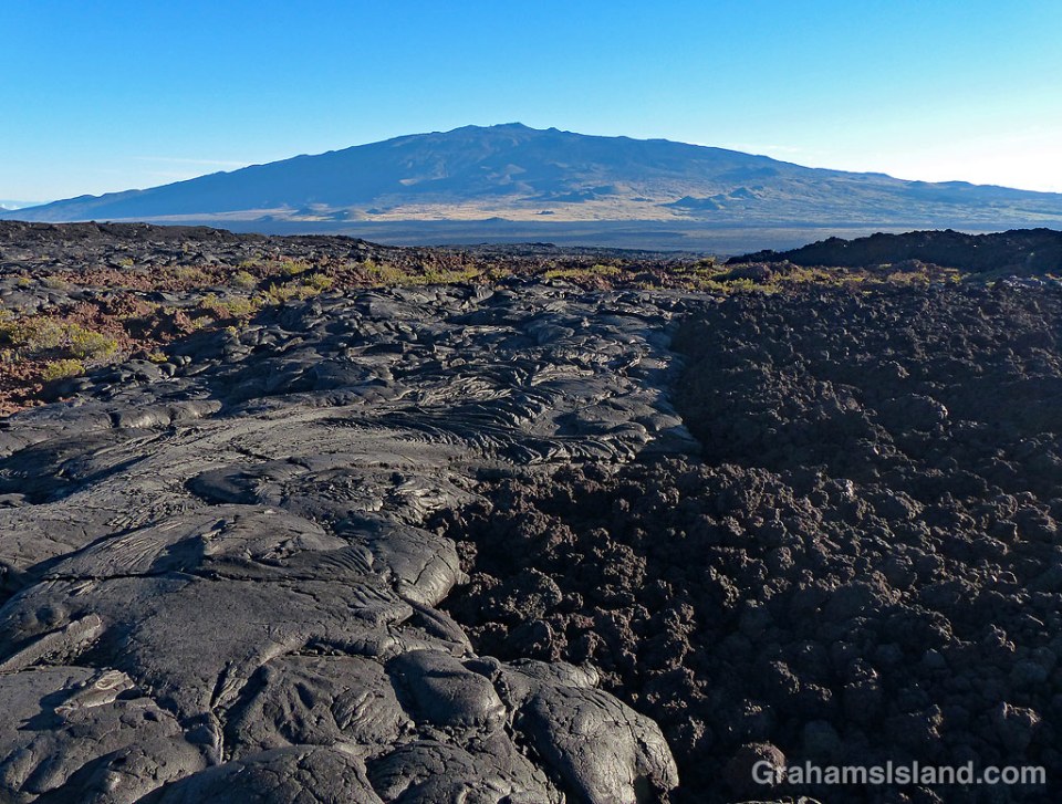
This photo shows the two main types of lava found on the Big Island. On the left is pahoehoe lava and to the right, a’a lava. They’re noticeably different. Pahoehoe lava is typically rounded and smoother, and the height of the flow is quite modest. A’a flows are characterized by a rough, clinker surface and the flow height is greater. Both types of lava can be produced by the same eruption and even in the same flow, depending on conditions.
Pahoehoe flows occur when lava is hot and fluid. Typically, pahoehoe flows result from an eruption that outputs lava at a lower rate, has a lower flow rate and a slower moving flow front. The slower movement of the flow allows a skin to form on the surface and this insulates the lava within. The flow is actually made up of a large number of ‘toes.’ Each toe flows for a short time, a matter of minutes. When it stops, the lava inside causes the toe to expand until the skin cracks and releases a new toe.
A’a flows are more viscous, but with a higher flow rate and faster flow front. The lava in the center of the flow is very dense with a layer of rough clinker on top. As the flow advances, the front tumbles over itself breaking into more rough pieces.
It’s easy to see from the photo that walking is much easier over pahoehoe lava than a’a lava. That’s when it’s cooled of course. When it’s red hot and flowing, it’s best not to get too close.
This flow was on the north side of Mauna Loa, looking across to Mauna Kea.
For a more thorough description of the difference between a’a and pahoehoe lava, go to http://volcano.oregonstate.edu/book/export/html/131
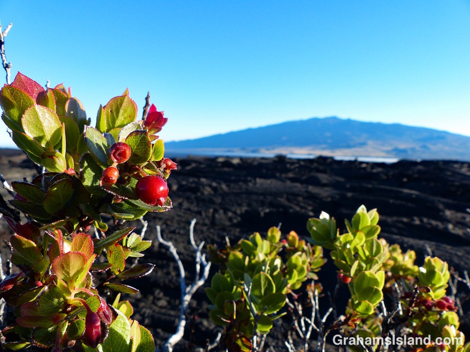
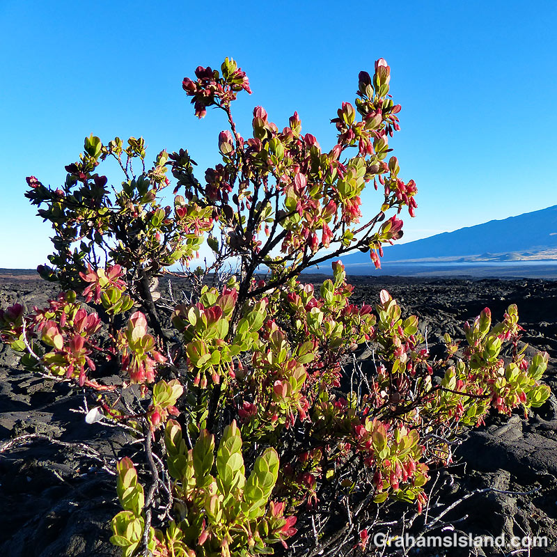
Ohelo ‘Ai (Vaccinium reticulatum) is an endemic plant also known as Hawaiian blueberry. It’s seen here growing on the inhospitable slopes of Mauna Loa, with Mauna Kea in the background.

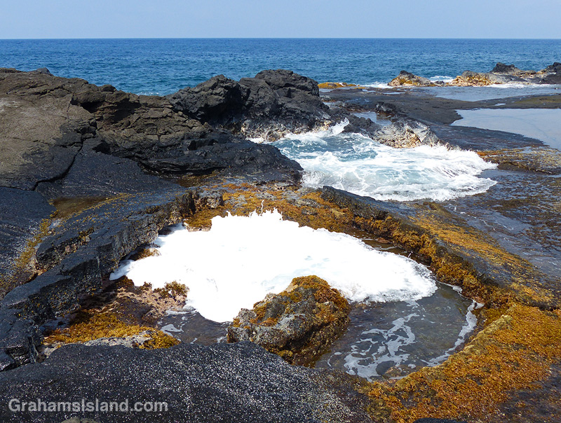
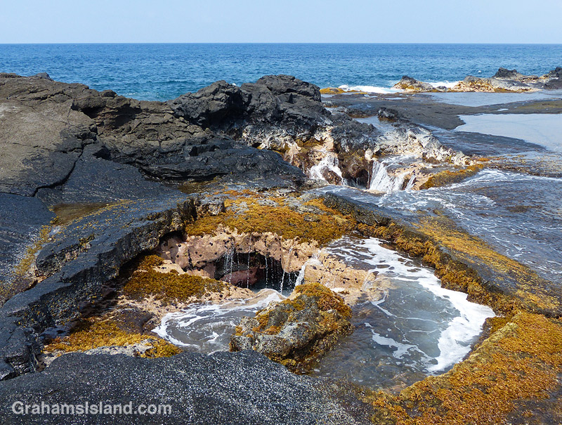
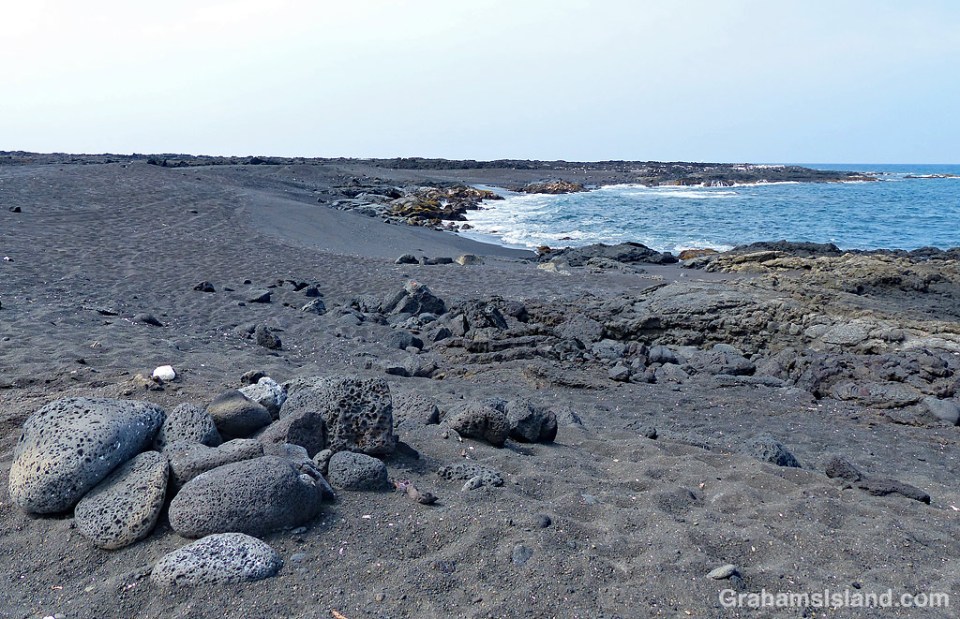
Between Kailua Kona Airport and Kekaha Kai State Park is a stretch of coastline heavy on lava and aircraft coming in to land, but light on vegetation and people.
There’s a fair smattering of black sand to be found in little coves and one proper black sand beach at Makole’a (below).
In several places, white plastic tubes can be seen wedged or cemented in to the lava (above). They’re fishing pole holders and are a common sight on most of the island’s coastline.
And then there are the usual features of old lava flows by the ocean including blow holes and fractured lava tubes where the ocean surges in and out again (right).

The twisted remains of a dead tree lie, under heavy skies, on an old lava field at Hawaii Volcanoes National Park.
For more information about Hawaii Volcanoes National Park, go to nps.gov/havo/.
Posted in response to this week’s WordPress Photo Challenge ‘Twisted.’

