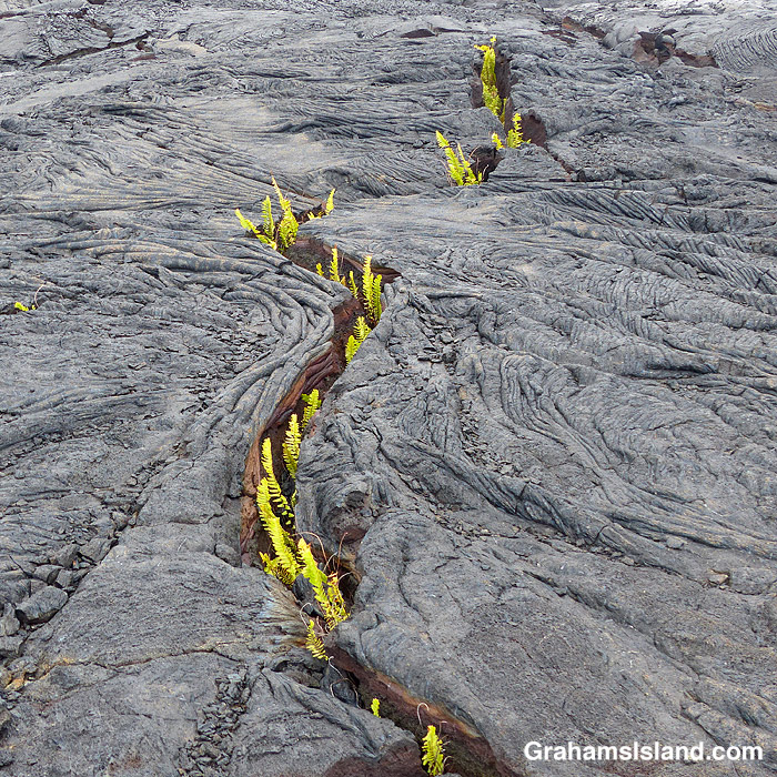
It’s often easy to see cracks in a lava field because there are endemic ‘ae ferns (Polypodium pellucidum) growing in them and they make a distinct green line through the mostly gray lava.
Posted in response to Becky’s October Squares challenge theme of ‘Kind.’ See more responses here.
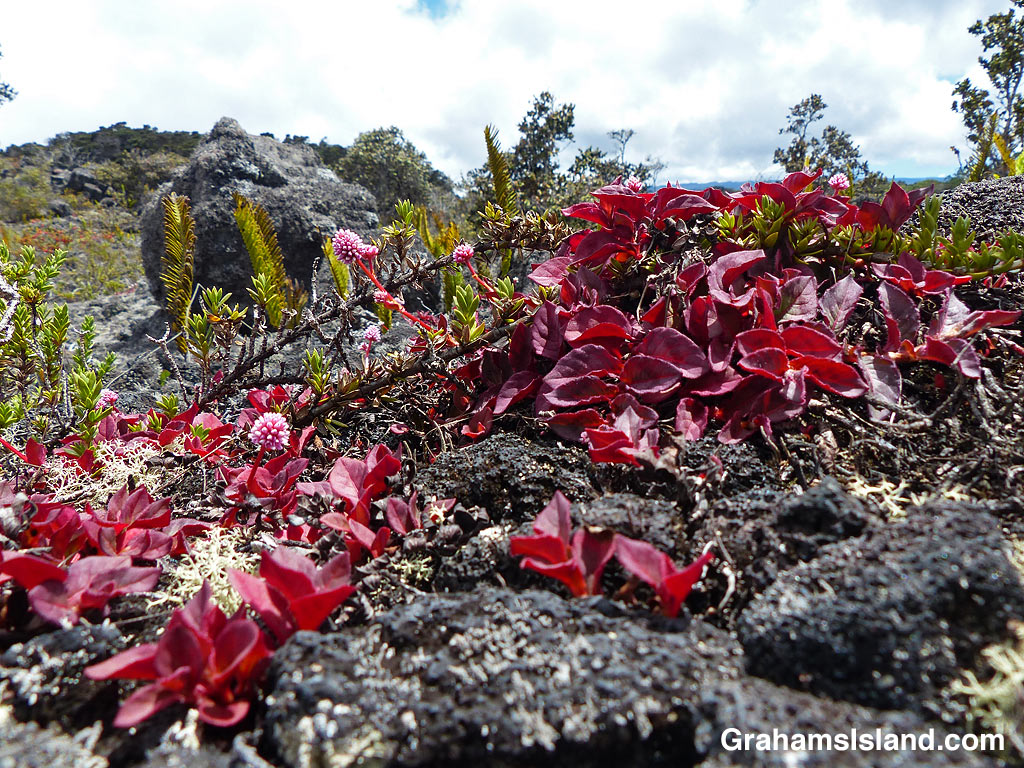
Ohelo ’Ai (Vaccinium reticulatum) is an endemic shrub also known as the Hawaiian blueberry. It’s one of several kinds of native plant adapted to the harsh environment of a volcanic island. This plant was growing on a lava flow off Saddle Road, which is typical here. It does well in disturbed ground above 2,000 feet.
The berries, which are edible, are a food source for nenes, but I really like the delicate flowers and the leaves, which start out as a matching red.
Posted in response to Becky’s October Squares challenge theme of ‘Kind.’ See more responses here.
The trail winds down through woods and abundant vegetation.
Steps lead down from the mossy pass featured in a previous post.
Recently, I posted a couple of photos (here) of a section of the Halema’uma’u Trail in Hawaii Volcanoes National Park. I thought I’d follow up with a few more photos of the trail, which runs from near the visitor center down to the edge of the summit caldera of Kilauea Volcano.
For more information about Hawaii Volcanoes National Park, go to nps.gov/havo/.
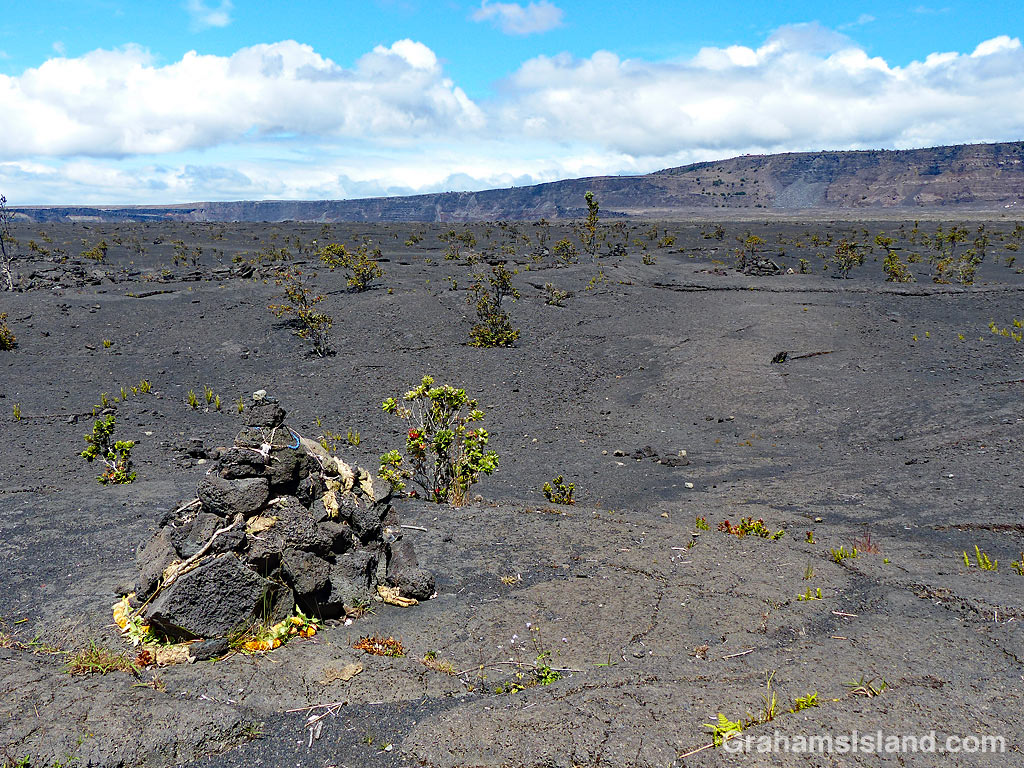
The trail suddenly emerges at the edge of the summit caldera of Kilauea Volcano. In the morning, the bench is a shady spot to take in the view.Halema’uma’u Trail carries on across the caldera, marked by cairns, but this section has been closed since 2008, when the Halema’uma’u Crater vent became active. These days it would lead straight into the depths of the greatly enlarged Halema’uma’u Crater.
Halemaumau Crater, at the summit of Kiluaea Volcano, underwent profound changes during the 2018 eruption. When lava drained from the summit vent, the crater floor experienced a series of collapses, radically changing the appearance of the crater and its surrounds.
I had seen this area from the air and posted about it (here). The middle photo was taken during that flight and shows where a section of Crater Rim Drive slid into the crater. When I last visited the park, I got a different view of this.
The recently reopened Byron Ledge Trail has good views across the crater. In the top photo, the chunk of road is clearly visible with its white line running down the middle of it. The bottom photo shows the longer view across the crater with the road in the distance. In the center of the photo, equipment used to monitor the volcano’s activity, can be seen. The tree in the foreground is an ‘ōhi‘a lehua with its brilliant red flowers. It’s an early colonizer of new lava flows and all those little dark spots on the main crater floor are ‘ōhi‘a lehua trees, mostly still shrub-sized at this time.
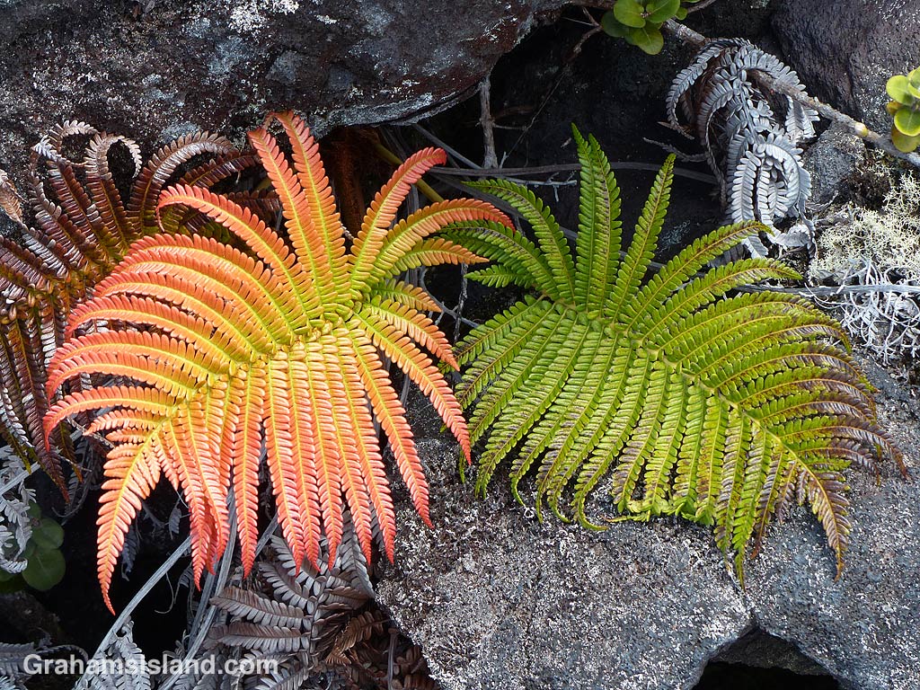
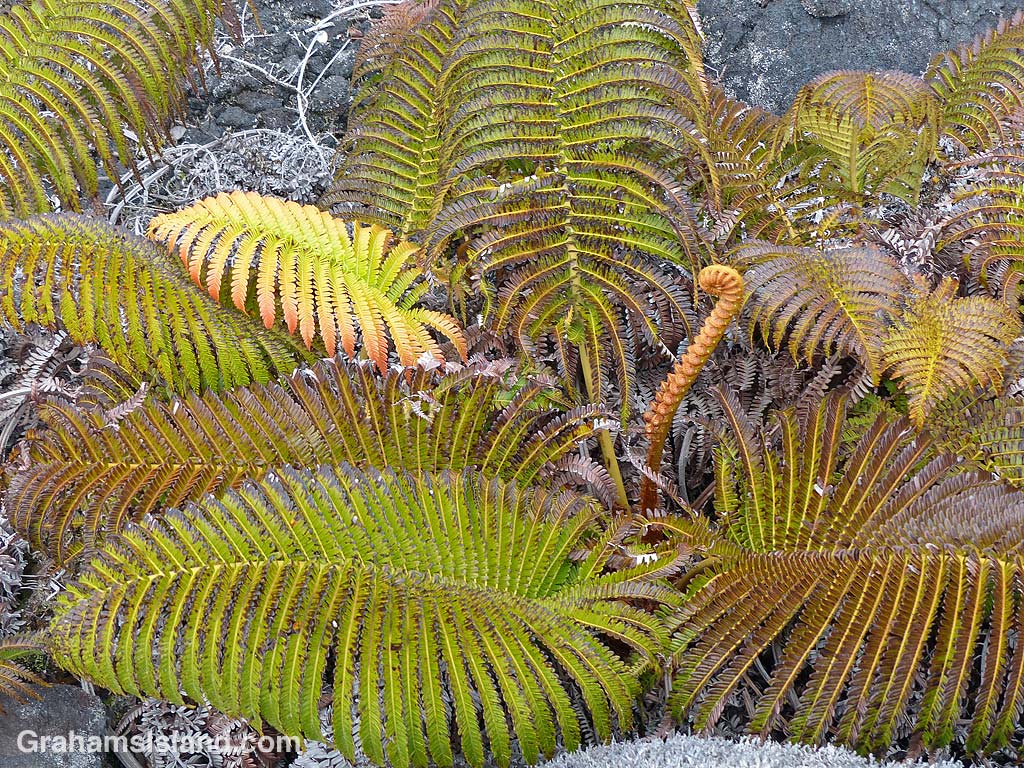
The amaumau fern (Sadleria cyatheoides) is endemic to Hawaii and grows in a variety of areas from wet forests to recent lava flows. I saw these on the Powerline Trail, off of Saddle Road, where the elevation is above 5,000 feet.
These ferns are quite common, but on this day, the color of the new growth really caught my eye. New fiddles are orange to red, changing to green with age. In these photos, the various stages of growth can be seen. These ferns were low growing, but they can also take the form of a tree fern with an upright, trunk-like appearance.
I’m still surprised by what I see in some of the most inhospitable-looking areas on the island. I saw this grasshopper out in the lava fields on the Puna Coast Trail.
This week’s Friendly Friday challenge theme is ‘The Color Pink.’ See more responses here.
Pinkhead smartweed (Polygonum capitatum or Persicaria capitata) is a groundcover that hails from western China and the Himalayas. It’s variously known as pinkhead knotweed, pink knotweed, Japanese knotweed, pink-headed persicaria, or pink bubble persicaria. I use pinkhead smartweed for the very good reason that I like the name. It sounds like the name of someone pretentious, but slightly seedy, from the alleged upper crust of society.
In this bounty of names, a couple of elements stand out. One is ‘pink,’ the other is ‘weed.’ This is a very pink plant and, in Hawaii and elsewhere, an invasive weed. Drive eastbound over Saddle Road (officially Hawaii Route 200, the Daniel K. Inouye Highway) and, once you cross the saddle and begin your descent, this plant will become obvious very quickly. It lines the road on both sides for several miles with very little in the way of other plants competing for that space. This is because pinkhead smartweed will grow in poor ground and lava fields fit that description.
This is also a stretch of highway that, relatively recently, was converted from a narrow, winding road, that rental car companies routinely forbid their clients from driving on, to a wide, smooth thoroughfare, the only place on the island where you can legally go 60 mph, and where you can expect to receive a ticket if you go 80 mph like everybody else.
Redoing the road left verges of rock and gravel and very little else. Pinkhead smartweed was quick to move in and colonize this unpromising territory so that now the descent toward Hilo begins with pleasing pink borders.
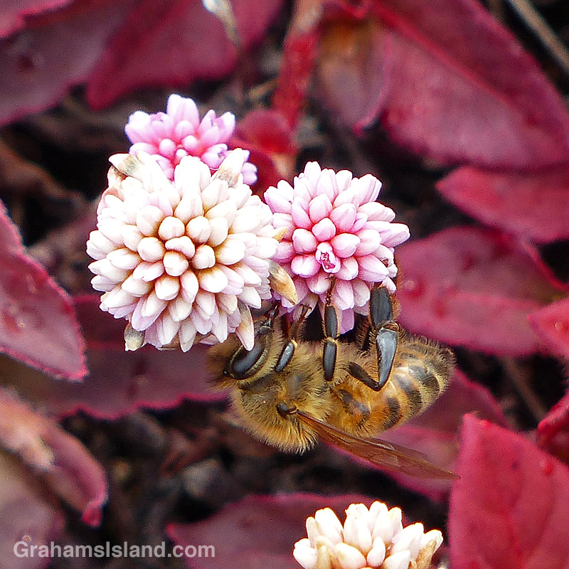
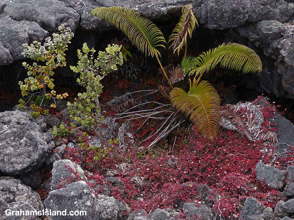
The top photo shows the rugged kind of ground pinkhead smartweed can grow in. To the right, bees appreciate the flowers of this plant growing at an elevation over 5,000 feet. Below, the collapse of a lava tube has left a shady hole where pinkhead smartweed, an endemic amaumau fern, and an ohia tree have established a good foothold.
This week’s Sunday Stills challenge theme is ‘Straight.’ See more offerings here.
Last week, I revisited the Powerline Trail off of Saddle Road. This trail, when combined with the Pu’u O’o Trail, makes a good long loop hike. I like hiking the Pu’u O’o Trail because it passes through several kipukas (patches of old forest that have been spared by lava flows) and those kipukas have lots of birds living in them.
The Powerline Trail is a bit less interesting. There are fewer kipukas and it’s a long, exposed hike in a straight line across the lava. The reason for this can be found in the name. It follows an old 4-wheel drive road that serviced a power line that ran across the lava fields. The line is gone, but the sawn-off stumps of power poles can be seen alongside the trail (to the right of the trail in the top photo, to the left in the bottom photo).
One advantage the Powerline Trail has over the Pu’u O’o Trail can be seen in the bottom photo. This was near the end of my hike in the mid-afternoon as clouds closed in. It’s not unusual for this part of the saddle to be shrouded in thick fog and, if you happen to be out hiking in those conditions, the straight and clear Powerline Trail is much easier to follow than the Pu’u O’o Trail which, crossing the lava fields, can be hard to follow when you can’t see the cairns that mark its route.
The trail, of course, isn’t perfectly straight (though I suspect the power line was). It bumps around lava upwellings and collapsed tubes. But most of the time, one just needs to look up to see, straight ahead in the distance, the faint pale thread of the trail topping a hill or emerging from a dip in the landscape.