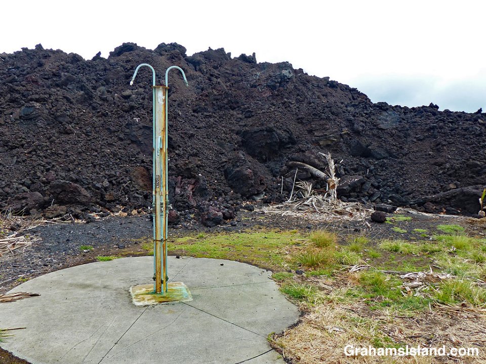
A couple more photos from my visit to Pohoiki at the end of January. Here, an abandoned shower in the picnic area is backed by lava from last year’s flow.


A couple more photos from my visit to Pohoiki at the end of January. Here, an abandoned shower in the picnic area is backed by lava from last year’s flow.
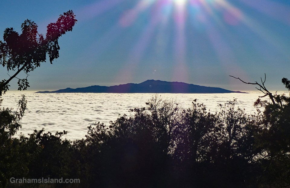
I’ve spent a fair amount of time in my life looking up at clouds, often as they poured water in my direction, so it’s nice to look down on them once in a while. Airplanes are probably the most common place to enjoy this view, but here on the Big Island, the upper reaches of Mauna Kea and Mauna Loa also offer this perspective.
In this case, the clouds were low enough that, when I was visiting the Palila Forest Discovery Trail at around 7,000 feet, the clouds blanketed the landscape below. Here, Hualalai pokes through the cloud layer in the late afternoon.
For more information about Palila Forest Discovery Trail, go to dlnr.hawaii.gov/restoremaunakea/palila-forest-discovery-trail/.
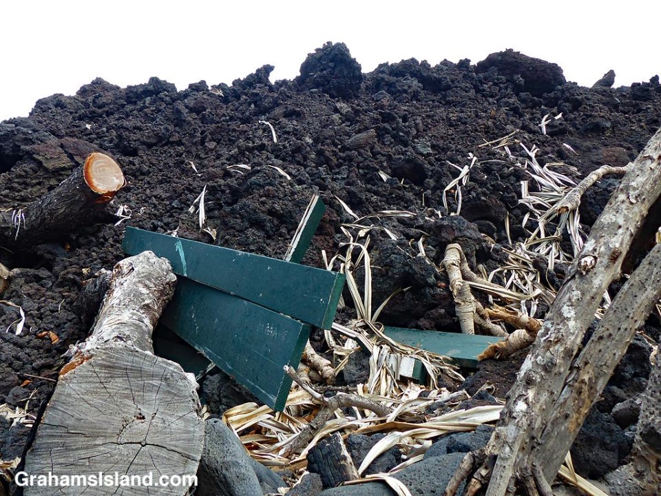
Yesterday I posted here about revisiting Pohoiki, also known as Isaac Hale Beach Park. Today, in response to this week’s Sunday Stills challenge on the theme of ‘Fire,’ (more responses here) I’m posting a couple more photos from that visit. Being perverse, I’ve chosen photos with no fire in them.
The top photo shows where the flow from the 2018 Kilauea eruption came to a halt, in the park’s picnic area. It has swallowed up one of the picnic tables, as well as some surrounding trees. What I find interesting about this is that neither the table, nor the trees, caught fire. I think this is because, by this time, the supply of lava had already stopped reaching the extremities of the flow and, consequently, those areas had already cooled considerably to below the temperature needed to cause combustion.
The bottom photo has a simpler, fire-related appeal. It could easily be captioned, ‘the barbecue pit meets the mother of all barbecues.’


 It’s been a while since I was last at Pohoiki, also known as Isaac Hale Beach Park. One reason for this is that it’s about as far away from where I live as is possible on the island. But back in July 2016, I went down there at an ungodly hour to board a boat and go see lava flowing into the ocean. I wrote about that trip here and here. At the park were restrooms, picnic tables, and a boat launch ramp protected by a small breakwater.
Last year, Pohoiki was in the news because it was where the flow from the 2018 Kilauea eruption finally ground to a halt, about 100 yards short of the boat ramp. A few days ago, I decided to revisit the park and see the changes that had taken place.
Driving into the park, the cooled lava flow could be seen, stretching down the side of the grassy picnic area (bottom photo). But what I really wanted to see was the boat ramp and the black sand beach at the bottom of the park. They did not disappoint.
The boat ramp, previously used to launch quite large boats, including the lava tour catamaran of 2016, now leads to a small lagoon (top photo). (Note the signs on the left of the photo.) This lagoon is perfect for swimming or sailing model boats, but as a boat launch ramp it has one big drawback. There’s now a long, deep, curve of black sand separating the ramp from the ocean (photo below). This beach began forming during the eruption, but I was surprised by how substantial it was. It’s rocky in places and the sand is quite coarse, but it is unquestionably a beach and it looks like it’s here to stay.
An indication of the beach’s substance can be seen in the second photo. The red triangle on a pole marked the end of the breakwater. Now it’s deep in sand. The breakwater is still there, but almost entirely buried.
The beach was formed by lava pouring into the ocean. Some of it solidified into large chunks, but a lot was quickly broken into smaller pieces and fine sand. (In the postings about my 2016 trip, one of the photos shows a black sand beach forming at the base of the flow.) A good deal of this sand was carried a short way down the coast to form this new beach.
I don’t have a good photo of the park before these changes, but the local newspaper has an aerial view here that shows the features I’ve mentioned. In that photo, the boat ramp, breakwater, and rocky shore can be seen at the bottom. Top left is the restrooms building that is also top left in the bottom photo here. The paths and picnic tables can also be seen.
I’d expect that on my next visit, all these new features that I’ve mentioned will still be there, but there is one caveat. If there’s a new eruption in this area, then everything could change. It’s one of the facts of life of living near an active volcano.
Posted in response to this week’s Friendly Friday challenge on the theme of ‘Revisited.’ See more responses here. Tomorrow, I’ll post a few more photos in response to the Sunday Stills photo challenge.

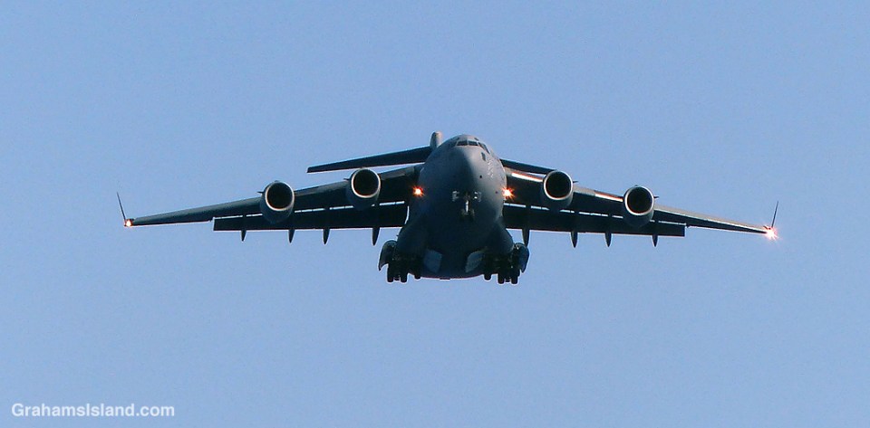
Kekaha Kai State Park, north of Kailua Kona, is a pretty park with some excellent beaches. It’s also right under the flight path for aircraft heading to Kona International Airport (officially known as Ellison Onizuka Kona International Airport at Keahole).
What this means is that a steady stream of jets, on final approach to the airport, pass overhead, and not that far overhead either. It’s not the quietest park in the state.
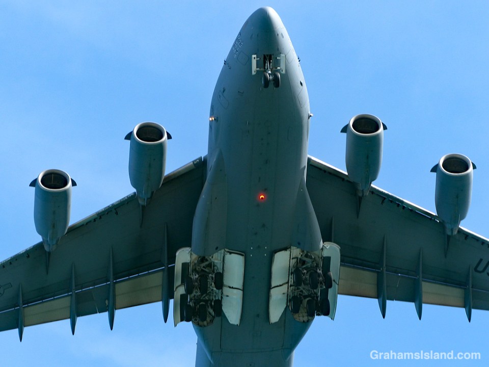
While most of the aircraft are operated by the usual airlines, a few military planes pepper the skies. This one is a C-17 Globemaster, a military transport plane. It was arriving from Oahu, delivering firefighting equipment for the military’s Pohakuloa Training Area.
 Several weeks ago, when the Big Island had a couple of hurricanes in the vicinity, we were inundated with rain. Tired of staying indoors or slogging through mud, I headed down the road a few miles, to the dry side of the island, in the hopes of finding somewhere I could go for a walk.
I stopped at Lapakahi State Park, which holds the remains of an ancient Hawaii fishing village. It was dry and warm, though the trails there were still slick with moisture and closed to the public.
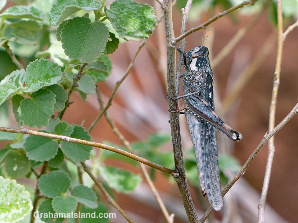
While I soaked up the warmth, I noticed this grasshopper (Schistocerca nitens I think) on a plant. It was hanging onto the stem and, despite my presence, seemed not in any hurry to move. It took me a while to realize there was something odd about it, but eventually I noticed that it was missing one of its hind legs. It’s not the first grasshopper I’ve seen in this condition and I always wonder how it affects them. The hind legs are the ones that launch them, so if they’re missing one do they ping off to one side? Do they end up going in circles? Or are they able to compensate?
I didn’t find out on this day as the grasshopper remained in roughly the same position the whole time I was there. Eventually I gave up watching and headed back into the gloom.
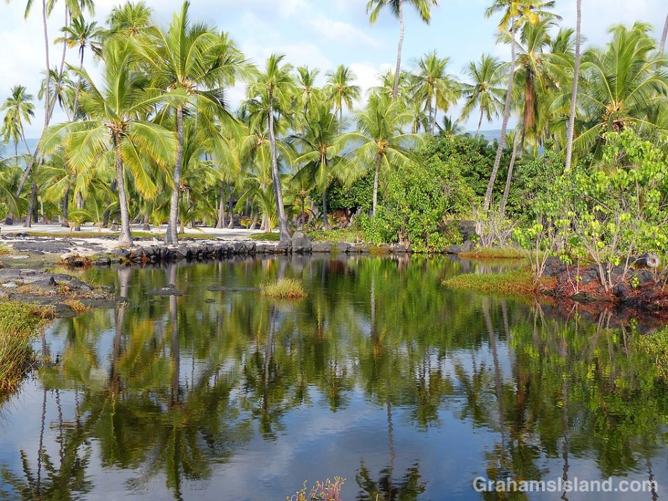
Palm trees are reflected in still waters at Pu’uhonua o Hōnaunau National Historical Park, otherwise known as Place of Refuge. This is one of the royal fish ponds, an anchialine pool in which fish were held for consumption by Hawaiian royalty.
For more information about Pu’uhonua o Hōnaunau National Historical Park, visit https://www.nps.gov/puho/index.htm.
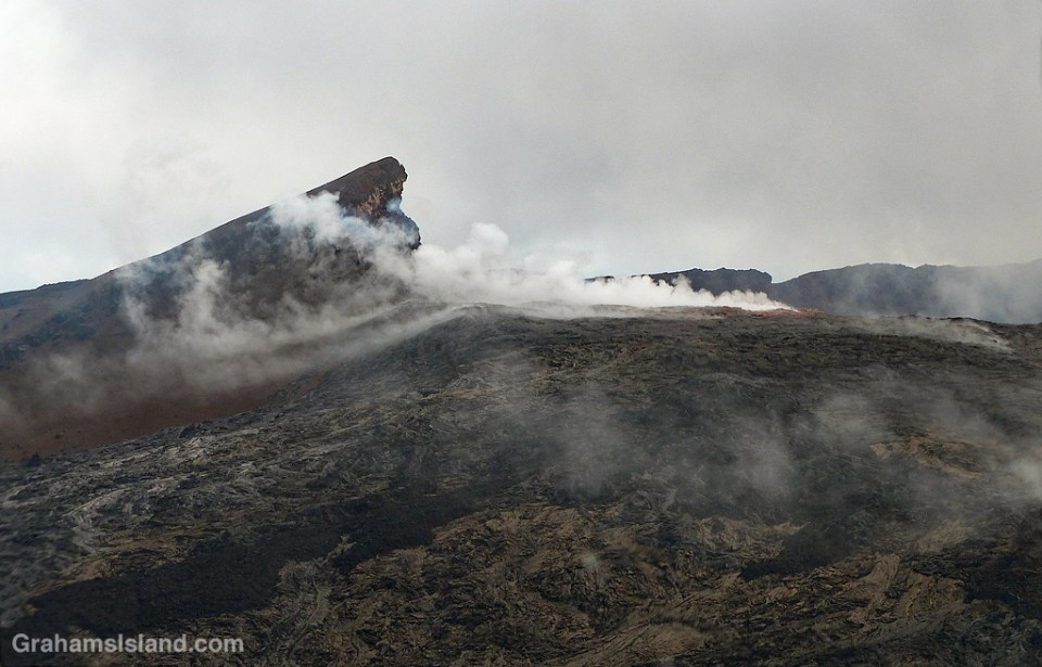
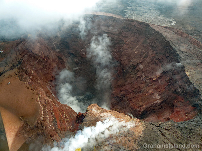
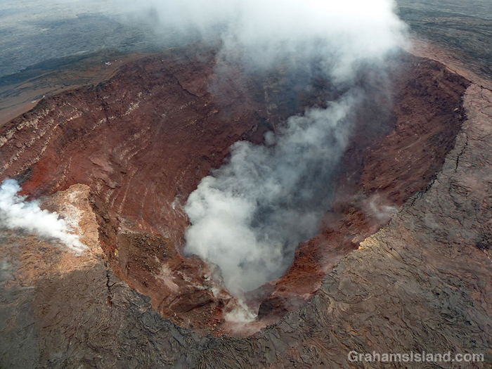 This week’s Sunday Stills challenge theme is ‘Time.’ (See more responses here.) I had a couple of thoughts about this. The first is that the state of Hawaii is a kind of geologic timepiece. The Hawaiian islands exist because a magma source known as the Hawaii hotspot generates volcanic activity. This creates underwater seamounts that eventually break the surface to form new islands. Such a process is currently taking place with Lōʻihi Seamount, off the southeast coast of the Big Island. It’s about 3,000 feet below the surface but, if it continues its present activity, it will rise above sea level in another 10,000 to 100,000 years.
But if Hawaii is on a volcanic hotspot, why doesn’t it produce one volcano that just gets bigger and bigger? Well, the tectonic plate on which Hawaii sits is in constant motion to the northwest. So the volcanic activity generates an island, but as the plate moves, that island edges away from its creative source and the volcanic activity ceases. What happens then is that the winds and waves begin a long process of erosion until that island is reduced to an atoll and finally disappears below the ocean’s surface. We’re not talking months here. We’re talking millions of years for this process to take place.
Look at a map and you’ll see this chain of Hawaiian Islands stretching away to the northwest, the islands or atolls becoming progressively smaller until they disappear and return to being below-surface seamounts. And while I say this is a slow process, it can also be speedy. In October of this year, Hurricane Walaka ripped through the French Frigate Shoals, part of the northwest Hawaiian chain. Its passage completely removed the second largest island in the group, East Island, from the map. Researchers had been working there before the hurricane struck. After its passage, it was gone (more info here).
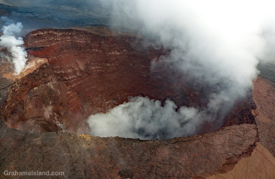
So Hawaii is an example of the geologic passage of time. But there’s another aspect of our view of time that is illustrated here. The photos are of Kilauea’s Pu’u O’o vent. Kilauea is one of the planet’s most active volcanoes and the Pu’u O’o vent had been more-or-less continuously active since 1983. Then, in May of this year, the activity in this vent, and in the summit vent at Halema’uma’u Crater, ceased. The magma drained from these places and traveled down the east rift zone of the volcano before emerging in a residential subdivision, Leilani Estates, in the southeast corner of the island. This new eruption produced a lava flow that reached the ocean, destroying more than 700 structures en route, but adding hundreds of acres to the Big Island coastline.
What’s the time aspect of this? Well, it’s part of the geologic time process noted above. But there’s another way of looking at it. Kilauea has been erupting so long and so regularly that it’s been a little bit taken for granted. “Oh, lava’s flowing into the ocean? You know, I’m really busy right now. I’ll catch it later.” “The summit vent is spilling onto Halema’uma’u Crater’s floor? I’ll check that out next time I’m down that way.”
I consider myself fortunate that I got to see the firehose of lava entering the sea after a cliff collapse (here). Next day, following another cliff collapse, it was no longer visible. And in April of this year I went down to see the summit lava lake (here) bubbling up to the crater floor and visible from Jagger Museum. Two weeks later, the level had dropped a thousand feet. It continued to fall.
I might never see these things again in my lifetime, but at the time, there seemed to be lots of time to visit. But even events happening in a long, geologic timeframe might occur in the space of a week, a day, even an hour. It’s a reminder to me that each moment is something fleeting, perhaps something special, something to pay attention to.
These photos are of Pu’u O’o vent in late September of this year. No lava is visible in the vent, but it’s still hot enough that rainfall generates steam, which is what’s visible here. It was quite dramatic to pass over this vent, which for 35 years has pumped lava out onto the surrounding landscape.