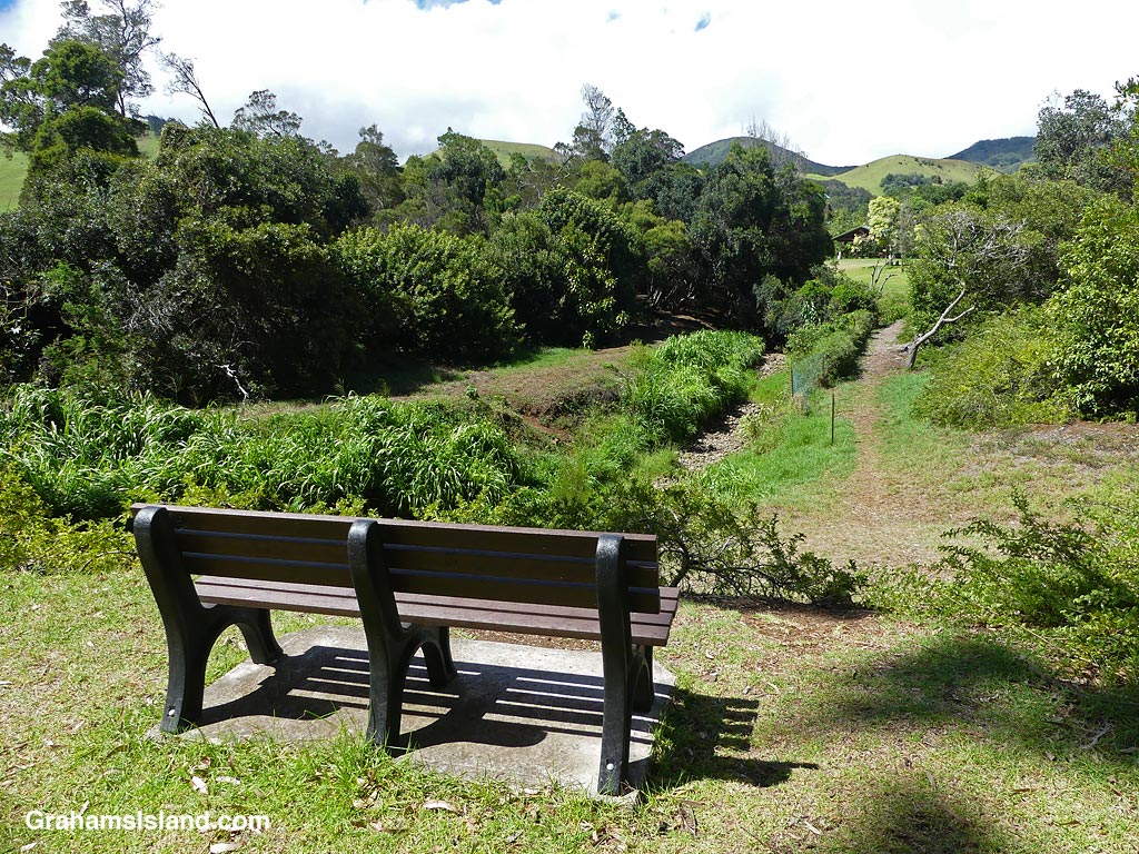
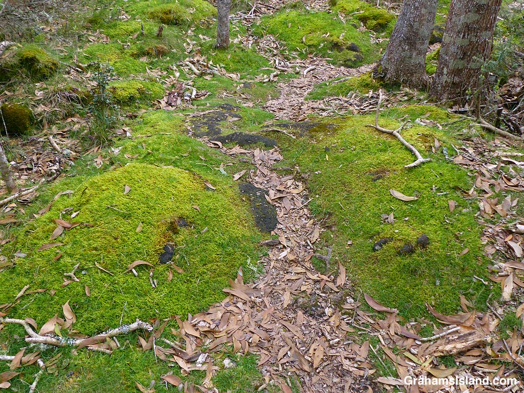
Recently, while waiting to visit my dentist, I walked the trail in the Waimea Nature Park, also known as Ulu La’au. The trail follows the Waikoloa Stream for about a mile from the town center down toward the ocean. It’s a work in progress, with volunteers removing invasive species and planting native and canoe plants in their place.
On my walk, the Waikoloa Stream had water in it, but not much. I think it would be fun to walk there after a heavy rain. But one thing I liked was the abundance of benches, some of which offered nice views of the park, the stream, and the hills surrounding the town.
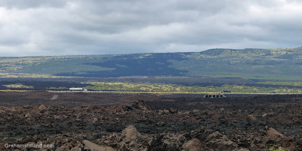
A few days ago, I headed out on the trail from Spencer Beach Park to Mau’umae Beach Beach. I was curious to see how far last month’s brush fire, that burned near Mauna Kea Resort, had reached down by the ocean. A hundred yards into the walk the answer became clear. It reached the shore. Spencer Beach Park was untouched, but the woods on the edge of the park are one tree deep in places.
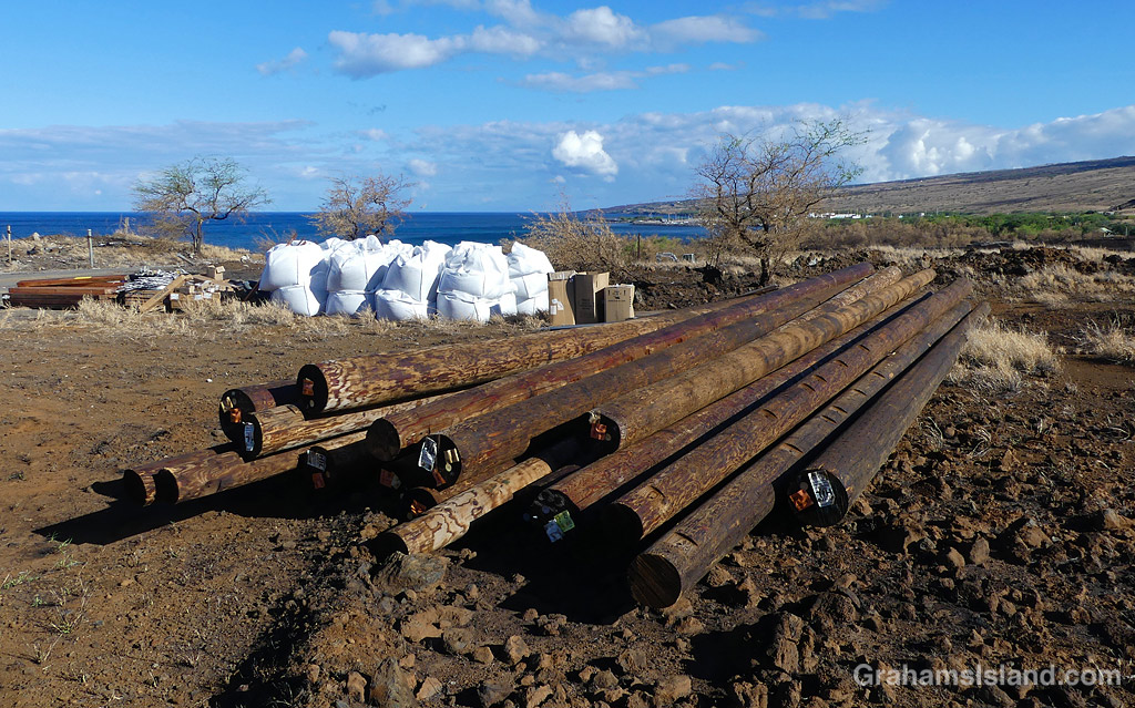
I walked back to Spencer on the service road, a quarter mile inland. The power line ran along the ground or was draped in blackened trees. There was a clump of poles and other supplies in one spot, ready for restoring service.
The vehicle access road to Mau’umae Beach beach is closed now, as two small wooden bridges were destroyed in the fire. Currently, and for the foreseeable future, the only access to the beach will be along the coast trail from Spencer. It’s only a 15 minute walk, but that’s often enough to discourage people from going there.
A view across Waipi’o Valley from the road into the valley. This road has been closed to visitors for some time, because of rockfalls from the steep slopes above it. A project to improve the road recently finished its first phase, but it’s likely to be a few years before the road is opened to anyone other than residents, licensed tour operators, and native Hawaiians exercising traditional rights. Even then, it’s not clear what access will be permitted.
One thing this means is that the (strenuous) Muliwai Trail, into the next door Waimanu Valley, is currently closed and is likely to be so for some time, if it ever reopens. That trail can be seen (very faintly) making a zigzag up the steep slope on the far side of the valley.
This week’s Sunday Stills challenge theme is ‘The Great Outdoors.’ See more responses here.
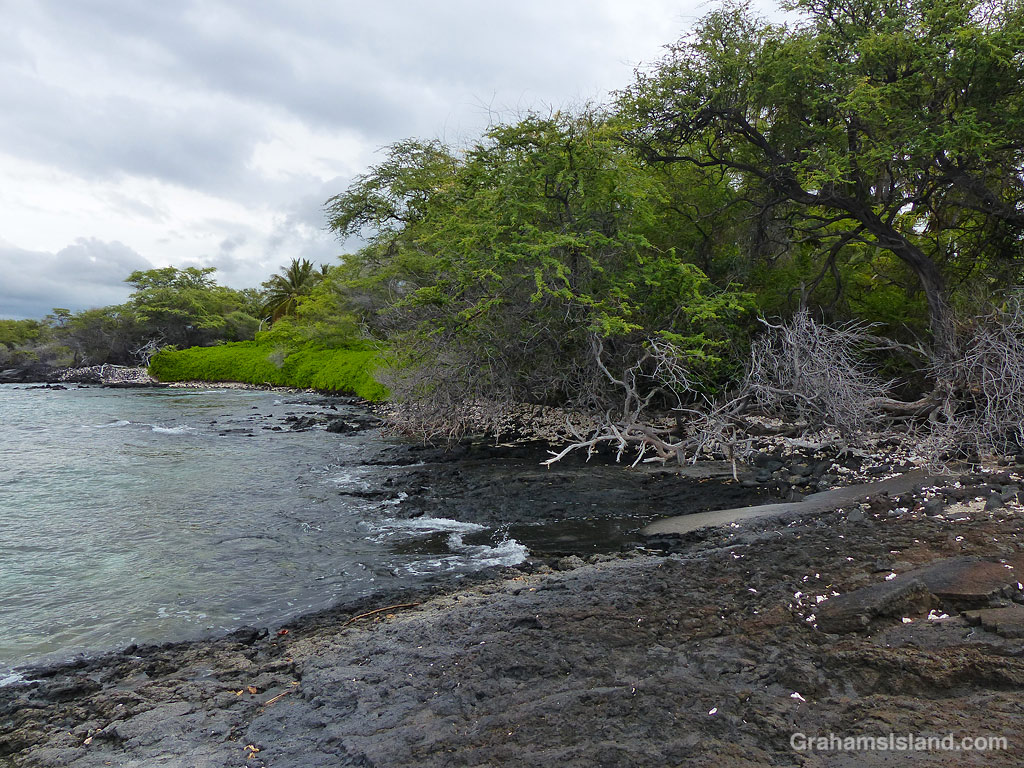
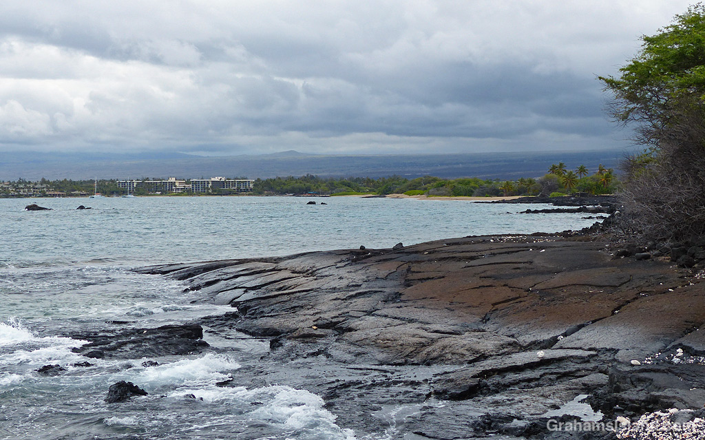
Recently, I took a hike along the South Kohala Coast, starting out at ʻAnaehoʻomalu Bay in Waikoloa Resort, and heading south to Keawaiki Beach, before returning the same way. This is a hike I’ve done before, but not for some time.
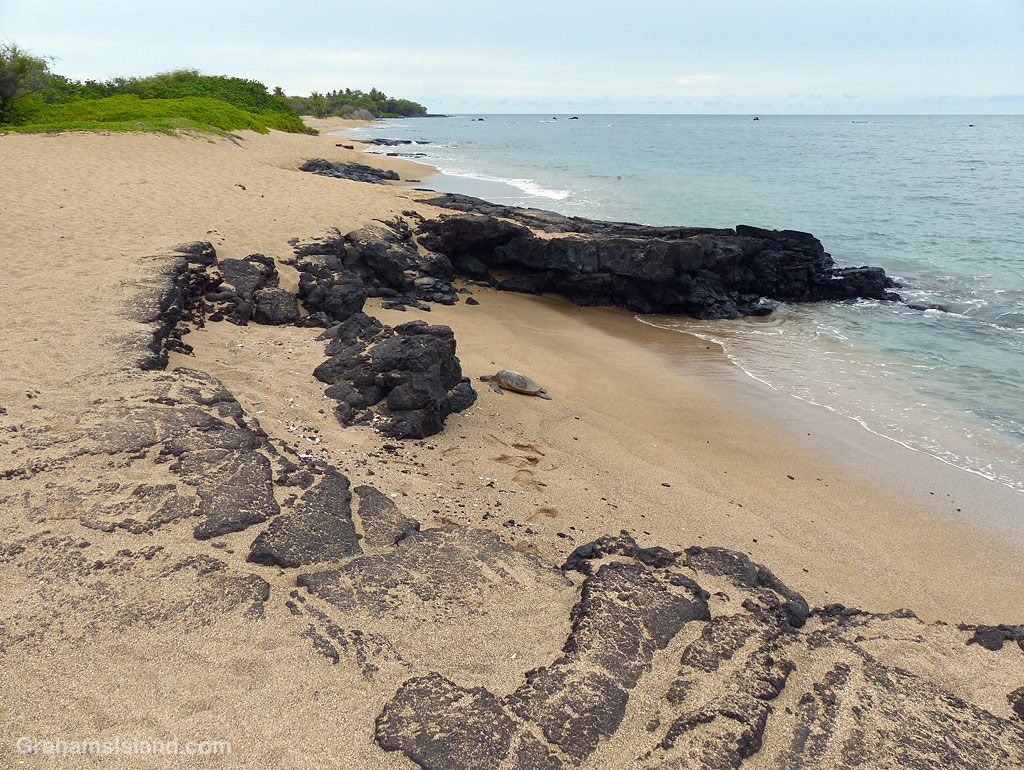
ʻAnaehoʻomalu Bay is often referred to as A Bay because it’s a tad easier to pronounce. It’s one of the more popular beaches on the island, but head south, around the corner from the main beach area, and the golden sands are largely deserted. Well, except for the odd green sea turtle taking a nap.
There are a few rustic structures behind the beach along here, but it’s a far cry from the resort developments less than a mile to the north. When the sands end, there’s a short stretch where high tides wash up against a wall of greenery. Hiking at those times, which I did, involves nimble footwork or getting your feet wet. I’m not nimble!
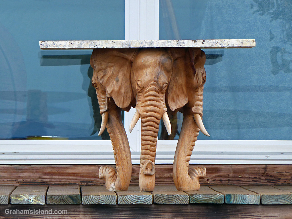
A table supported by elephant heads!The trail can be underwater at high tide.Looking back towards A Bay.This turtle found a quiet rocky beach to rest on.
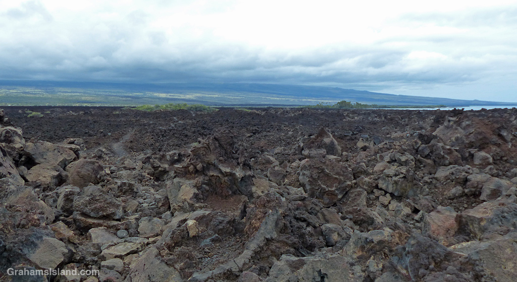
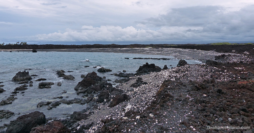
Beyond this point the coast becomes rocky lava, where flows from Mauna Loa have tumbled into the ocean in bygone days. The trail is mostly over a’a lava, which is irregular and rough. The trail itself is not hard to walk, but straying into the lava fields is another matter entirely.
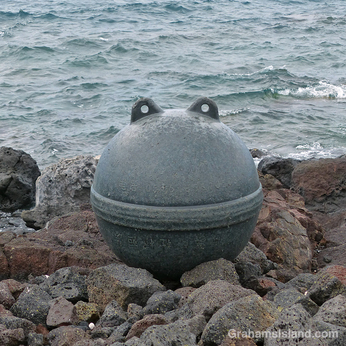
I found this sad looking buoy banging around in a tide pool, so carried it higher on shore where it looked much happier.
The first marker on this part of the trail is the lone palm tree at Akahu Kaimu Bay. Just inland from this palm is a pool, which is mostly freshwater and deep enough to swim in. This is a welcome option on a hot day, but since it was mostly overcast with a nice onshore breeze, I didn’t take a dip this time.
The lone palm tree at Akahu Kaimu Bay from the north.The lone palm tree at Akahu Kaimu Bay from the south.The lone palm tree and pool at Akahu Kaimu Bay.
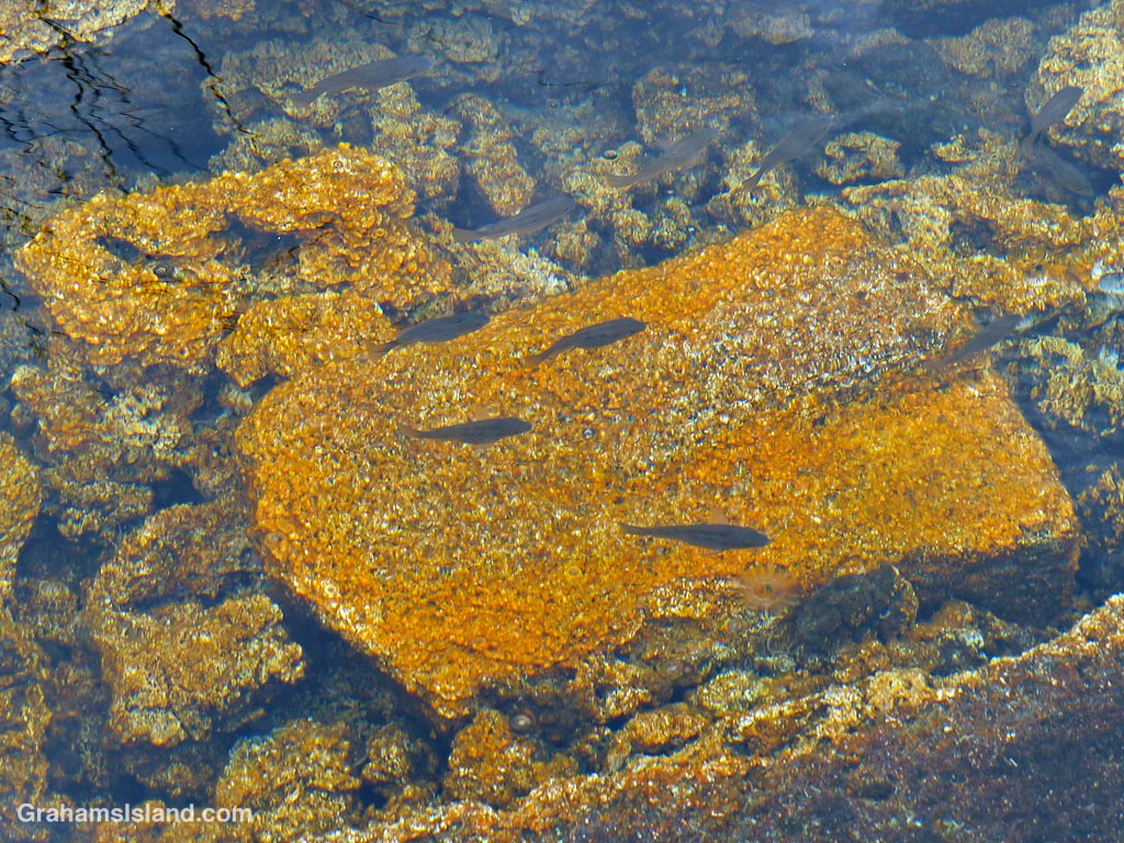
The trail continues over the lava field to the next bay and it was here I got lost. The coast trail often passes over the lava rather than follow the coast around points and the only trail I could see appeared to be doing just that. But when I followed it for a while I saw that it continued inland. However, I could also see that where it headed was to the Golden Pools of Keawaiki, which was I planned on visiting anyway, so I carried on until I came to familiar ground. The golden pools owe their color to a unique algae that grows here. These are not pools for swimming in since that could alter the conditions and destroy the algae.
The trail to the Golden Pools of Keawaiki.The highway, less than a mile away, is seldom seen and never heard. The Golden Pools of Keawaiki.The Golden Pools of Keawaiki.
Heading back to the coast, the trail comes out at Pueo Bay where I found an abandoned kayak, not in great condition. Keawaiki beach, just beyond, is another bay marked by a sole palm tree, but this poor tree has been badly damaged by storms and is no longer much of a tree.
Abandoned kayak at Pueo Bay.Keawaiki Beach.The beach at Pueo Bay.The house near Weliweli Point.
Heading back north, I passed the sole house on this part of the coast, just beyond Weliweli Point. I have yet to see anyone at this spot, though someone obviously maintains the property. I got back to the bay where I had strayed off the track and realized where I’d gone wrong. The coast trail zigzags up from the beach and is marked only by a couple of pieces of bleached coral, which don’t stand out much on a beach strewn with the same kinds of coral pieces.
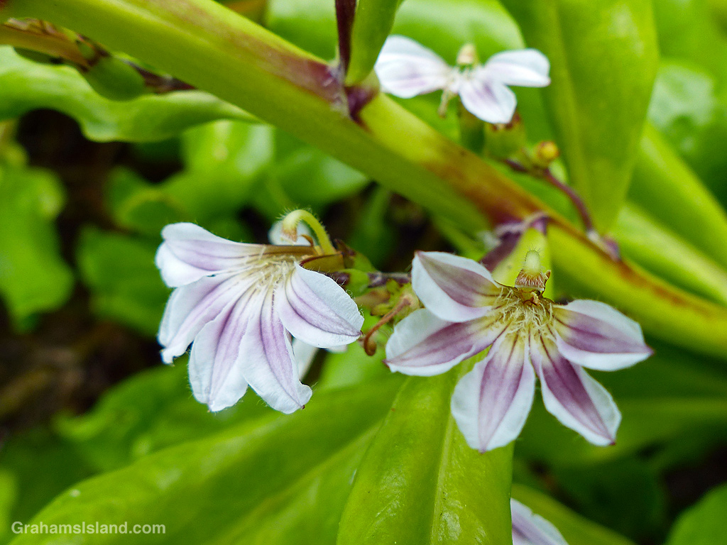
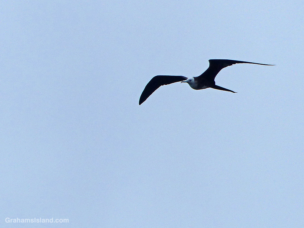
This trail isn’t a great one for birds, but I did see a Great Frigatebird wheeling overhead, which is always nice. And though this coast appears unforgiving, there are hardy plants to be found including native Hau trees and swathes of Beach Naupaka.
A Hau flower.Beach Naupaka flowers.A great frigatebird.
By the time I got back to A Bay, the Lava Lava Beach Club was busy with dinner patrons, enjoying their meals at tables set up on the sand and close to the water.
Lava Lava Beach Club.
Also posted for Jo’s Monday Walk. See more responses here.
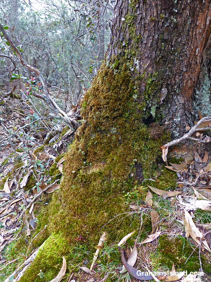
Whether coating the forest floor, or cloaking tree trunks, the abundance of moss alongside the Pu’u O’o Trail, off Saddle Road, always reminds me of the Pacific Northwest, where I lived for 30 years, before moving to Hawaii.
My lunch spot with a view of the Kamakai’a Hills and various kinds and colors of lava.
This week’s Sunday Stills challenge theme is ‘I’d Rather Be…’ See more responses here.
It had been a while since I went hiking, for various reasons, and it’s something I was missing, something I’d rather be doing. So last week, I headed down to Hawaii Volcanoes National Park to try the Ka’u Desert Trail. This backcountry trail has been on my list for a long time, but I had never done it before. For one thing, it’s about as far from my house as one can get on the island. For another, it’s directly downwind from Kilauea Volcano, so when the volcano is active and the trade winds are blowing, gasses blow across the length of the trail.
The latest eruption of Kilauea is currently either paused or over, so gas emissions are much reduced, and last week, the trade winds had given way to winds from the southwest. So off I went.
Signs explain the rich history and geology of the area.Tenacious Ohia trees grow in the lava.Ohia flowers are a magnet for bees……as are the native Ulei flowers.
The trailhead is several miles west of the main entrance to the park, with a strip of parking along the highway. The first mile of the hike is also known at the Footprints Trail. It’s a sort of paved path that threads through ohias to a small building that houses footprints left by early Hawaiians in volcanic mud and ash. Alas, I couldn’t identify any footprints in the display. Shortly after the footprints, the path breaks out of the vegetation into open lava fields. This isn’t a tropical Hawaii walk, this a bleak hellscape Hawaii walk. Or is it?
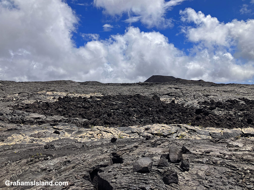
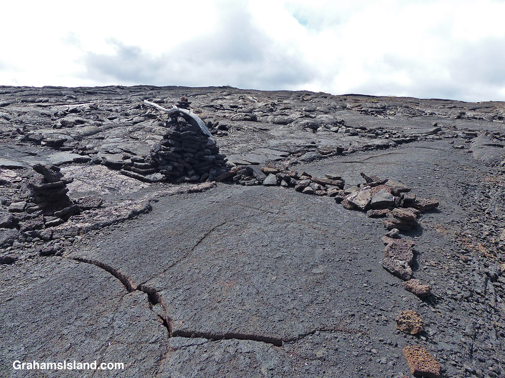
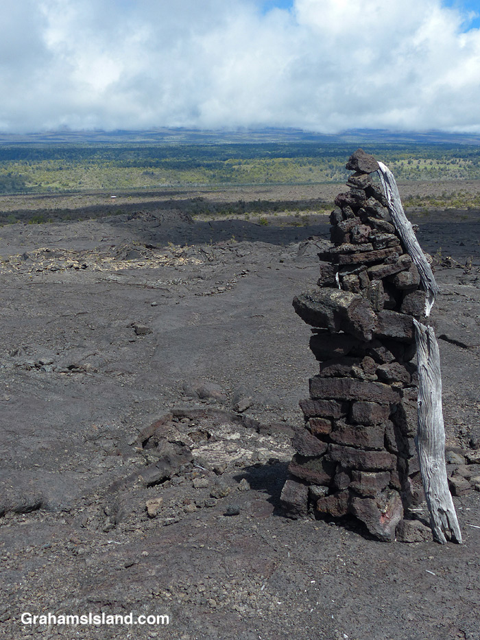
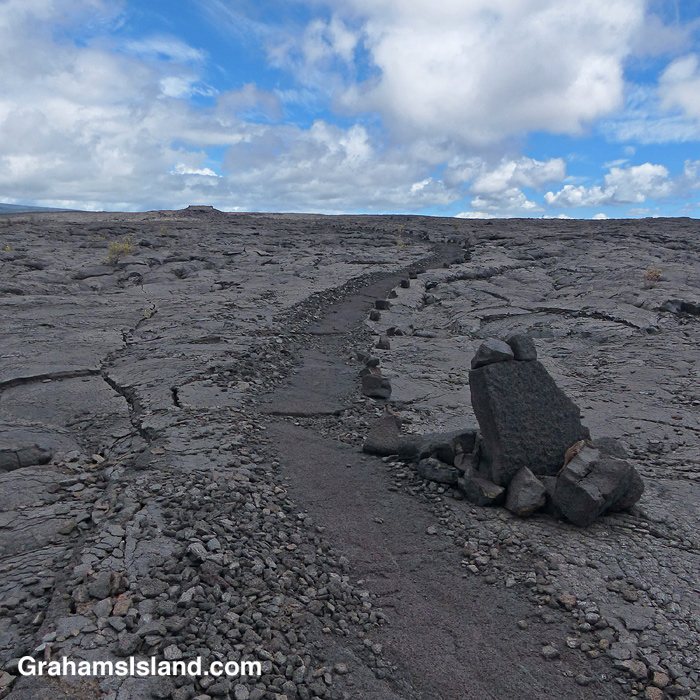
A view of the Kamakai’a Hills from the trail junction.The trail was rerouted here, from its previous path, for reasons unknown.Cairns mark the trail, some bigger than others.Walking on the trail removes the top, crumbly layer of pahoehoe lava.
The trail ascends gently to the only junction for miles around, at Mauna Iki. To the left is a trail back towards the heart of the park. The Ka’u Desert Trail heads to the right and into backcountry wilderness. Mauna Iki was the site of an eruption in 1919 and the trail traverses the lava fields from this eruption.
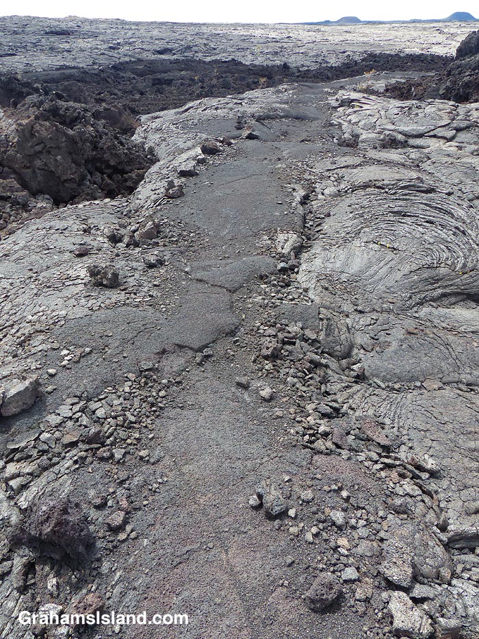
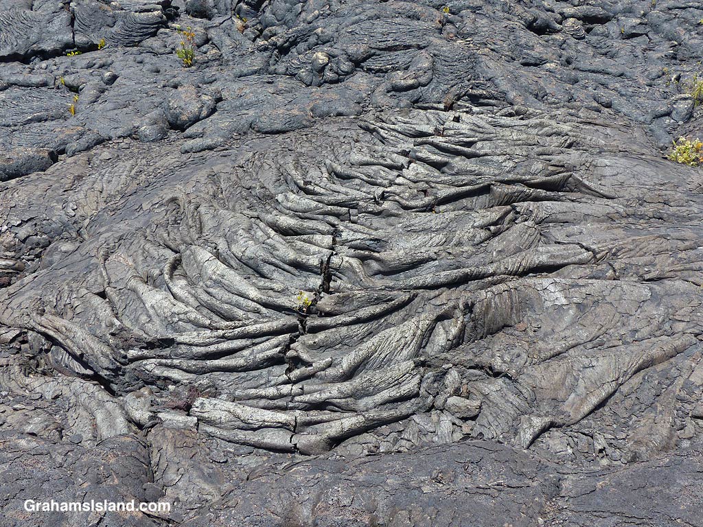
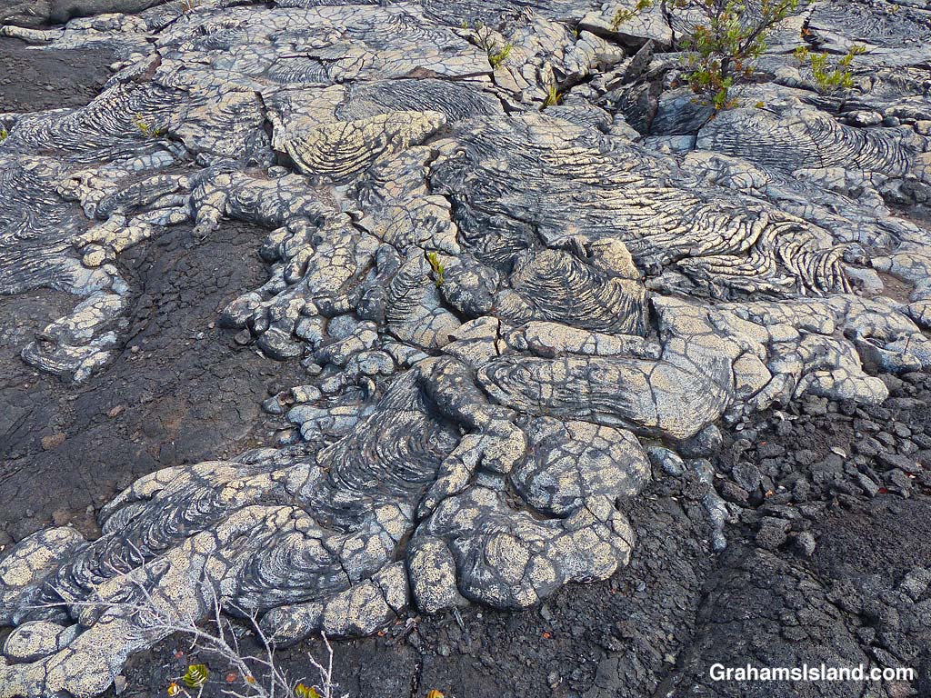
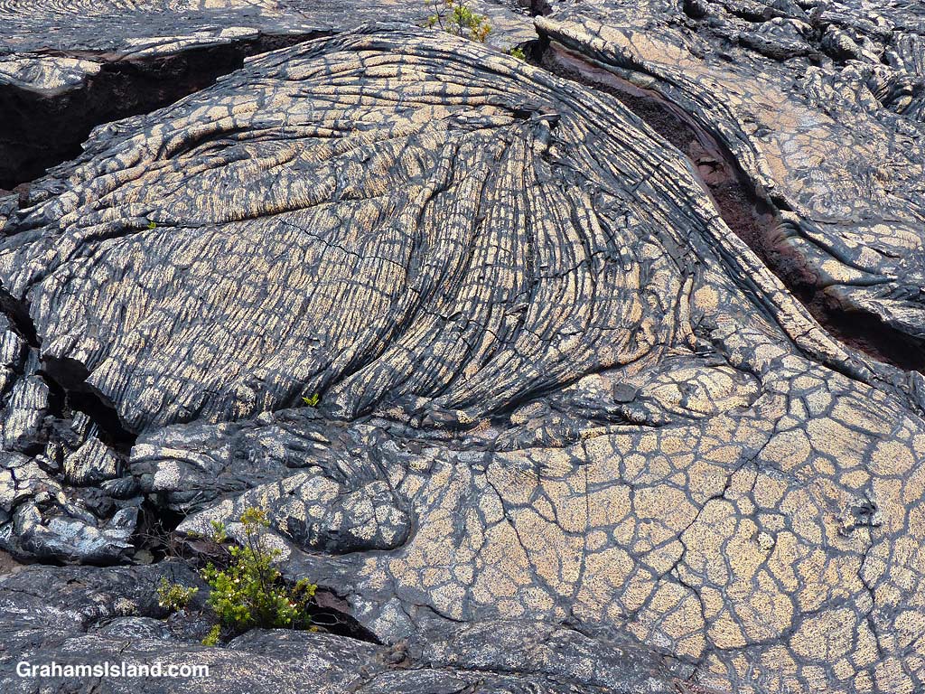
A’a and pahoehoe lava flows can be seen side by side.Gold colored ropey pahoehoe lava makes it look even more like ropes!The lava has many weird and wonderful folds and shapes.
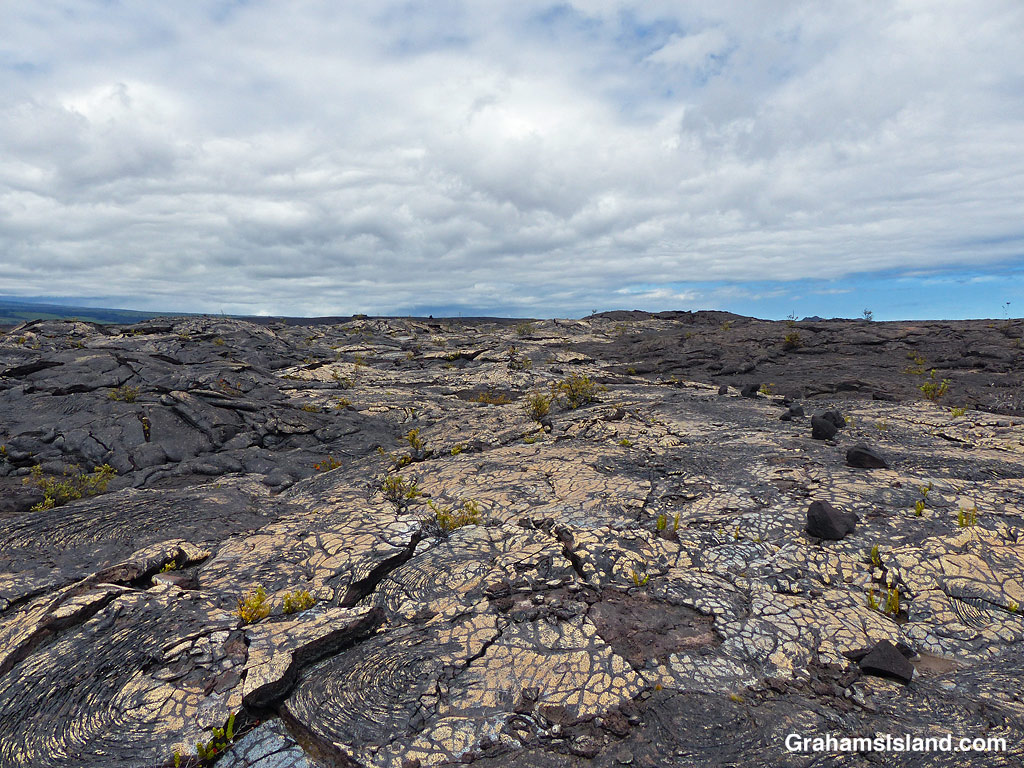
Much of the trail is over pahoehoe lava, which is rounded and much easier to walk on than jagged a’a lava. The trail is marked by cairns and single rocks placed alongside it. It’s pretty easy to follow with just one or two parts where attention has to be paid to make sure one doesn’t stray.
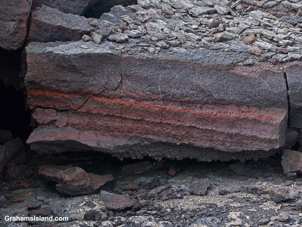
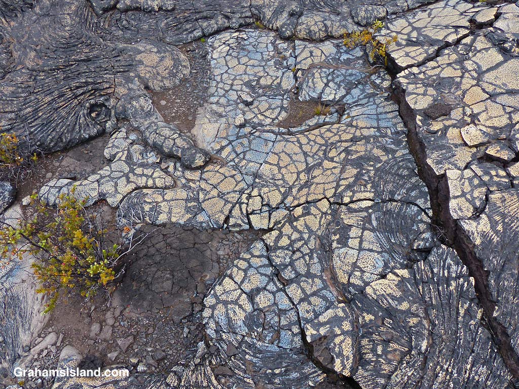
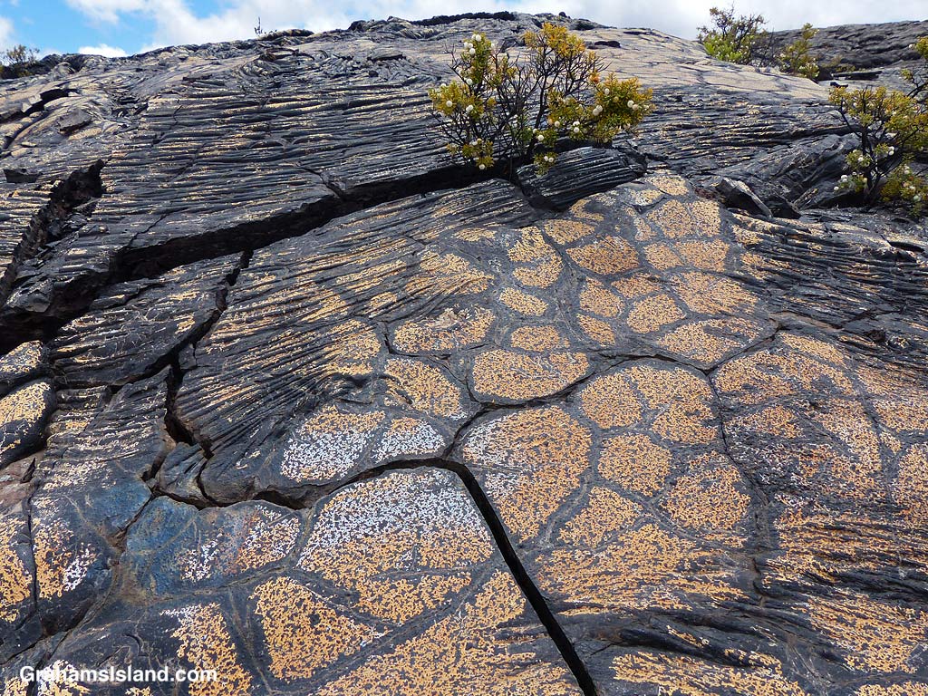
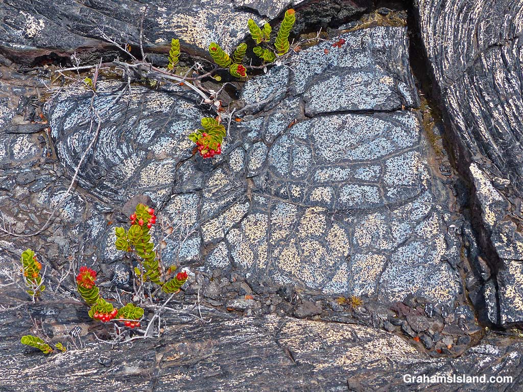
Bronze colored lava.Bands of red in the lava.A crack in the trail……revels shades of orange within.Blue and gold lava flow.Colorful and dramatic, but slowly nature returns.Colorful ropey pahoehoe lava next to smooth.Blue lava!The patterns and colors reminded me of Roman mosaic floors.Bold color and markings.Plants gain a toehold in the cracks and provide a splash of different colors.Don’t stray off the trail. There are holes and thin spots everywhere.Bright colors and bold shapes can be seen along a lot of the trail.
It wasn’t far along this part of the trail that I first encountered blue lava. That’s right, blue lava. Who knew? But not just blue. There’s bronze, pink, red, orange, gold, and who knows what. I’ve seen colorful lava on the Puna Coast Trail, but this was more varied and quite wonderful. In places the trail crossed this colorful lava and I felt bad for walking on it, though as I hiked I could see many more patches of color out in the lava fields. It’s not wise to leave the trail since there are many lava tubes, some with very thin ceilings.
This is an out and back trail and I turned around once I reached the Kamakai’a Hills, after about 5 miles. It’s another 2 or 3 miles to the next junction where there is a small cabin.
Also posted for Jo’s Monday Walk. See more responses here.
The trail crosses one of the fields of colorful lava.
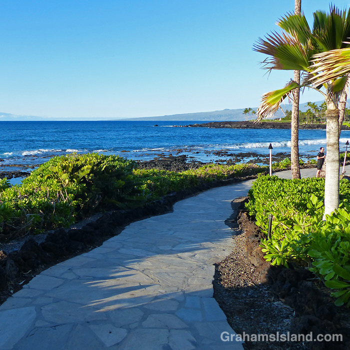
This is the last day for the November edition of Becky’s Squares with the theme of “Walking” (See more responses here).
I’m finishing off with part of the coast path in South Kohala. Blue skies, blue water, palm trees, and a nice, easy path underfoot. Oh, and a gentle breeze and warm, but not too warm temperature. What’s not to like?