This week’s Sunday Stills challenge theme is ‘Churches, Temples, and Spiritual Centers.’ See more responses here.
Here’s a few of the churches that can be found in this part of the island.
Kalāhikiola Congregational Church (top photo) is located east of Kapaau, where rainfall is plentiful and the foliage lush. It was built in 1855, though previous versions had existed for some years before this. The church was badly damaged by an earthquake in 2006, but rebuilt in the winter of 2009/2010.
St. Augustine’s Episcopal Church (second photo) was founded in 1884 in Kapaau, and expanded in 1913. It sits on a small hill by the main highway.
Sacred Heart Catholic Church (third photo) was founded in Hawi in 1905, but this structure was built in 1925 and continues to be used daily to this day.
Kohala Baptist Church (bottom photo) is located on the road to Pololu at Makapala. It can’t be seen from the road, but there is a sign by the highway pointing out the way. Currently, the church is undergoing some renovations and services are held in the area below the Royal Poinciana tree on the grounds.
This week’s Sunday Stills challenge theme is ‘Roads, Paths, and Streets.’ See more responses here.
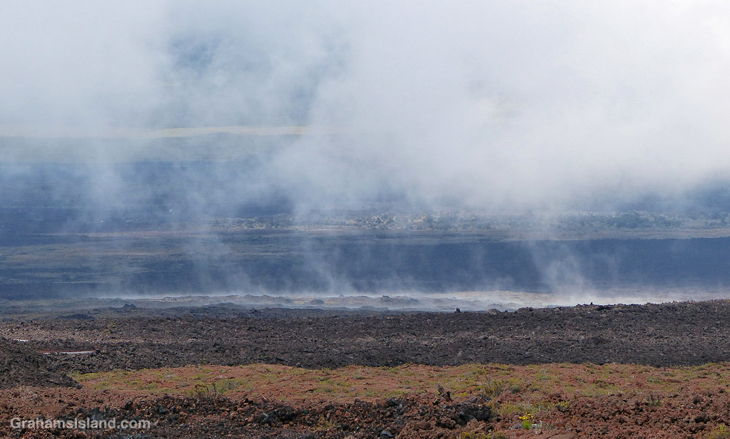
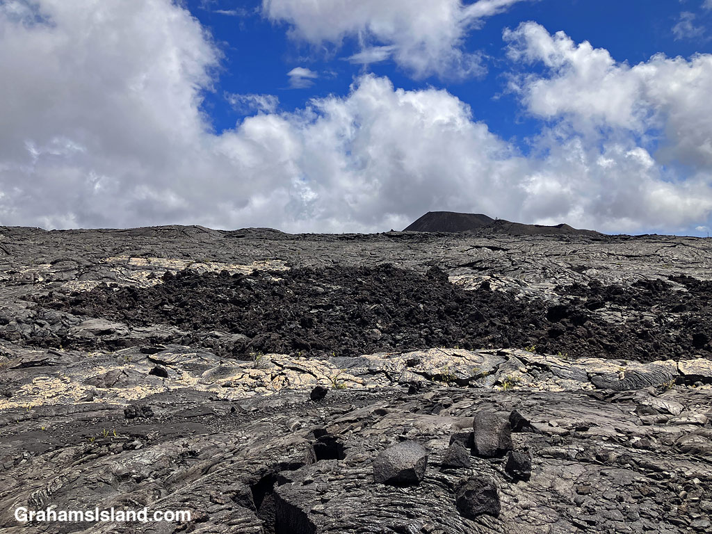
After a recent hike off Saddle Road, I had time to take a drive up one of my favorite roads on the island, which leads to the Mauna Loa Observatory. Well, it used to; it doesn’t get there anymore. That’s because a flow from last fall’s eruption of Mauna Loa crossed the road a few miles short of its destination. I was curious to see what the scene looked like now.
The cloudy skies added some atmosphere to the drive which was, as always, a lot of fun. It’s a winding one lane road, so even though there’s little traffic, one has to pay attention. Any distraction could result in driving off the road into the inhospitable lava fields bordering it.
I confess, my secret hope was that, when I arrived at the flow, there would be a sign saying ‘Road Closed.’ Alas, that was not the case. Clearly, the Department of Transportation figured the seven foot high wall of lava conveyed the message well enough on its own. The only sign there warned against walking on the new flow. I didn’t need that warning. This is a’a lava which is really hard to walk on anyway, and in a new flow it could be quite unstable and even harbor pockets where one could fall through into still hot lava! Still, I’m sure some folks have clambered up there just because it’s there.
I took a few photos, then turned around and headed back down, not least because it was damp, windy and I was freezing, which is not why anyone comes to, or lives in, Hawaii.
On the drive down, I got a good view of the HI-SEAS (Hawai’i Space Exploration Analog and Simulation) dome. This is where teams of volunteers do research for what it would be like to be living on the Moon or Mars. I’m not sure if it’s in use since the COVID shutdown, but at least it survived the last eruption.
Farther down, the land seemed to be steaming, but in the saddle between Mauna Kea and Mauna Loa, the weather often seems to be part of the landscape.
And the views, which change with every twist in the road, are strange and stunning and wonderful. It may not be possible currently to reach the end of the road, but it’s still a great drive.
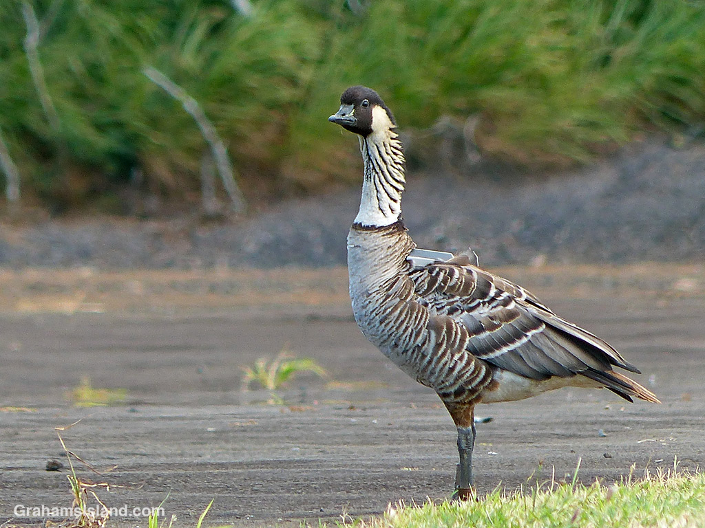
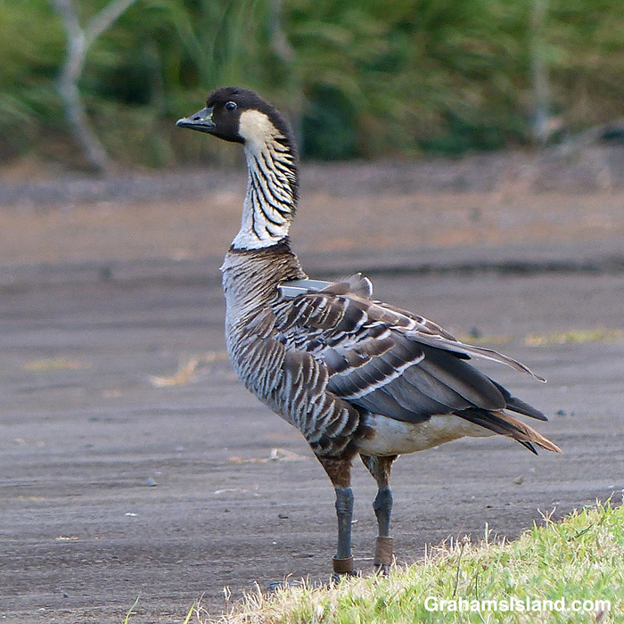
In last week’s Sunday Stills, Terri included a photo of a bald eagle with a transmitter on its back. In the comments, I mentioned that those trackers don’t stay on that long. Cue a few days ago when I saw this nene at Upolu. When I see nenes at Upolu, I report them to a contact at the Department of Land and Natural Resources (DNLR). The DNLR uses sighting information to build a picture of where the nenes are and where they go.
This is 32A, a bird I first saw in January of 2020. Back then, he didn’t have a tracker, but shortly after I saw him, one was attached. The DNLR thought the bird might be flying to and from Maui, but it turns out he wasn’t. Instead, the tracker has shown he mostly flies between Upolu, Hakalau, and Mauna Kea, all on the Big Island. However, the tracker is still on and still working, and I learned that they generally work for 3 to 5 years.
The reason I know this bird is 32A, besides the tracker, is that many nenes have bands on their legs to help with identification. In the second photo, the bands can be seen at grass level. The smaller band, on the left leg, is a US Fish and Wildlife tag. I’ve never been able to see any information on this smaller tag on any of the birds I’ve seen. The tag on the right leg is actually gray and shows the bird is one of almost 600 birds that were moved to the Big Island from a golf course near Kaua’i airport, between 2011 and 2016. These birds more than doubled the population of Big Island birds at that time. The fact that the tag is on the right leg means the bird is a male. The fact that the tag is brown and barely readable shows this bird has been wading through some very muddy conditions!
This week’s Sunday Stills challenge theme is ‘Earth Day.’ See more responses here.
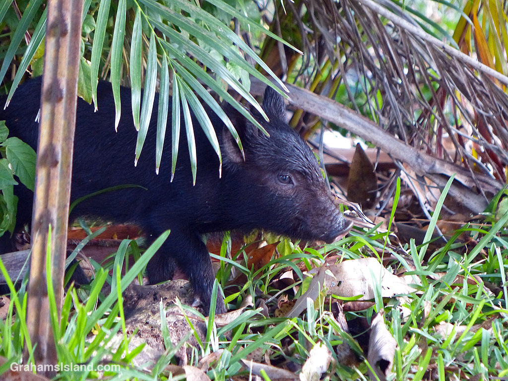
What’s more earthy than pigs. Of course, these piglets aren’t really back. The last litter is now much larger and correspondingly less cute. The ones in this photo are the latest batch. There are seven of them and they’re still in the ‘Everything is new and exciting’ phase. They root around in the dirt with such vigor that their back ends sometimes fly into the air. However, they haven’t yet learned that, while they’re doing this, they need to retain awareness of their surroundings. When something or someone, such as myself, can approach within five feet without them noticing, that might not end well. If mom’s around, she’ll warn them. If not, they’re easy to surprise.
In these photos, the piglets found something in the base of the palm and were clambering over each other to get a piece of it. I could have tapped one on the shoulder and it would probably have ignored me!
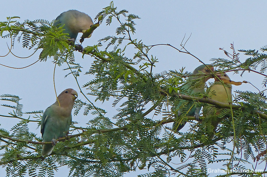
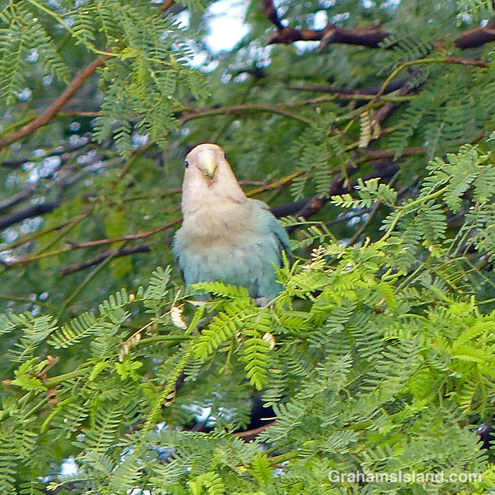
This week’s Sunday Stills Monthly Color Challenge is ‘White and Pastels.’ See more responses here.
Rosy-faced Lovebirds are also known as Peach-faced Lovebirds and they have a lot of color variations. I have yet to see a rosy face in Hawaii outside of tourists who’ve seen too much sun. Instead, the local birds tend towards pastel shades whether they’re dining or simply hanging out.
This week’s Sunday Stills challenge theme is ‘Awakening.’ See more responses here.
There’s no shortage of roosters and hens in Hawaii and the roosters are keen to fulfill their role in making sure everyone knows a new day is dawning. However, it has to be noted that they’re just as likely to awaken you from an afternoon nap as from a good night’s sleep. That’s because they can be heard crowing most any time of day, and sometimes half the night, too. This one was going off at five in the afternoon.
This week’s Sunday Stills challenge theme is ‘Peek.’ See more responses here.
I had a couple of photos lined up for this, but a few days ago I was outside cleaning windows. (I do it annually, whether they need it or not!) I got distracted by a kerfuffle in the cane grass behind me. I thought I saw an anole, so dashed inside and got my camera. When I got back and peeked into the tangle mass of cane grass, I could see two anoles locked in mortal combat.
I was pretty sure this was two males fighting. Usually, when there’s a territorial dispute there’s a lot of puffing and posturing that resolves the issue. This time, the two anoles were similar sized and the challenge was on.
It was hard to get a clear view, but each anole had a grip on the other’s head. Both sported dark bruising from the encounter. They wrestled to gain the upper hand, jerking up and down the cane grass as they did so.
Eventually, they fell apart. It was hard to tell who was the winner, but since one of them left the scene, I figured the other had won or defended his territory. However, since he was staggering around like he’d just gone 15 rounds with Mike Tyson, the other one might want to regroup and see about coming out for round 2!
My lunch spot with a view of the Kamakai’a Hills and various kinds and colors of lava.
This week’s Sunday Stills challenge theme is ‘I’d Rather Be…’ See more responses here.
It had been a while since I went hiking, for various reasons, and it’s something I was missing, something I’d rather be doing. So last week, I headed down to Hawaii Volcanoes National Park to try the Ka’u Desert Trail. This backcountry trail has been on my list for a long time, but I had never done it before. For one thing, it’s about as far from my house as one can get on the island. For another, it’s directly downwind from Kilauea Volcano, so when the volcano is active and the trade winds are blowing, gasses blow across the length of the trail.
The latest eruption of Kilauea is currently either paused or over, so gas emissions are much reduced, and last week, the trade winds had given way to winds from the southwest. So off I went.
Signs explain the rich history and geology of the area.Tenacious Ohia trees grow in the lava.Ohia flowers are a magnet for bees……as are the native Ulei flowers.
The trailhead is several miles west of the main entrance to the park, with a strip of parking along the highway. The first mile of the hike is also known at the Footprints Trail. It’s a sort of paved path that threads through ohias to a small building that houses footprints left by early Hawaiians in volcanic mud and ash. Alas, I couldn’t identify any footprints in the display. Shortly after the footprints, the path breaks out of the vegetation into open lava fields. This isn’t a tropical Hawaii walk, this a bleak hellscape Hawaii walk. Or is it?
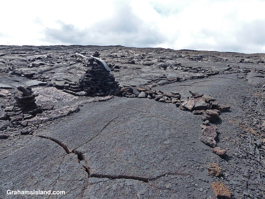
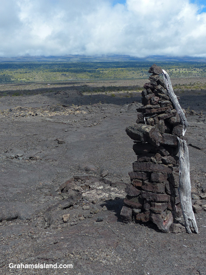
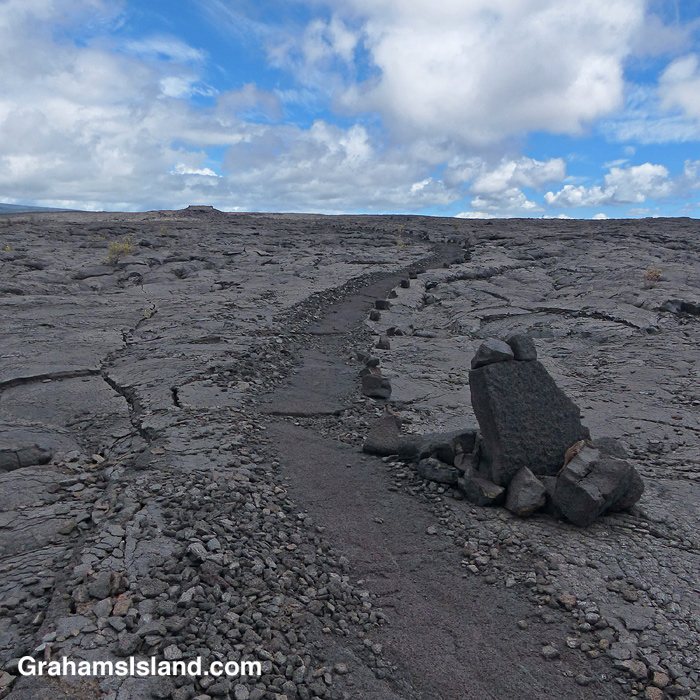
A view of the Kamakai’a Hills from the trail junction.The trail was rerouted here, from its previous path, for reasons unknown.Cairns mark the trail, some bigger than others.Walking on the trail removes the top, crumbly layer of pahoehoe lava.
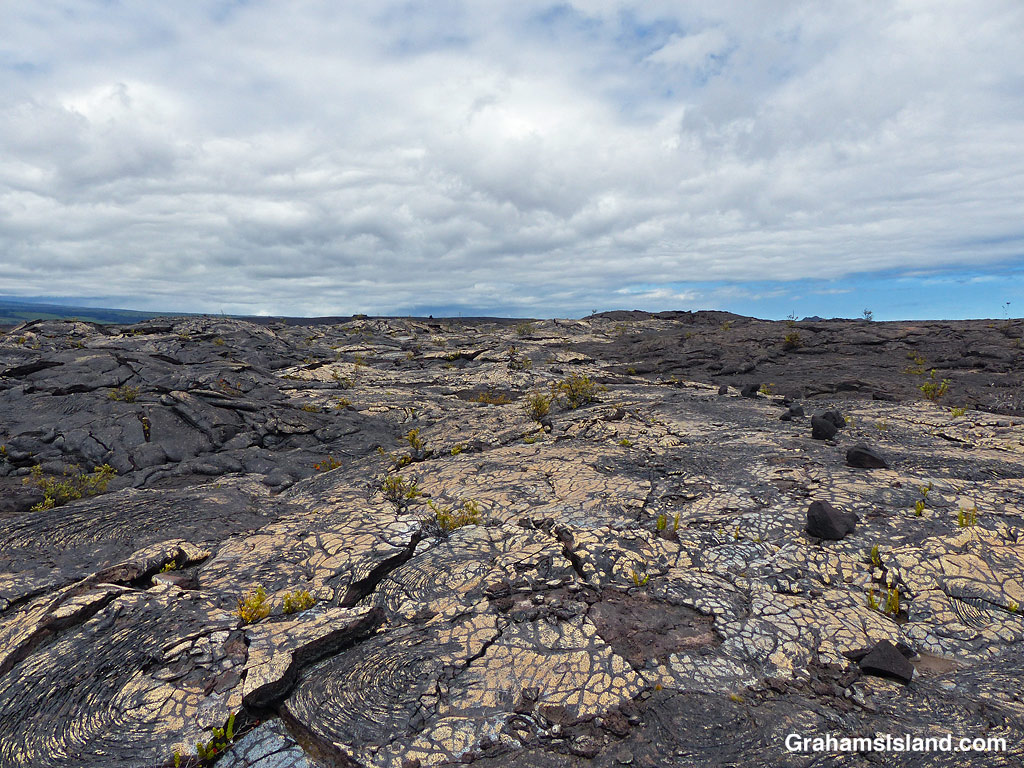
The trail ascends gently to the only junction for miles around, at Mauna Iki. To the left is a trail back towards the heart of the park. The Ka’u Desert Trail heads to the right and into backcountry wilderness. Mauna Iki was the site of an eruption in 1919 and the trail traverses the lava fields from this eruption.
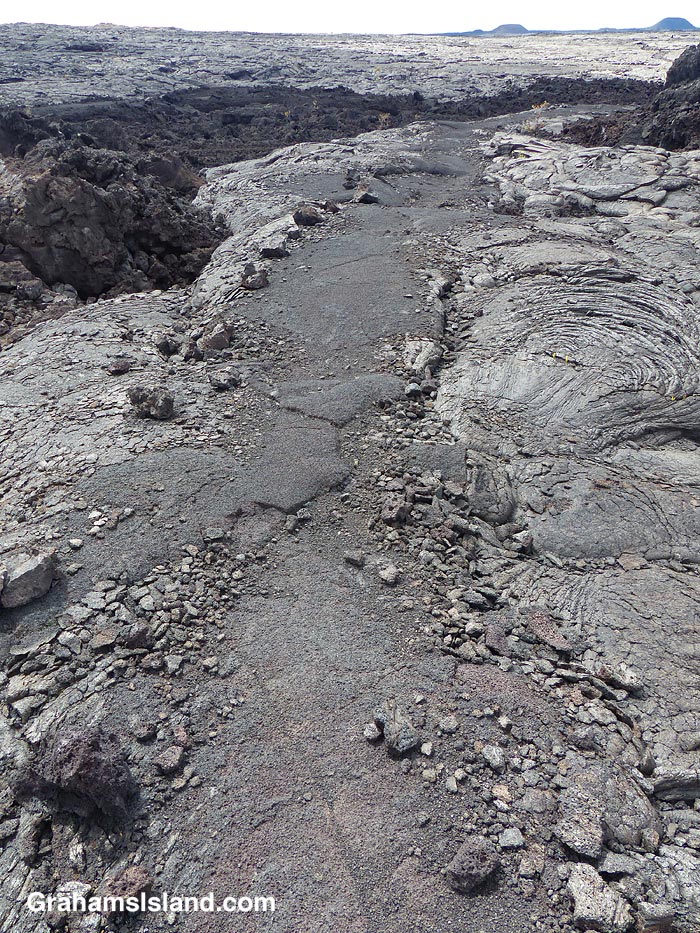
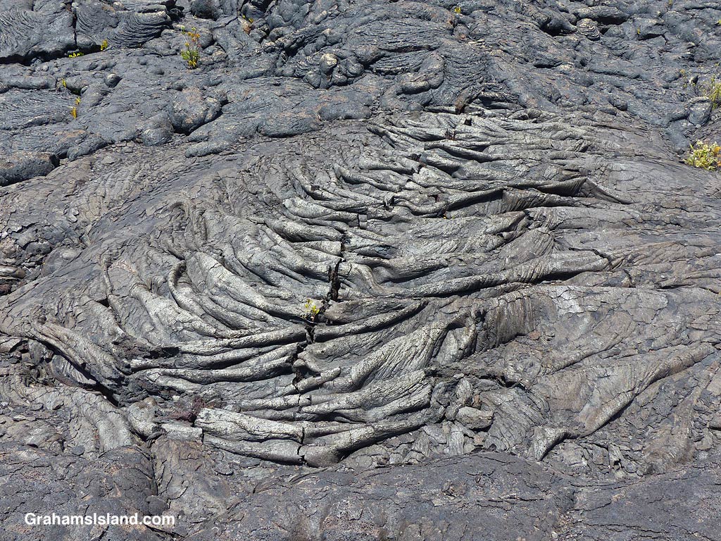
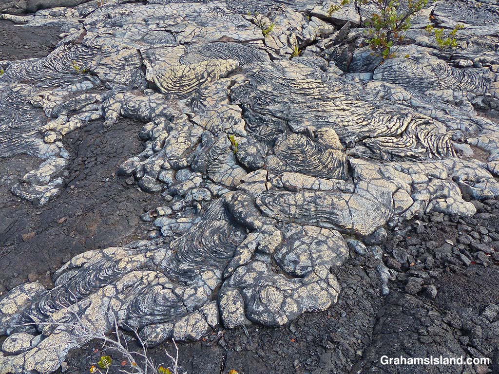
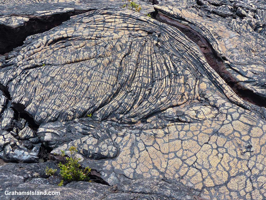
A’a and pahoehoe lava flows can be seen side by side.Gold colored ropey pahoehoe lava makes it look even more like ropes!The lava has many weird and wonderful folds and shapes.
Much of the trail is over pahoehoe lava, which is rounded and much easier to walk on than jagged a’a lava. The trail is marked by cairns and single rocks placed alongside it. It’s pretty easy to follow with just one or two parts where attention has to be paid to make sure one doesn’t stray.
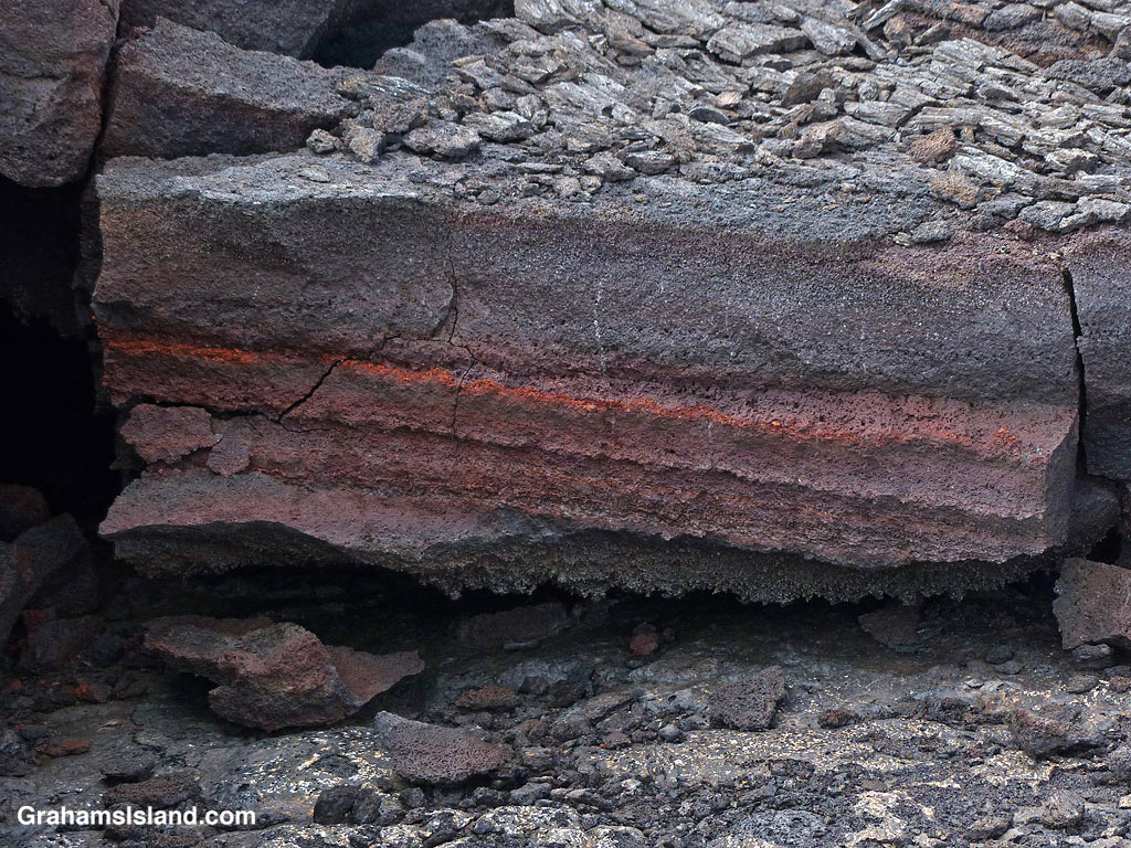
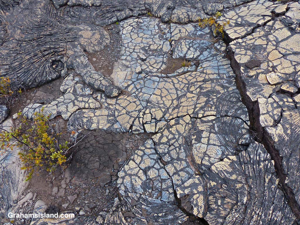
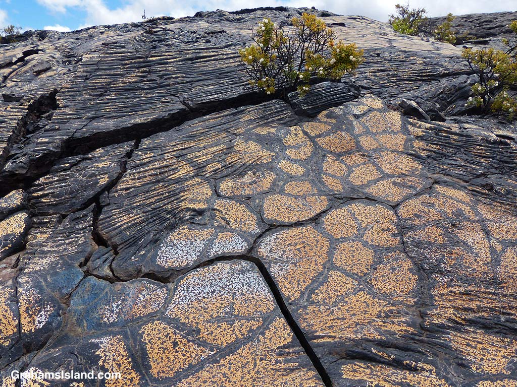
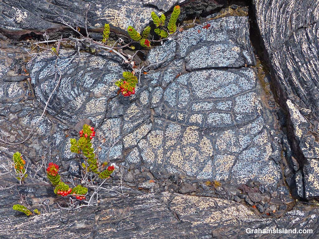
Bronze colored lava.Bands of red in the lava.A crack in the trail……revels shades of orange within.Blue and gold lava flow.Colorful and dramatic, but slowly nature returns.Colorful ropey pahoehoe lava next to smooth.Blue lava!The patterns and colors reminded me of Roman mosaic floors.Bold color and markings.Plants gain a toehold in the cracks and provide a splash of different colors.Don’t stray off the trail. There are holes and thin spots everywhere.Bright colors and bold shapes can be seen along a lot of the trail.
It wasn’t far along this part of the trail that I first encountered blue lava. That’s right, blue lava. Who knew? But not just blue. There’s bronze, pink, red, orange, gold, and who knows what. I’ve seen colorful lava on the Puna Coast Trail, but this was more varied and quite wonderful. In places the trail crossed this colorful lava and I felt bad for walking on it, though as I hiked I could see many more patches of color out in the lava fields. It’s not wise to leave the trail since there are many lava tubes, some with very thin ceilings.
This is an out and back trail and I turned around once I reached the Kamakai’a Hills, after about 5 miles. It’s another 2 or 3 miles to the next junction where there is a small cabin.
Also posted for Jo’s Monday Walk. See more responses here.
The trail crosses one of the fields of colorful lava.