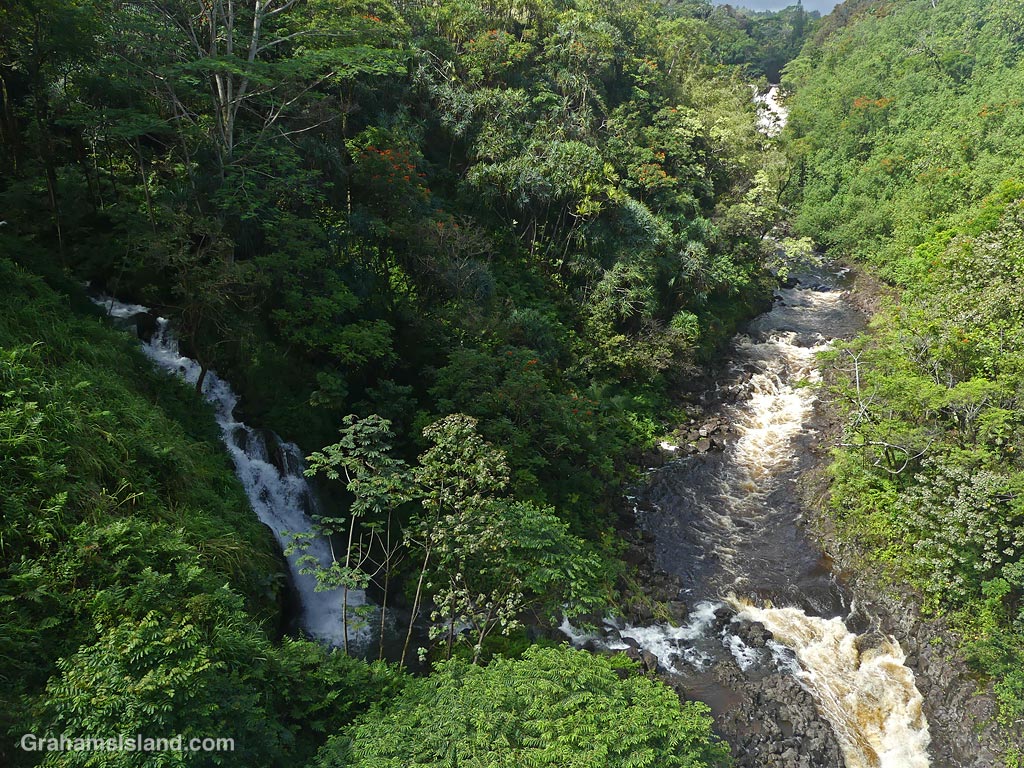
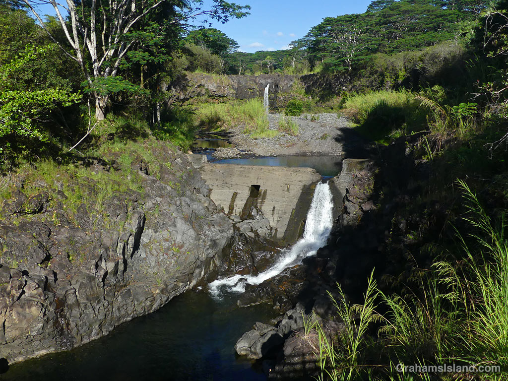
Umauma stream runs into the ocean on the east side of the island, several miles north of Hilo. I’d never seen this stream, or the waterfalls on it, because I was always driving when going over the bridge, which gave this view. On this occasion, I stopped after crossing the bridge and walked back to take photos. The stream and falls were running strong because of recent heavy rainfall.
There are three falls on the stream, which can be viewed by visiting a botanical garden in that area. One of them is visible at the top of the photo, on the right. The water flowing in from the left side of the photo is a smaller subsidiary stream.
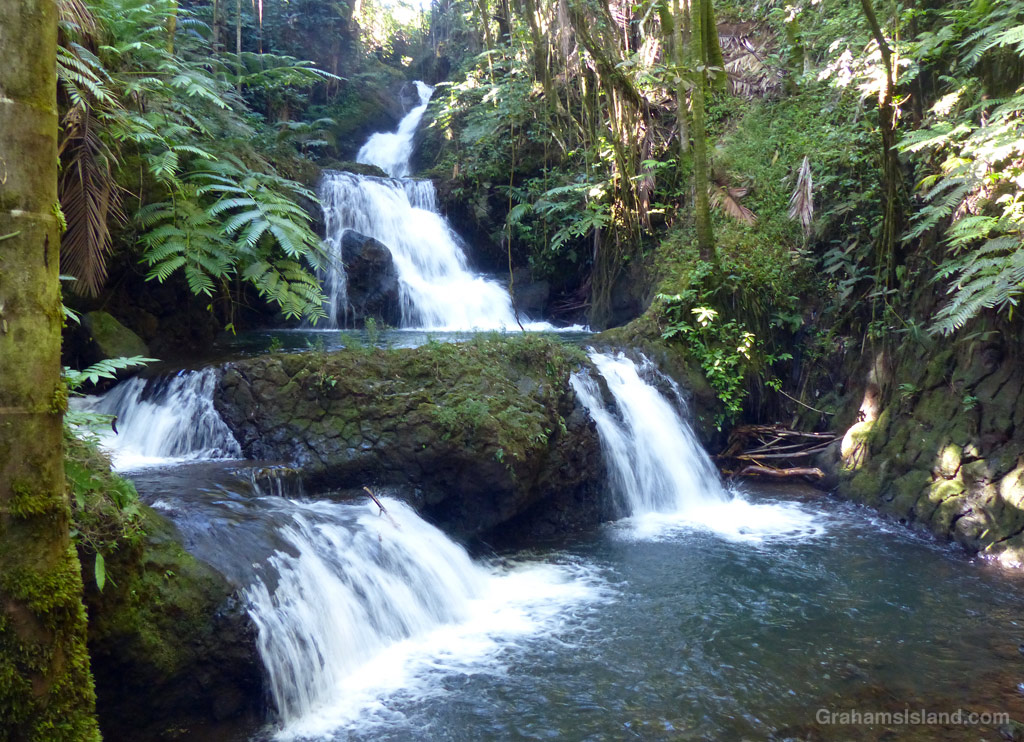
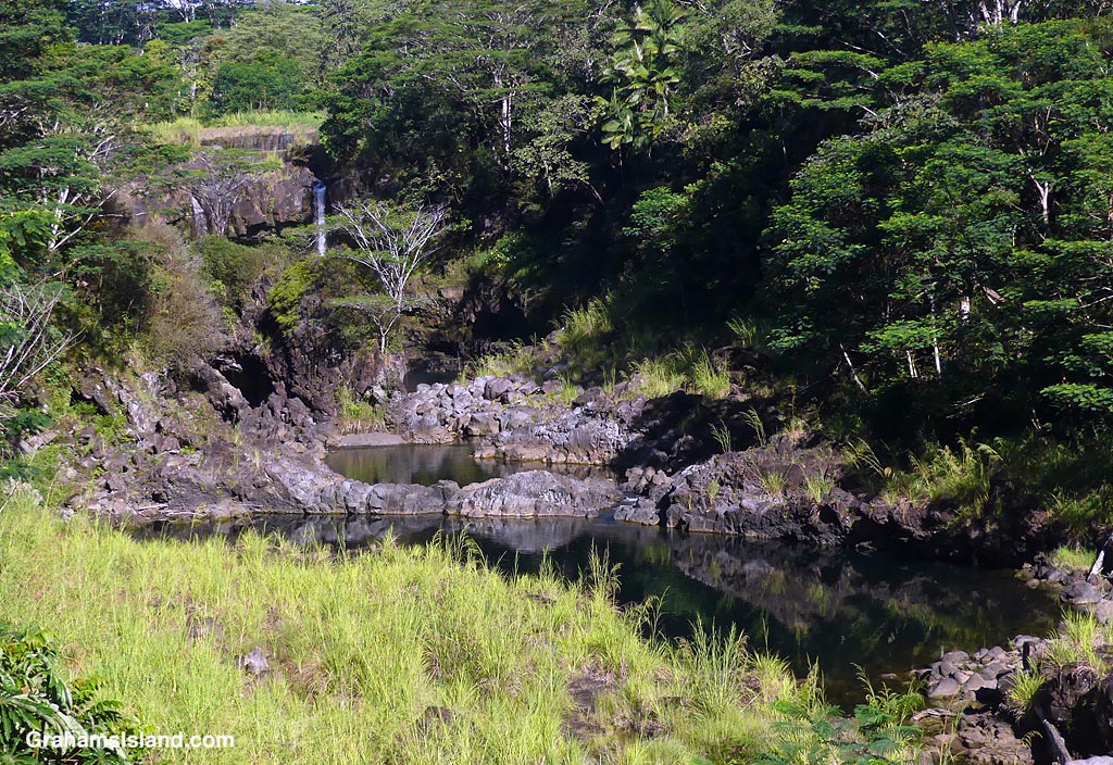
Onomea Falls at Hawaii Tropical Botanical Gardens.
This week’s Sunday Stills challenge theme is ‘Fountains and falls.’ See more responses here.
Looking up at a Kohala Mountain waterfall.A waterfall on the remote North Kohala coast.Wai’ale Falls in the distance from a bridge over the Wailuku River.The Wailuku River bed with Pe’epe’e Falls in the distance.Rainbow Falls in Hilo. No rainbow and not much water falling because it’s been so dry here.
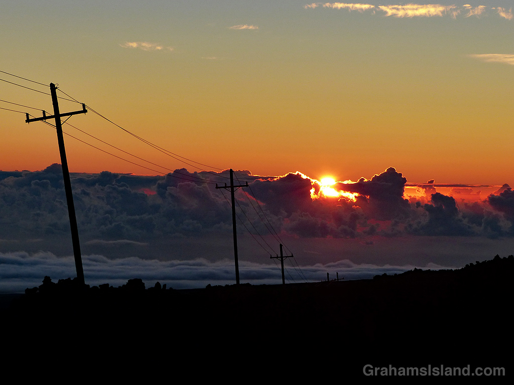
Sunrise from the road to Mauna Loa Observatory, now no longer accessible since the 2022 eruption.
The idea of The Numbers Game is to enter a number into the search bar of your computer and then post a selection of the photos that turn up. This week’s number is 147. Captions are on the photos. You can see more responses here.
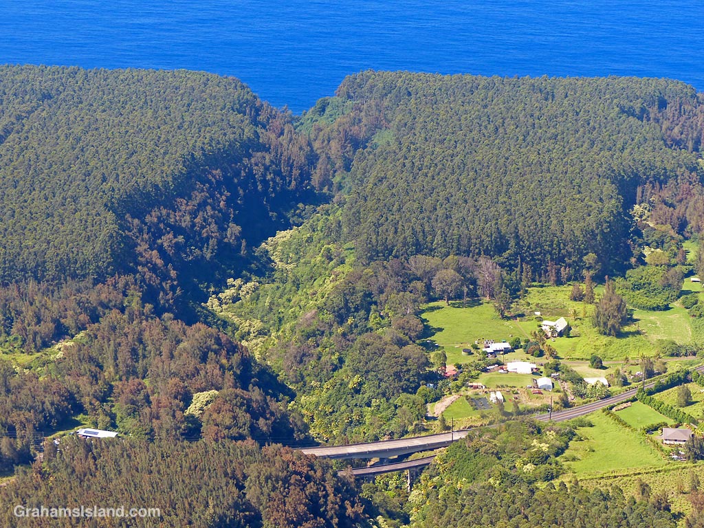
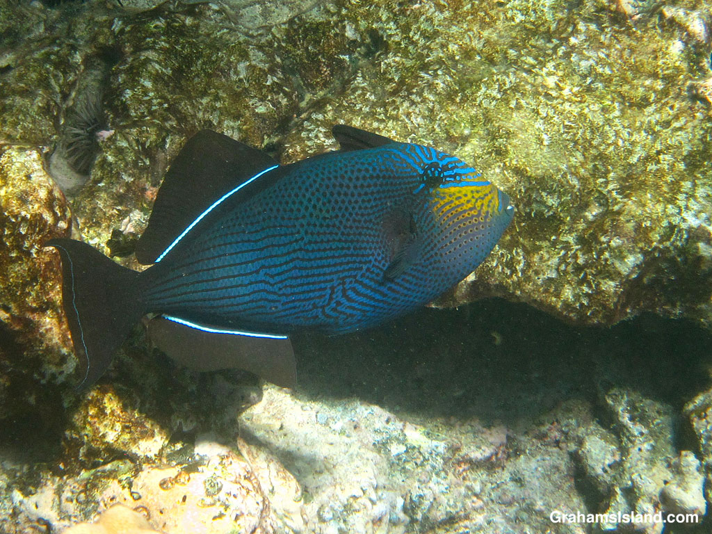
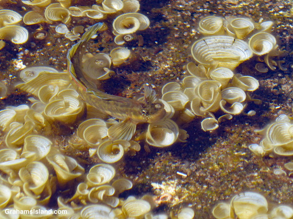
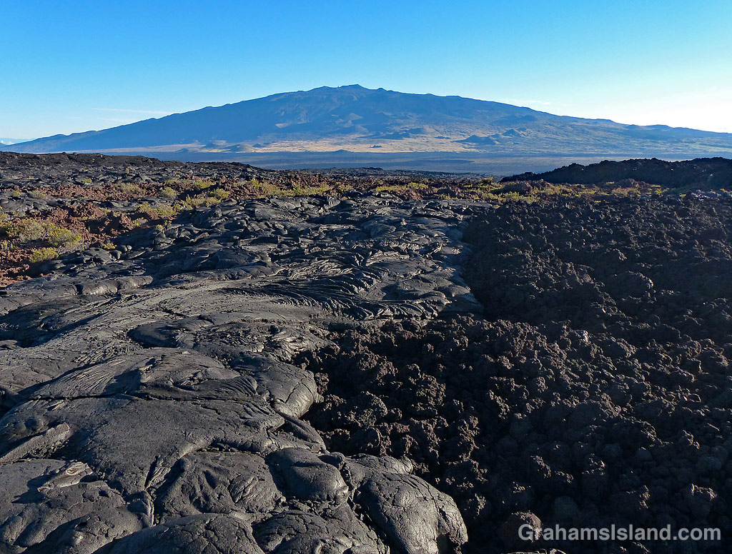
Rainbow Falls in Hilo.The stairs down to Kaumana Caves in Hilo.A view of Kealakaha Stream gully, on the Hamakua Coast, from the air.An agitated Black Triggerfish.Hawaiian Zebra Blenny in a filed of Padina japonica seaweed.A view of Mauna Kea from Mauna Loa showing Pahoehoe and A’a lava flows side by side.
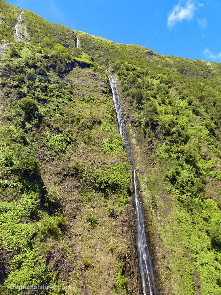
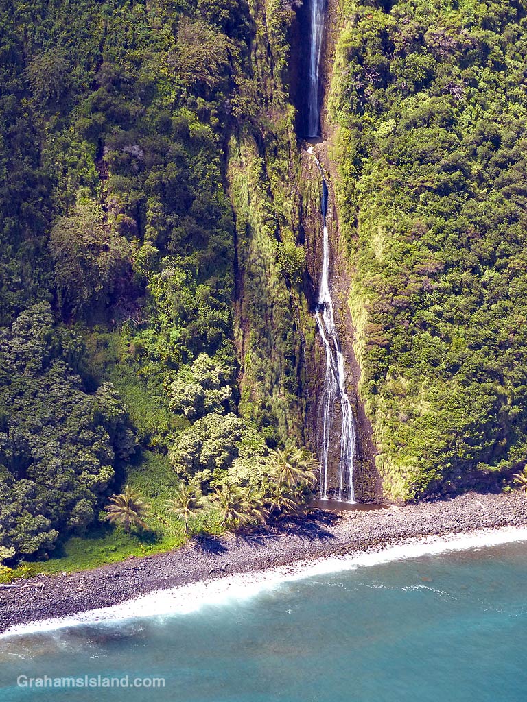
The North Kohala coast is largely inaccessible except by water or by air. This view shows a few of the many waterfalls that plunge into the ocean along that stretch of coast.
This week’s Sunday Stills challenge theme is ‘Meaningful Memories.’ See more responses here.
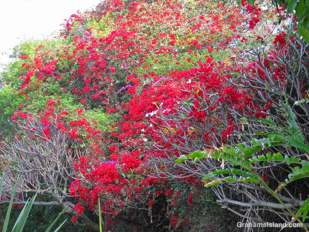
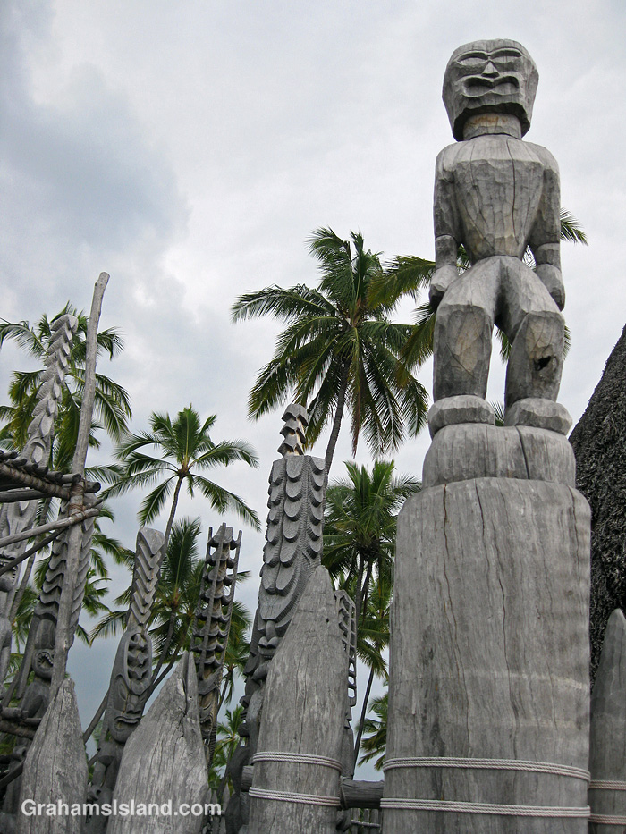
This seemed like an opportune time to revisit my first visit to Hawaii, back in 2010. My wife and I stayed in a vacation rental near Captain Cook, overlooking Kealakekua Bay. The sky was hazy with vog from Kilauea Volcano, but the place was awash with colorful flowers. Just down the road was the Painted Church and at the foot of the hill, Puʻuhonua o Hōnaunau National Historical Park celebrates Hawaiian culture and history with its wooden ki’i and towering palms.
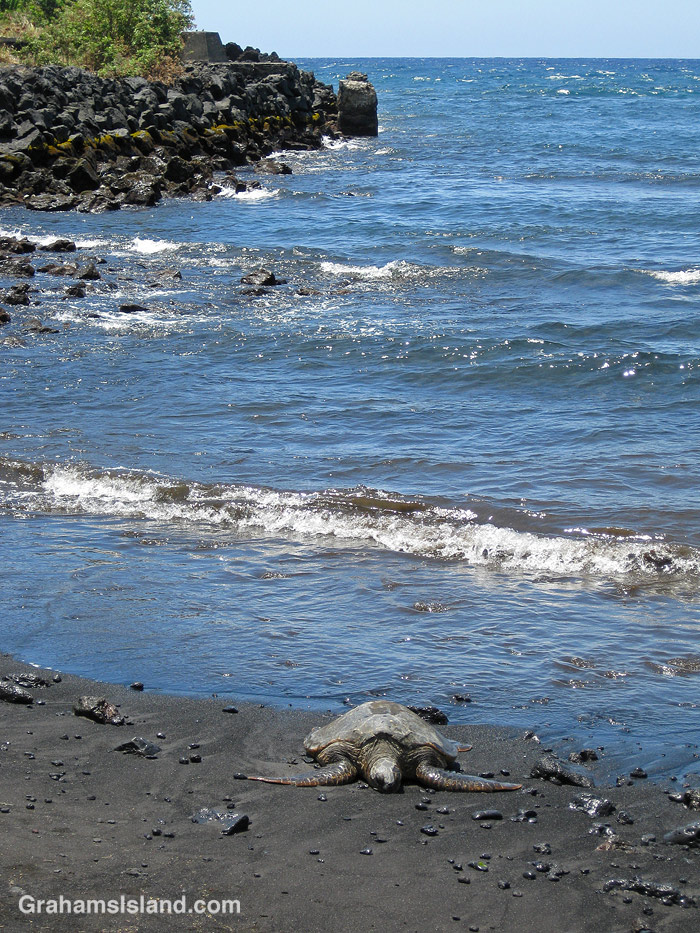
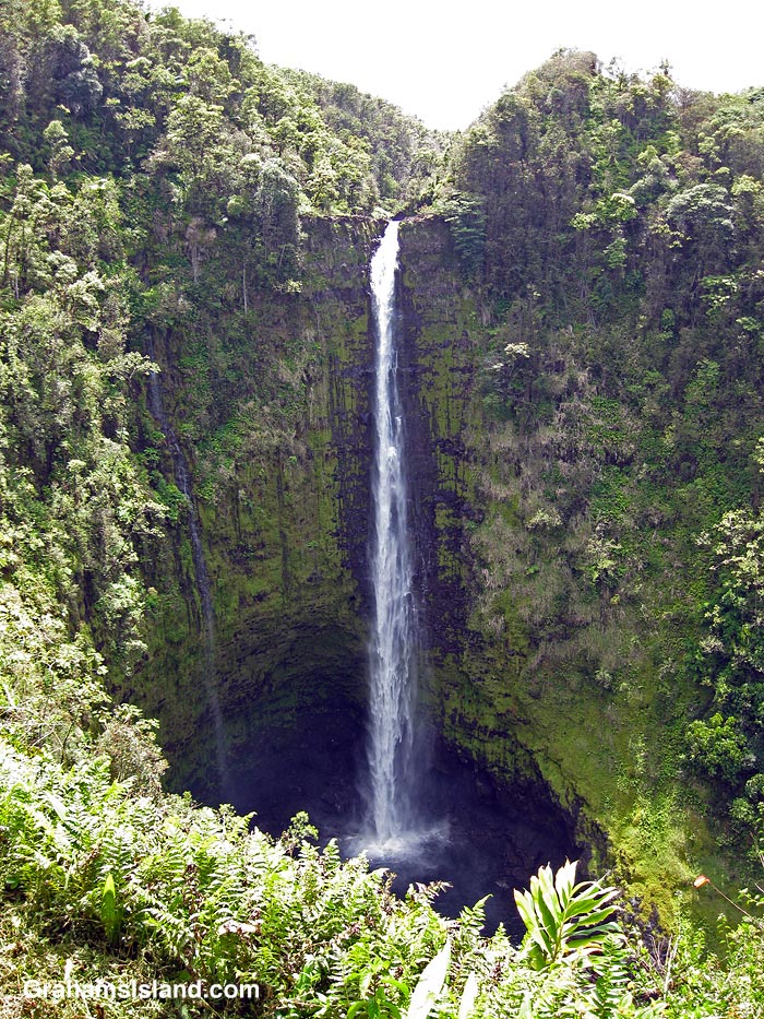
We traveled the whole island from the black sand beach at Pololu (even if we had to pass the carcass of a dead whale twice) to the black sand beach at Punalu’u, dotted with resting green turtles, and rocky surrounds. There were waterfalls big and small, and roads lined with tropical foliage leading to the active lava flow at that time.
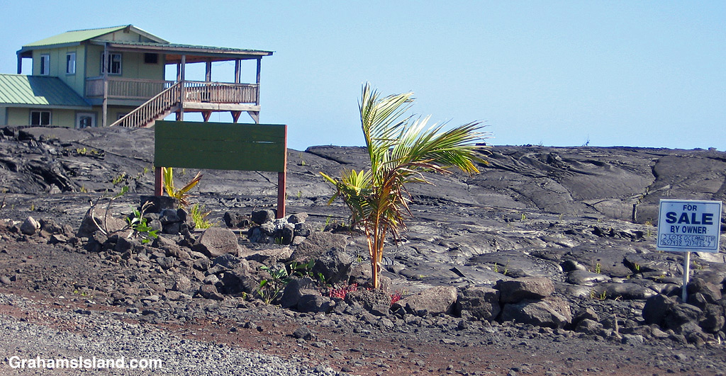
There, signs warned that flowing lava is dangerous (who knew?), but we were still able to get within 10 feet of oozing tongues of red, and saw small fires still burning in nearby brush.
There was even a house for sale: ‘Buy now before it burns!’ We didn’t, though that house still stands while others, much farther from that scene, have since been consumed by subsequent flows.
It was this visit that prompted us to return permanently two years later. Hawaii isn’t paradise – it has its pros and cons like any place – but we haven’t regretted the move and are looking forward to the next 10 years.
This week’s Sunday Stills challenge theme is ‘Bodies of Water.’ (See more responses here.) Last Sunday, I posted photos of the Kohala valleys. This week, I’m posting a bit about what goes on in them and elsewhere on the island.
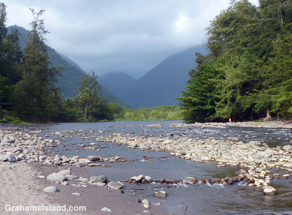
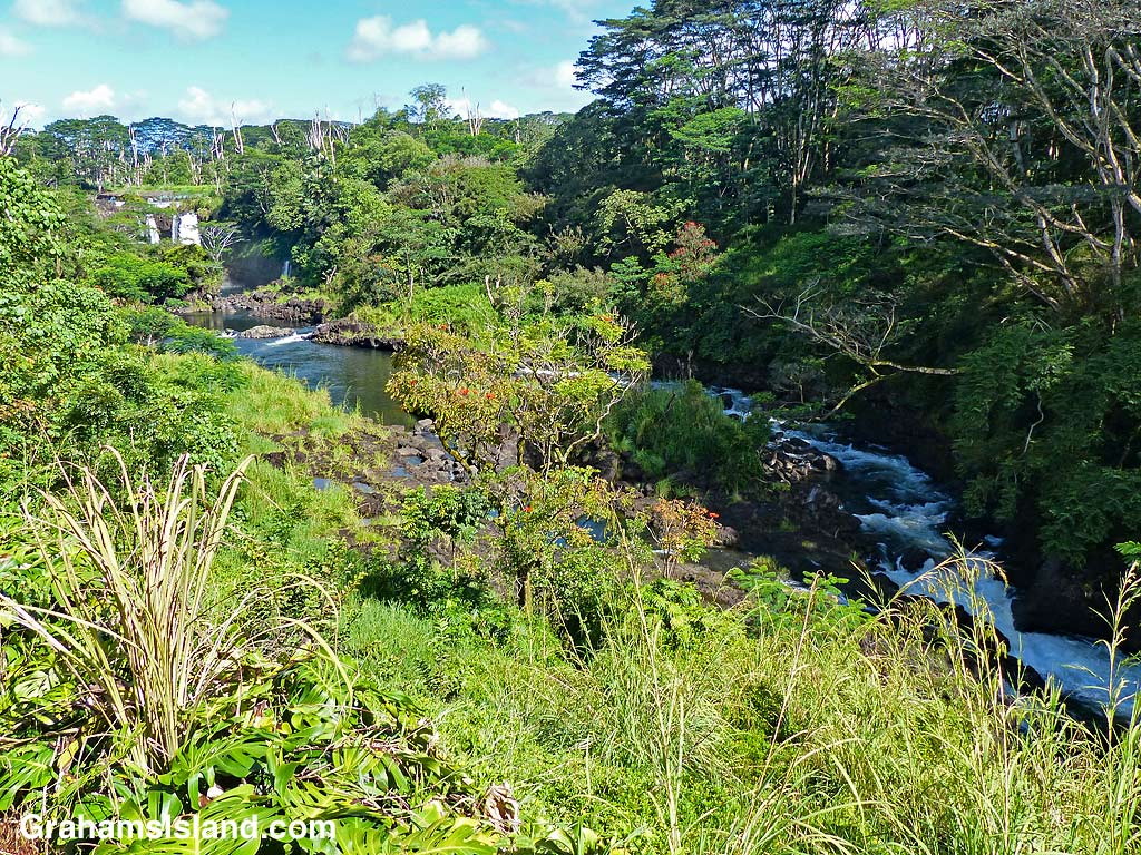
The top photo is shows the mouth of the Waipi’o River looking back toward the cloud shrouded Kohala hills. The river, is fed by water passing over Hi’ilawe Falls and other waterfalls deep in the fingers of the valley. Like all water courses on the Big Island, its flow is greatly increased by the often heavy rainfall.
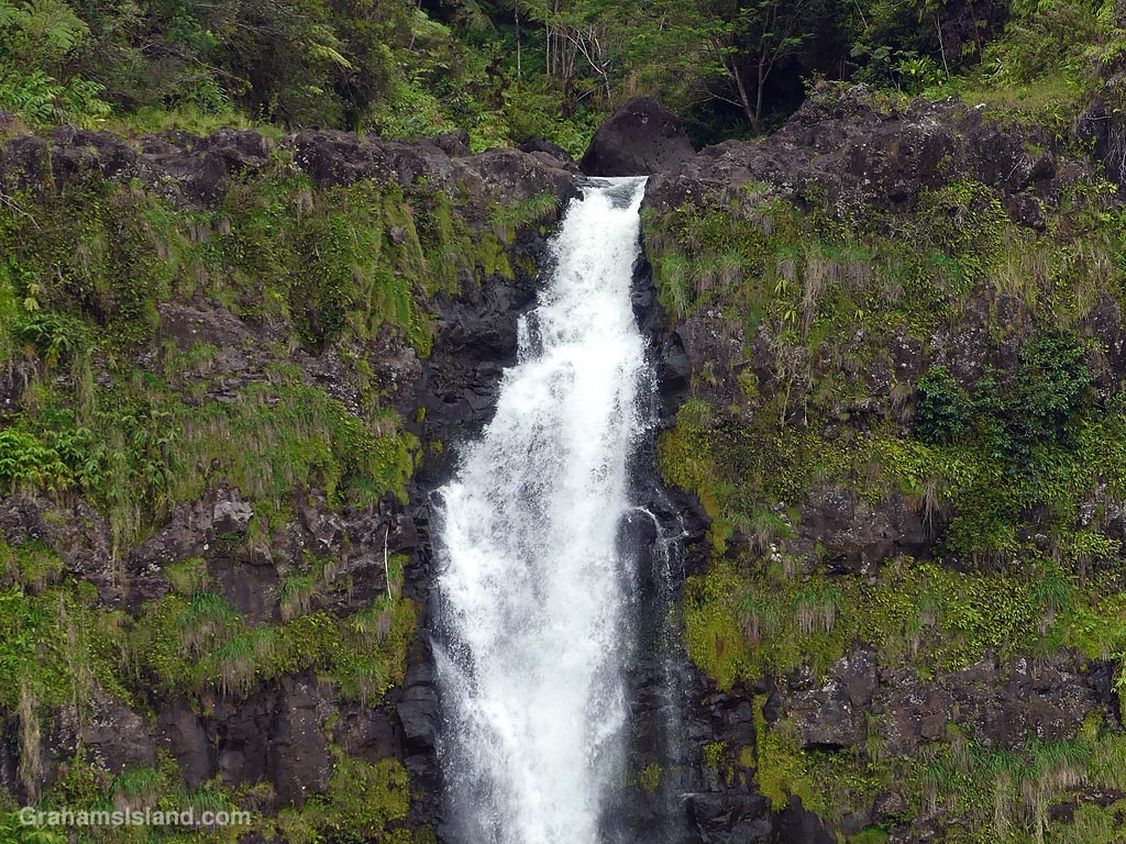
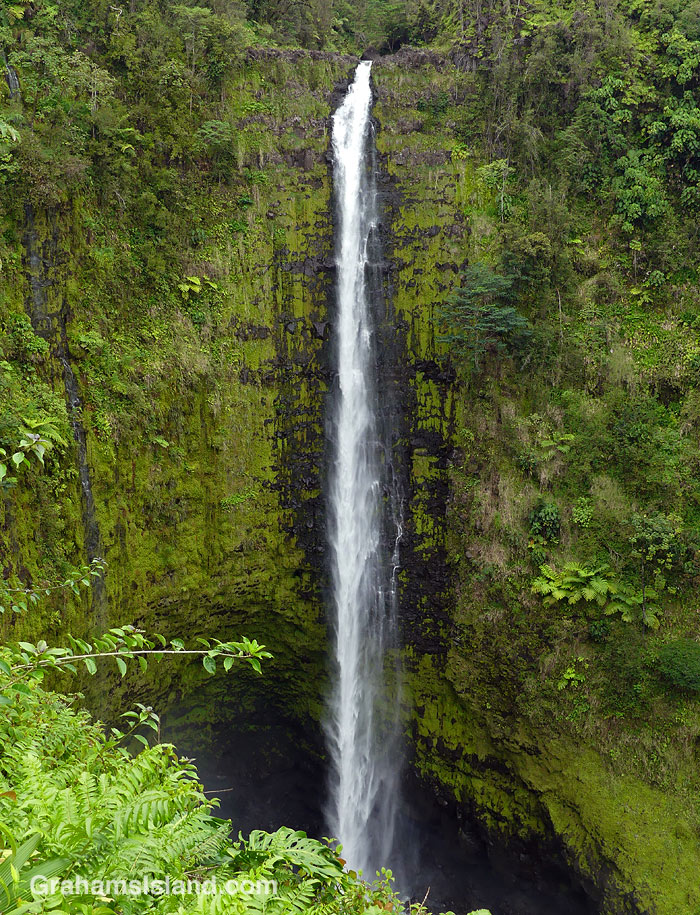
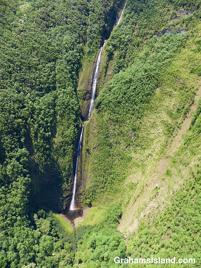
The second photo shows a waterfall, farther down the coast, cascading into a pool at the bottom before flowing out to the ocean. Some of these waterfalls drop more than a thousand feet. Some cascade into valleys, some directly into the ocean. During dry spells, the water flows are greatly reduced and many falls, those that are entirely rain fed, disappear for a while. When rains are heavy, the water flow is so great that some falls blend together to form a sheet of falling water.
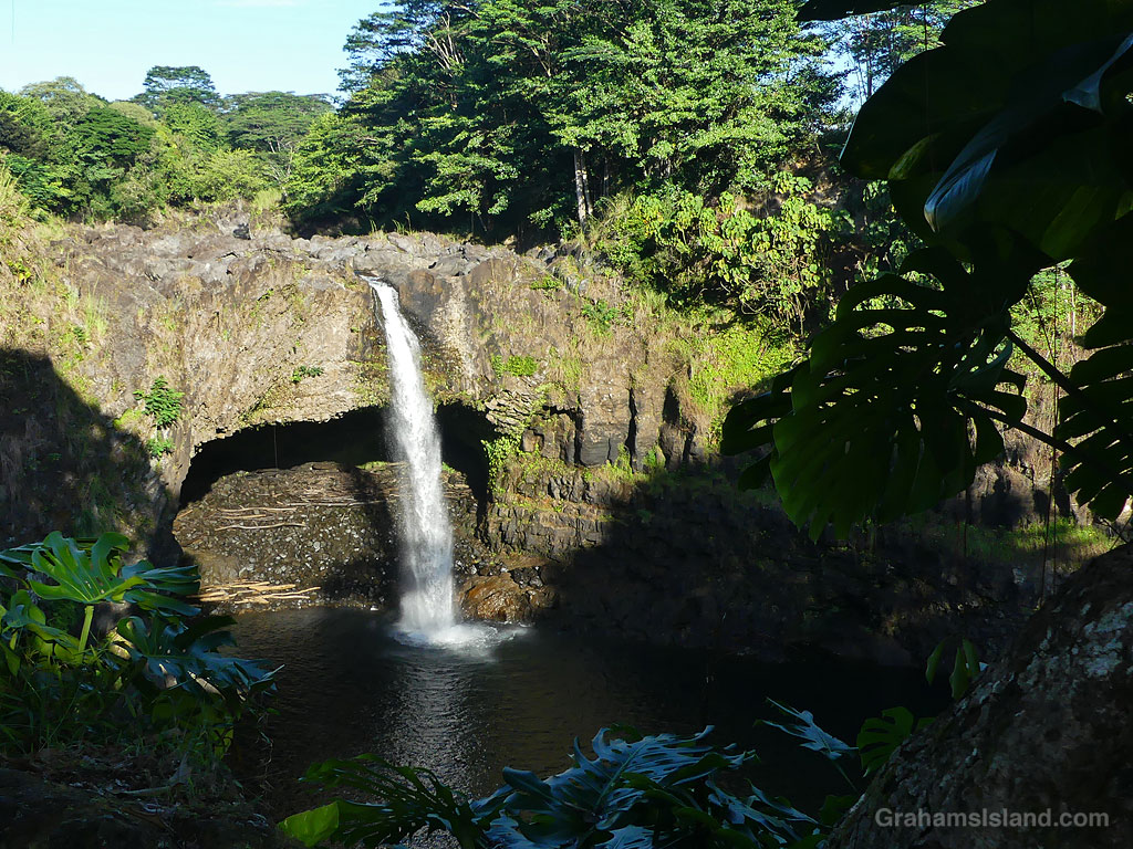
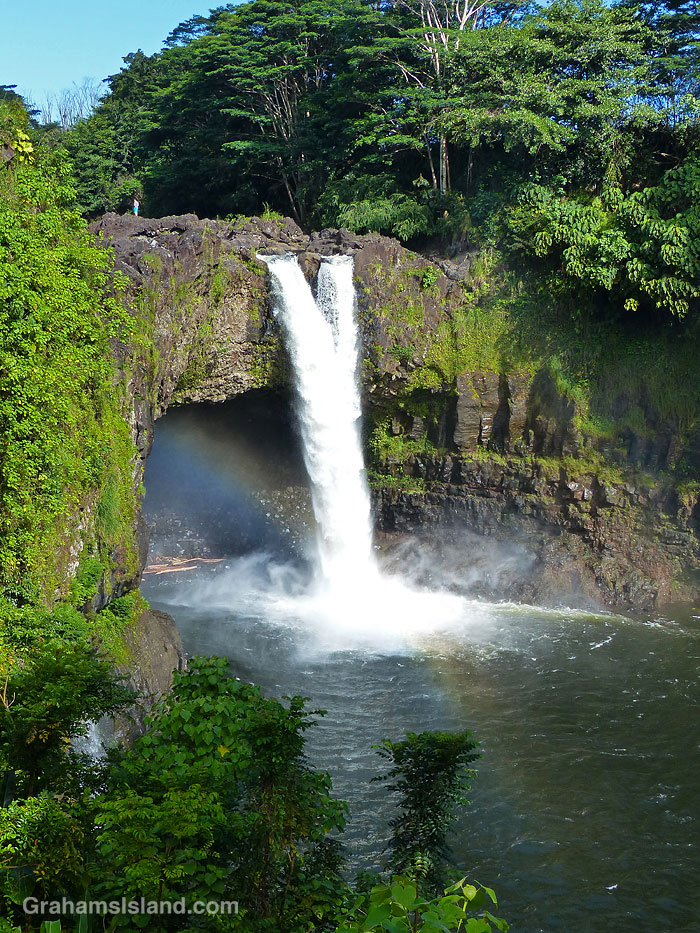
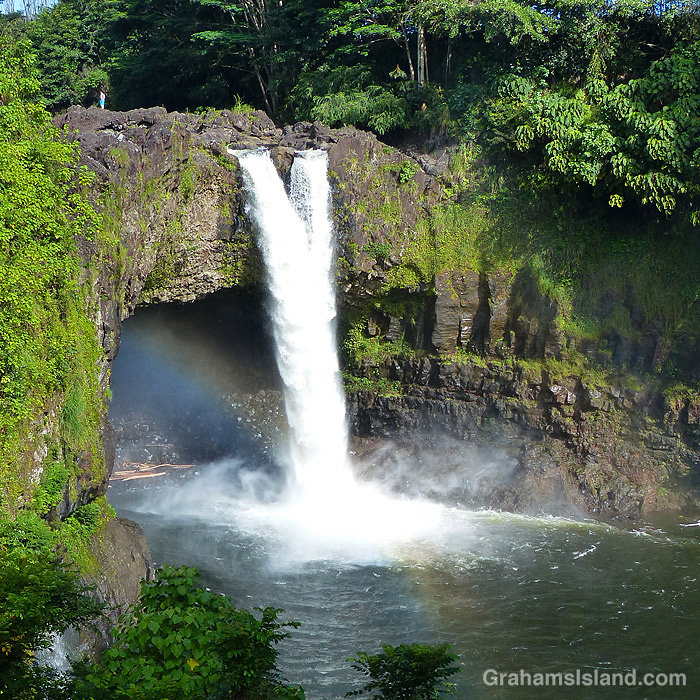
On the east side of the island is Wailuku River, the longest river on the island. This flows down to the ocean in Hilo, and on its way, tumbles over the aptly named Rainbow Falls (third photo). The falls and rainbows are best seen in the early morning. This stretch of the river is very dangerous with flash floods being common. People get swept away here every year.
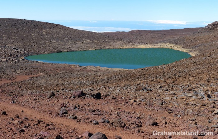
Finally, the bottom photo shows the biggest lake on the island, which can be found at the top of Mauna Kea! Lake Waiau is fed by rainwater and snow melt, mostly in the winter. That it exists at all is something of a mystery. The ground on Mauna Kea is highly permeable, and it’s not fully understood what the layer is beneath Lake Waiau that enables it to retain water. Lake Waiau is not just the biggest lake on the island, it’s the only one. Green Lake, the biggest lake previously, disappeared during Kilauea’s 2018 eruption (photos and story here).
Boiling Pots is part of Hilo’s Wailuku River State Park. In this photo, the pots can just be made out through the tree in the center. It looks serene here, but it’s a dangerous spot. The river is prone to flash floods and when it’s roaring, the water in the pots looks like it’s boiling, hence the name. People have been sucked under and trapped in hidden caves and lava tubes. There are lots of warning signs, but many people still think they know better. Not all of them are right.