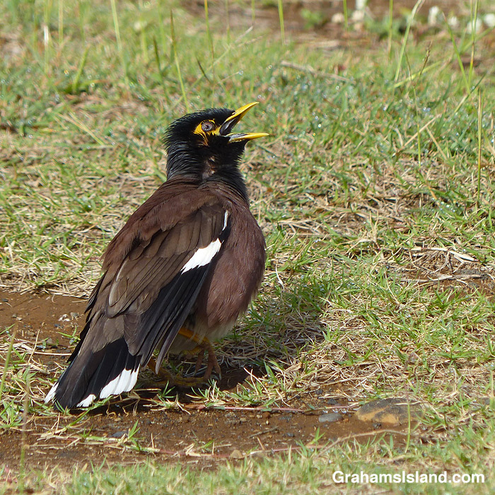
I saw this Myna at Punaluʻu Black Sand Beach Park. It was standing just as you see, before moving to do a bit of preening. Then it resumed this position. It repeated this process several times.
The bird was clearly waiting for mum or dad to return with food and, by golly, it wanted to be quite clear that it was ready and waiting to eat. Apparently, the parents weren’t overly impressed by this display, since they didn’t show up while I watched.
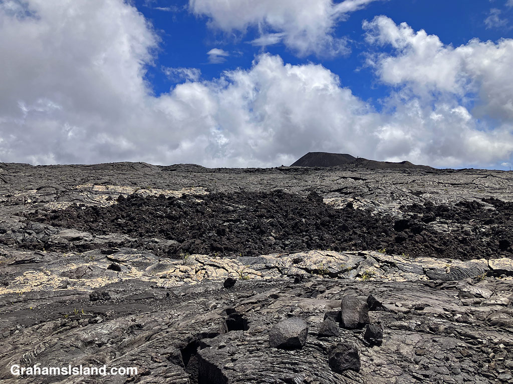
My lunch spot with a view of the Kamakai’a Hills and various kinds and colors of lava.
This week’s Sunday Stills challenge theme is ‘I’d Rather Be…’ See more responses here.
It had been a while since I went hiking, for various reasons, and it’s something I was missing, something I’d rather be doing. So last week, I headed down to Hawaii Volcanoes National Park to try the Ka’u Desert Trail. This backcountry trail has been on my list for a long time, but I had never done it before. For one thing, it’s about as far from my house as one can get on the island. For another, it’s directly downwind from Kilauea Volcano, so when the volcano is active and the trade winds are blowing, gasses blow across the length of the trail.
The latest eruption of Kilauea is currently either paused or over, so gas emissions are much reduced, and last week, the trade winds had given way to winds from the southwest. So off I went.
Signs explain the rich history and geology of the area.Tenacious Ohia trees grow in the lava.Ohia flowers are a magnet for bees……as are the native Ulei flowers.
The trailhead is several miles west of the main entrance to the park, with a strip of parking along the highway. The first mile of the hike is also known at the Footprints Trail. It’s a sort of paved path that threads through ohias to a small building that houses footprints left by early Hawaiians in volcanic mud and ash. Alas, I couldn’t identify any footprints in the display. Shortly after the footprints, the path breaks out of the vegetation into open lava fields. This isn’t a tropical Hawaii walk, this a bleak hellscape Hawaii walk. Or is it?
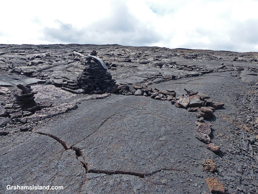
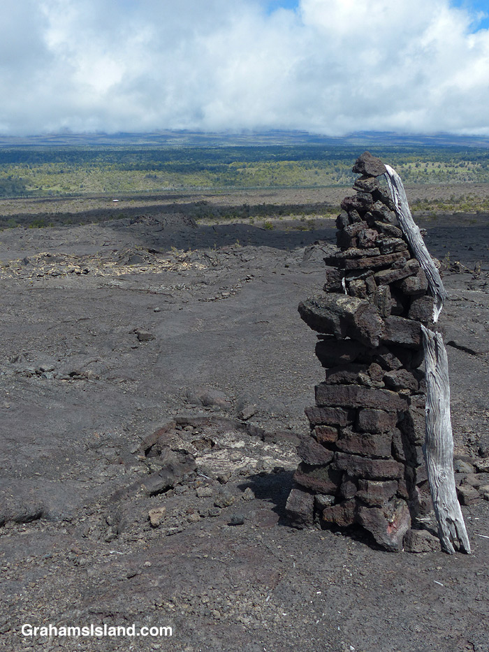
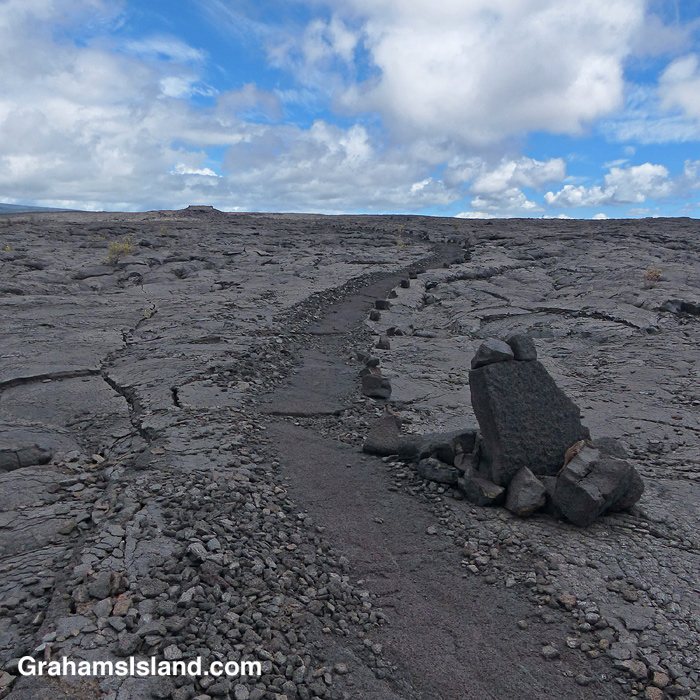
A view of the Kamakai’a Hills from the trail junction.The trail was rerouted here, from its previous path, for reasons unknown.Cairns mark the trail, some bigger than others.Walking on the trail removes the top, crumbly layer of pahoehoe lava.
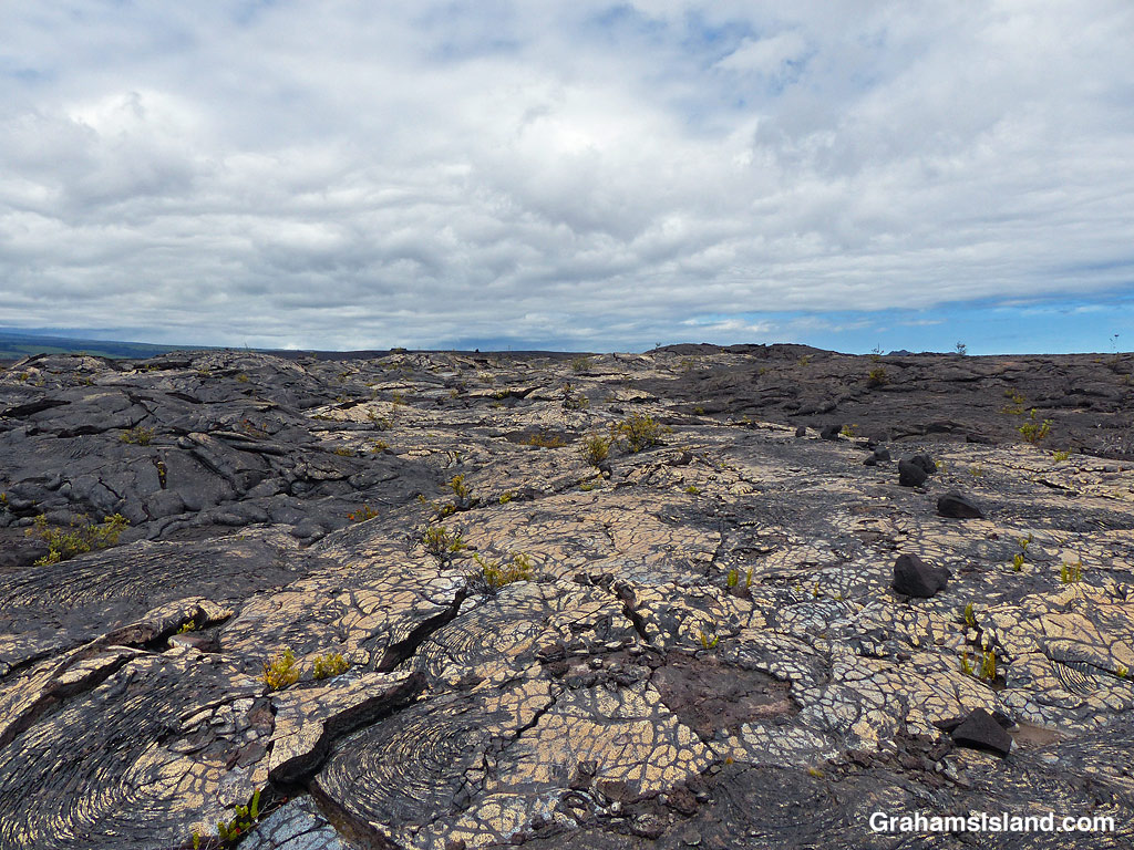
The trail ascends gently to the only junction for miles around, at Mauna Iki. To the left is a trail back towards the heart of the park. The Ka’u Desert Trail heads to the right and into backcountry wilderness. Mauna Iki was the site of an eruption in 1919 and the trail traverses the lava fields from this eruption.
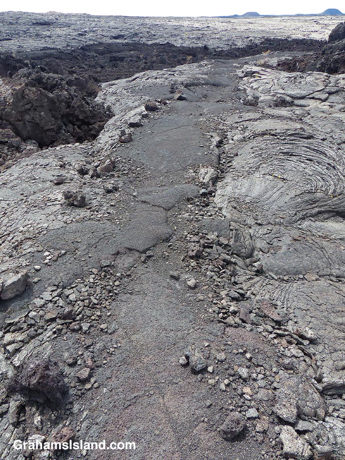
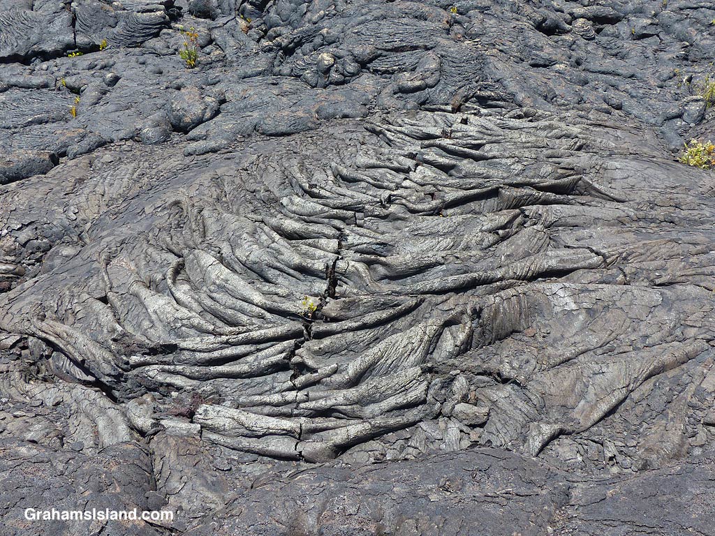
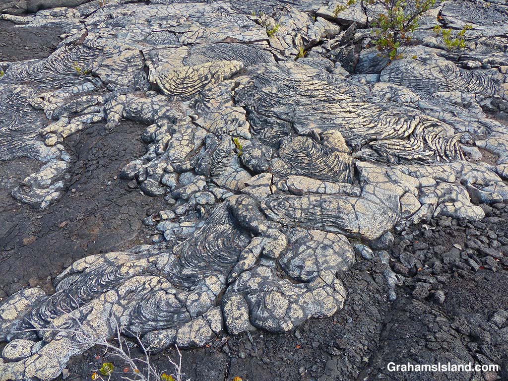
A’a and pahoehoe lava flows can be seen side by side.Gold colored ropey pahoehoe lava makes it look even more like ropes!The lava has many weird and wonderful folds and shapes.
Much of the trail is over pahoehoe lava, which is rounded and much easier to walk on than jagged a’a lava. The trail is marked by cairns and single rocks placed alongside it. It’s pretty easy to follow with just one or two parts where attention has to be paid to make sure one doesn’t stray.
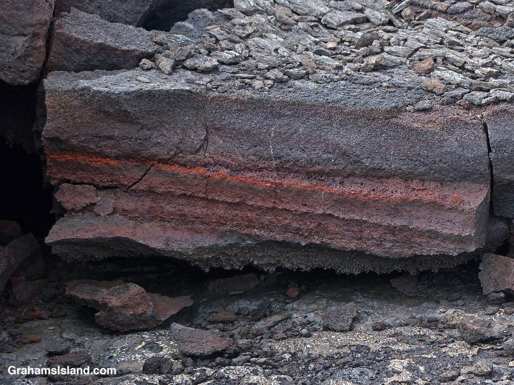
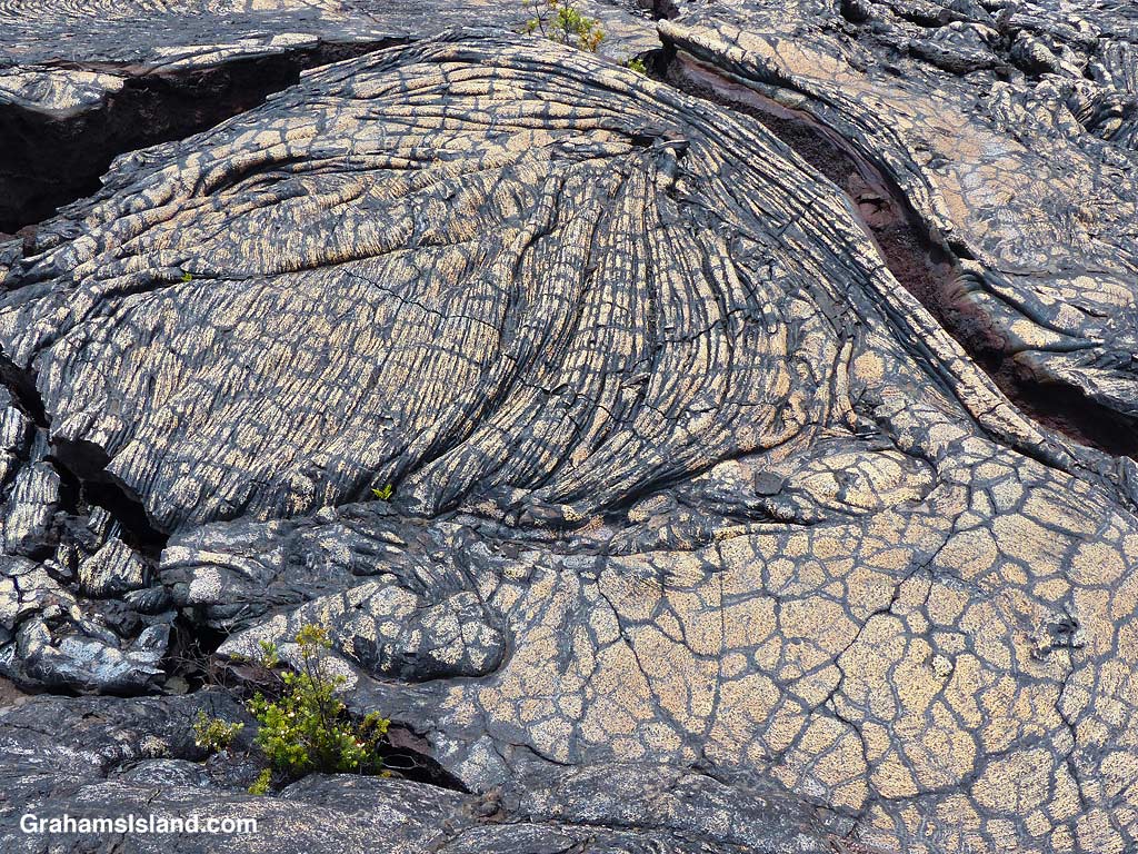
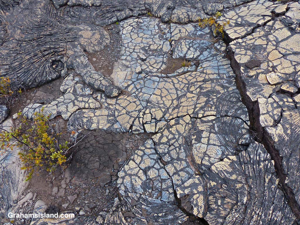
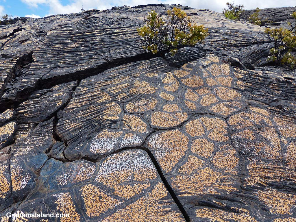
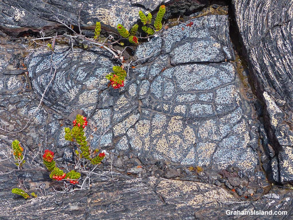
Bronze colored lava.Bands of red in the lava.A crack in the trail……revels shades of orange within.Blue and gold lava flow.Colorful and dramatic, but slowly nature returns.Colorful ropey pahoehoe lava next to smooth.Blue lava!The patterns and colors reminded me of Roman mosaic floors.Bold color and markings.Plants gain a toehold in the cracks and provide a splash of different colors.Don’t stray off the trail. There are holes and thin spots everywhere.Bright colors and bold shapes can be seen along a lot of the trail.
It wasn’t far along this part of the trail that I first encountered blue lava. That’s right, blue lava. Who knew? But not just blue. There’s bronze, pink, red, orange, gold, and who knows what. I’ve seen colorful lava on the Puna Coast Trail, but this was more varied and quite wonderful. In places the trail crossed this colorful lava and I felt bad for walking on it, though as I hiked I could see many more patches of color out in the lava fields. It’s not wise to leave the trail since there are many lava tubes, some with very thin ceilings.
This is an out and back trail and I turned around once I reached the Kamakai’a Hills, after about 5 miles. It’s another 2 or 3 miles to the next junction where there is a small cabin.
Also posted for Jo’s Monday Walk. See more responses here.
The trail crosses one of the fields of colorful lava.
Not exactly a mine, but this was how early Hawaiian settlers got their salt. Suitably cupped rocks were filled with saltwater. The hot sun evaporated the water leaving behind salt crusts on the rocks. In this instance, the water in the bowls is probably rainwater, hence the lack of any salt residue.
These rocks were at Lapakahi State Historical Park, which contains the remains of an old Hawaiian fishing village.
The boat hoist at Mahukona has featured in a few of my posts, most notably here and here. Over the years, it’s taken a lot of punishment and that has finally caught up with it. When I went for a swim a couple of weeks ago, this was all that remained of it. I rather liked the jaunty hat on the piece at the left. When I went down there again a few days ago, the last of the metal had gone.
I’ve heard it might be replaced, but the wharf would probably need fixing first. Next door at the beach park – though there is no beach – the old pavilion is cordoned off awaiting demolition and replacement. That process started several years ago and the old building is still standing. Everything will happen in its own good Hawaii time!
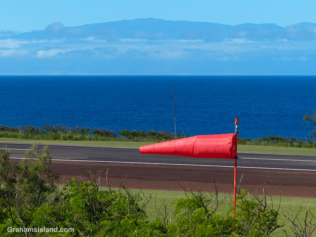
The windsock at Upolu Airport with Maui in the background.
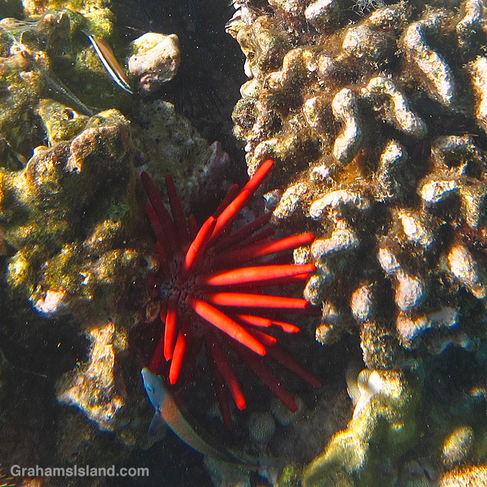
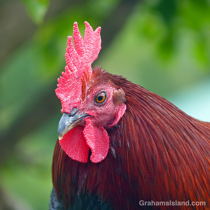
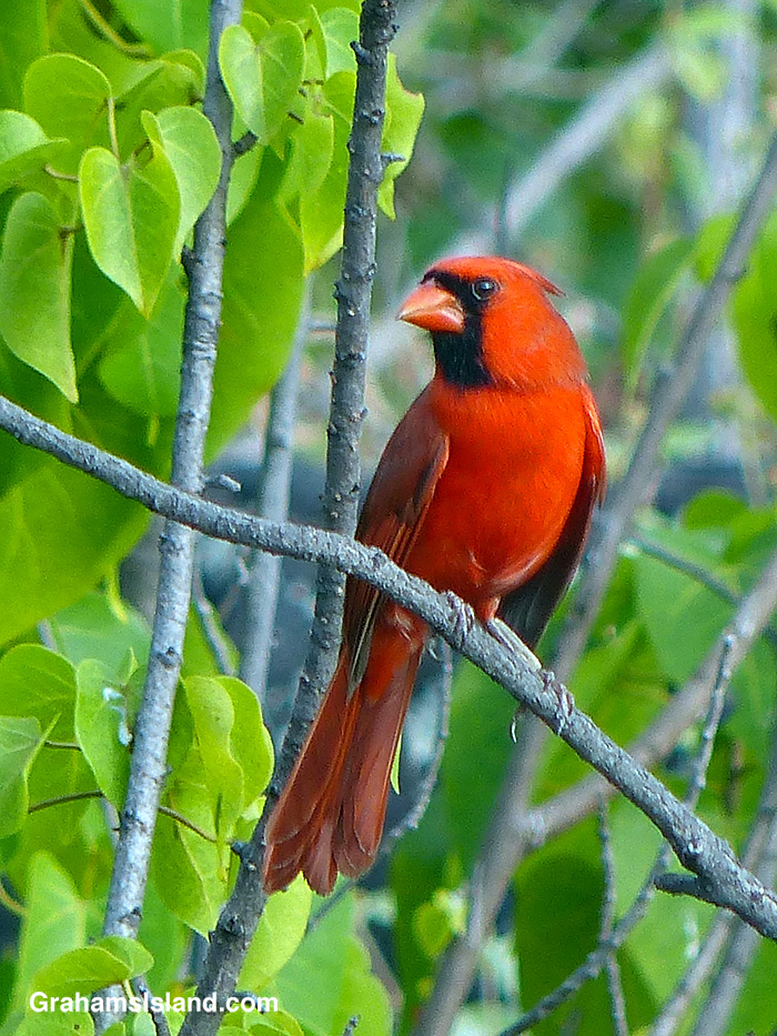
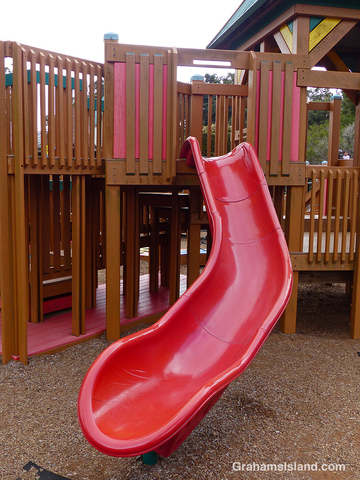
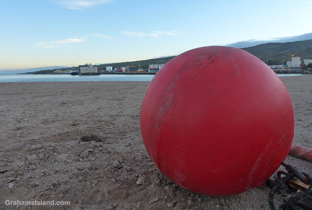
This month’s Sunday Stills Color Challenge is ‘Red.’ See more responses here. A variety of subjects for this one!
A Red Pencil Urchin in the shallows off Kohala.The red crest of one of the many chickens roaming free around here.A Northern Cardinal in a tree near the South Kona coast.A slide at a kid’s playground in Waimea.A large buoy on the beach at Kawaihae Harbor with an inter-island barge arriving in the background.