Category Archives: Places

Upolu Airport bombed

Planes gathered at Upolu Airport, on the northern tip of the Big Island, for a fly-in.

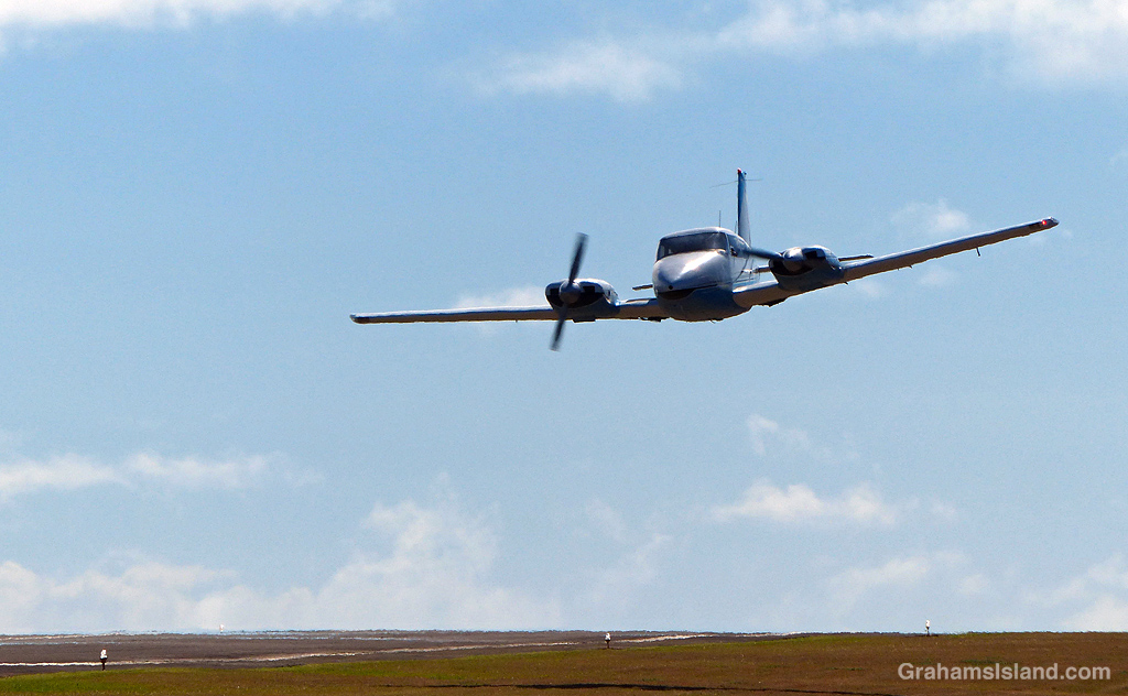
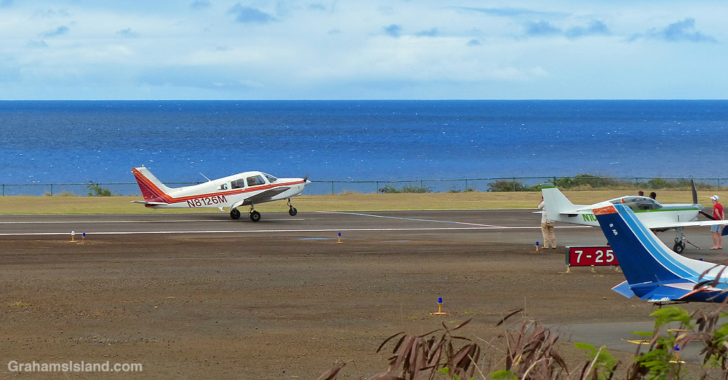
Why would anyone want to bomb Upolu Airport, a lightly used airstrip at the northern tip of the island, which is where I go walking because of the peace and quiet? That’s what I wondered when I went down there on Saturday and found 20-plus aircraft, cars parked alongside the road, and a lot of people milling around. Turns out, a group of aviation enthusiasts had organized a fly-in and I’d stumbled on it en route to my walk.

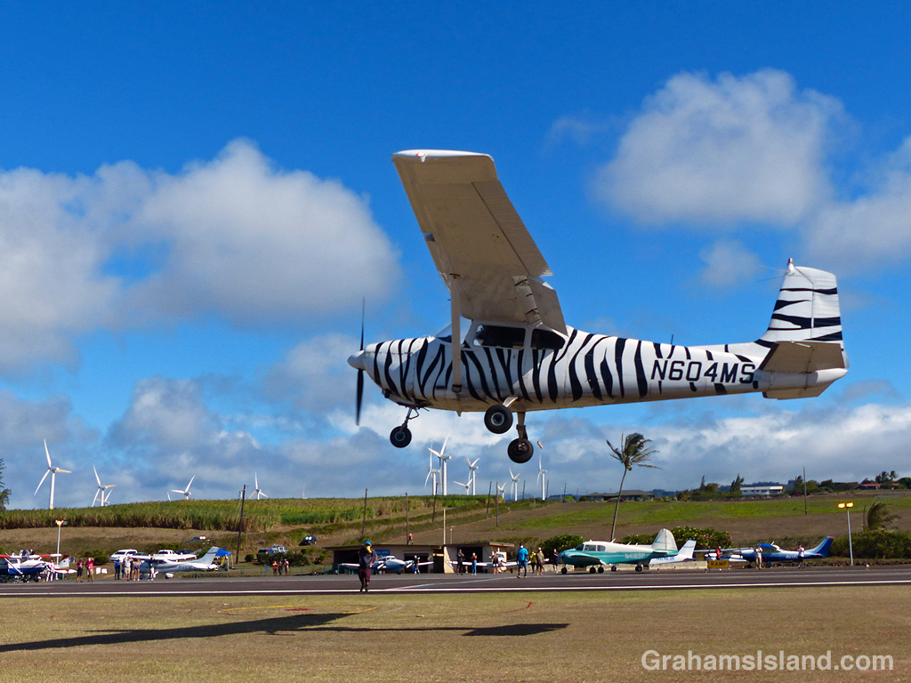
There were planes parked, planes circling above, planes zipping by a whisker above the ground. Apart from the general milling around, a couple of events were scheduled. The first was a touch and go challenge where the goal was to touch as close as possible in front of a line across the runway. Touch down after the line and it counted for nought.

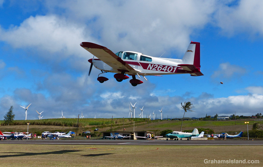
The other event was the bombing run. By the time that rolled around, I’d walked around to the other side of the runway and was leaning on a fence chatting to a couple of airport maintenance workers. The target circle for the bombing challenge, which involved bags of flour rather than high explosives, was not far from where I was so I decided to wait for it to play out, which took rather longer than I anticipated.

What I was hoping for was large bags of flour being dropped from a decent height and exploding in a large white cloud. Instead the bags were small and dropped from just a few feet above the ground as the planes flew by very low indeed. I don’t think the exercise even broke a bag, let alone throwing up a cloud of flour.

Still, it appeared that a good time was had by all, and while my walk got a zero on the peace and quiet scale, it got high marks for being, as they used to say on Monty Python, something completely different.

One of the planes makes a low pass over the airport.
A plane makes a touch-and-go landing, attempting to get as close to the line across the runway as possible.
One of the planes making a low pass for a bombing run. The bomb, a small bag of flour, can be seen just behind the rearmost wheel.
Another plane on a bombing run. The ‘flour bomb’ can be seen behind the plane.

Molted monk seal

A couple of days ago, I saw this monk seal resting on the shore below Upolu Airport. It turned out to be RA20, the same seal I saw there back in May (bottom photo). In the interim, she had obviously molted and looked very shiny and clean. Pre-molt monks seals look quite ratty and green, particularly around the flippers and head. After a molt, they look sleek and silvery as this one does.

Monk seals molt about once a year and it is a process that can take 10 days or so. During this time the seal will generally remain on the beach or rocks where it has hauled out.

Goats at the watering hole

A recent visit to Pu’uhonua o Hōnaunau National Historical Park, otherwise known as Place of Refuge, included this encounter with a herd of goats. The goats were passing through and stopped to get a morning drink in the ponds. These anchialine ponds are connected to the nearby ocean through underground channels. Because of this, the levels of water in the ponds vary with the tides.

In the ponds, fresher water floats on top of saltwater from the ocean, which is why they’re a good watering hole for the goats. Back in the days when Hawaiian royalty lived on these grounds, the ponds were used to hold fish for future consumption by those living here.

For more information about Pu’uhonua o Hōnaunau National Historical Park, visit https://www.nps.gov/puho/index.htm.

Big Island bodies of water

A view of Waipi'o Valley taken from the mouth of the river
Waipi’o Valley
Kohala waterfall
Rainbow Falls, Hilo
Lake Waiau.

This week’s Sunday Stills challenge theme is ‘Bodies of Water.’ (See more responses here.) Last Sunday, I posted photos of the Kohala valleys. This week, I’m posting a bit about what goes on in them and elsewhere on the island.

The top photo is shows the mouth of the Waipi’o River looking back toward the cloud shrouded Kohala hills. The river, is fed by water passing over Hi’ilawe Falls and other waterfalls deep in the fingers of the valley. Like all water courses on the Big Island, its flow is greatly increased by the often heavy rainfall.

The second photo shows a waterfall, farther down the coast, cascading into a pool at the bottom before flowing out to the ocean. Some of these waterfalls drop more than a thousand feet. Some cascade into valleys, some directly into the ocean. During dry spells, the water flows are greatly reduced and many falls, those that are entirely rain fed, disappear for a while. When rains are heavy, the water flow is so great that some falls blend together to form a sheet of falling water.

On the east side of the island is Wailuku River, the longest river on the island. This flows down to the ocean in Hilo, and on its way, tumbles over the aptly named Rainbow Falls (third photo). The falls and rainbows are best seen in the early morning. This stretch of the river is very dangerous with flash floods being common. People get swept away here every year.

Finally, the bottom photo shows the biggest lake on the island, which can be found at the top of Mauna Kea! Lake Waiau is fed by rainwater and snow melt, mostly in the winter. That it exists at all is something of a mystery. The ground on Mauna Kea is highly permeable, and it’s not fully understood what the layer is beneath Lake Waiau that enables it to retain water. Lake Waiau is not just the biggest lake on the island, it’s the only one. Green Lake, the biggest lake previously, disappeared during Kilauea’s 2018 eruption (photos and story here).

That’s a lot of bull

Recently, I stopped to take photos along Kohala Mountain Road. I was leaning against a gate when I glanced to the right and saw this rather large bull lying down in the enclosure. I took some photos, looked over again, and saw the bull stand up. It stared at me. I glanced down at the gate, wondering just how stout it was.

I finished my photo taking, snapped a couple of the bull, and retreated to my car. There’s no doubt in my mind that, should the bull feel like it, neither the fencing, nor the gate would keep it contained. Probably my car wouldn’t fare that well either.

Basket fern and orchid

This drynaria rigidula ‘Whitei’ basket fern was growing on a tree trunk at Hawai’i Tropical Botanical Garden (which has since change its name). I like basket ferns, which look like upturned umbrellas. This fern was complemented by a dinema polybulbon orchid, a delicate and fragrant epiphytic orchid that was winding it’s way up into the fern.

For more information about Hawai’i Tropical Bioreserve & Garden (formerly Hawai’i Tropical Botanical Garden), go to htbg.com.

Kohala valleys

This week’s Sunday Stills challenge theme is ‘Mountains and Valleys.’ See more offerings here.

Kohala Volcano is the oldest volcano on the Big Island and has long been extinct, having last erupted around 120,000 years ago. Since then, the various processes of erosion, from rainfall to landslides, have carved deep valleys into the volcano. Waipio, the easternmost of these valleys, is accessible by vehicle (4-wheel drive only), horseback, or on foot. It has permanent inhabitants so access within the valley is restricted.

The other valleys are most easily seen from the air, along the Kohala coast. The top photo shows Waimanu Valley. This can be accessed by foot from Waipio, after a long and arduous hike, and permits are available for camping there. Waimanu River can be seen on the far side of the valley and is one last obstacle to be crossed to reach the camp site, which is in the strip of land between the river and the ocean. The steep sides are typical of these valleys and another consideration to keep in mind when thinking about hiking here.

The middle photo shows a fairly typical view directly into one of the valleys from the ocean. Again, notice the steep valley sides and the abundance of foliage, evidence that this is the wet side of the island.

The bottom photo shows valleys cutting through the mountain farther inland. There’s little or no water running in this view. A few valleys have spring-fed streams, but most depend on rain for water flow. However, when it does rain, it can rain long and hard. Flash floods are common. It’s not a shock when campers in Waimanu Valley are cut off and unable to make the return hike.

I’ll do another post about the water courses for next week’s Sunday Stills challenge.

For more information about Hawaii’s volcanoes, go to https://www.lovebigisland.com/hawaii-blog/hawaii-volcano-history/.

Yucca flowers

I see this stand of yuccas on the drive into Waimea and watch for it to bloom. When it does, late afternoons are the best time for photographs so I try to remember to stop on the way back from hiking off Saddle Road or at Hawaii Volcanoes National Park. In this instance, it was the latter, and I was passing by around 6 pm.

Look closely at the top photo and the telescopes of Mauna Kea can be seen in the distant background, which is a bit unusual for this time of day, morning being their time to shine.