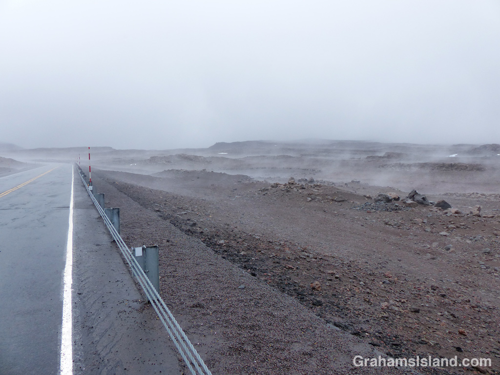
The idea of The Numbers Game is to enter a number into the search bar of your computer and then post a selection of the photos that turn up. This week’s number is 147. Captions are on the photos. You can see more responses here.

The idea of The Numbers Game is to enter a number into the search bar of your computer and then post a selection of the photos that turn up. This week’s number is 147. Captions are on the photos. You can see more responses here.
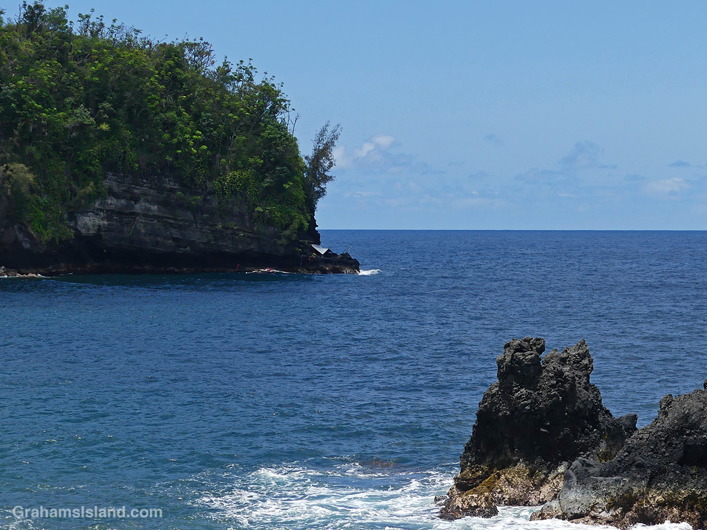
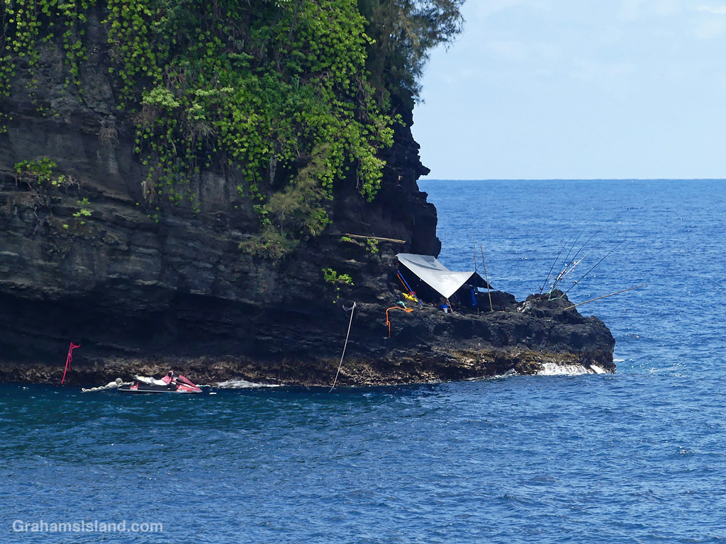
Last weekend, there was an island-wide fishing tournament. I’d seen people camped out the day before the event, when I went on my walk around Upolu, but on the day, I was on the east side of the island.
This camp caught my eye for its location, at the foot of a steep, wooded cliff. I don’t know whether there’s a path to the spot or whether it’s only accessible by foot. Neither method looks easy, and it’s not a spot I’d want to be in if the winds picked up.
I have no idea how they fared, though they should get some points for bravery. In case you’re wondering, I didn’t enter the tournament, though if I had, I’d have been a strong candidate for dead last!

This week’s Sunday Stills challenge theme is ‘Urban sights.’ See more responses here.
I went to Hilo recently, intending to spend time wandering around the downtown and taking photos. Hilo is the largest town on the island. Naturally, I got distracted on the way, arrived later than intended, and ended up with just a short visit. But while I was there I took these photos.


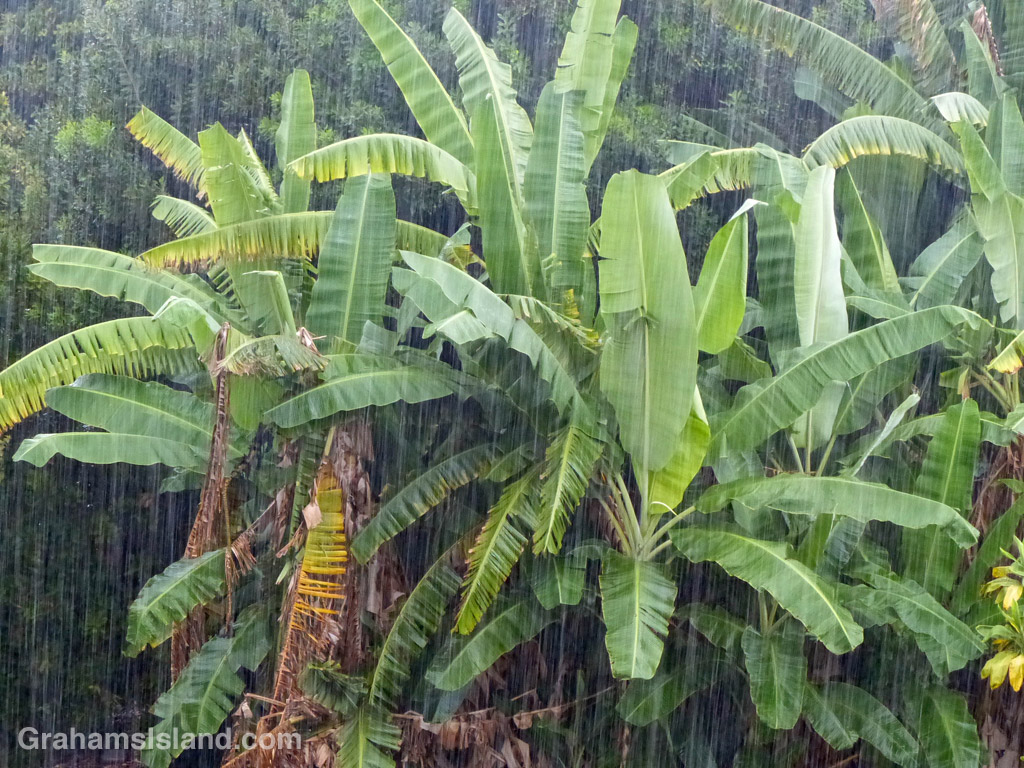
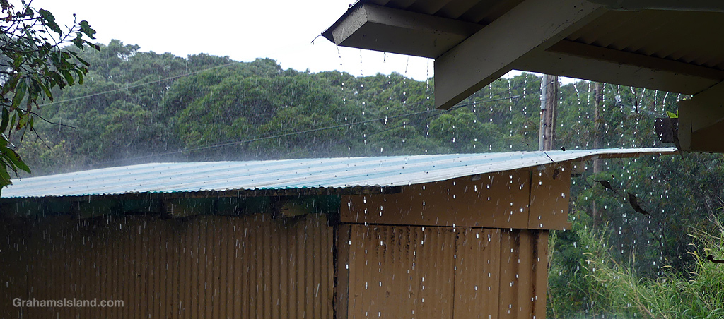
… They go together in this week’s Sunday Stills challenge theme of ‘Rainy Days.’ See more responses here.
There’s plenty of rain on the Big Island. Most falls on the wet east side, but the dry west side can get its share too. Hilo, on the wet side, averages around 140 inches of rain a year, and just to the west of Hilo is an area that gets more than 200 inches a year. In contrast, Kawaihae, on the Kohala coast, gets around 10 inches of rain annually, though I suspect last year was one of its wetter ones.
Where I live, on the northern end of the island, we get around 50 inches of rain a year, but being on the shoulder of Kohala Mountain, that figure can change quickly going a mile east or west, or a mile up the hill or down toward the ocean.
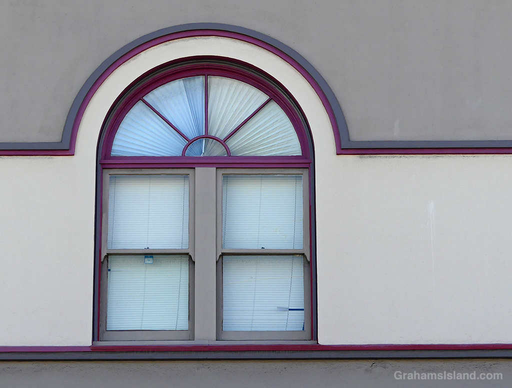

I like Hilo. It’s the largest town on the island, the seat of county government, and it’s been around a good while. I noticed these windows in the Volcano Block while I was eating at a restaurant across the street.
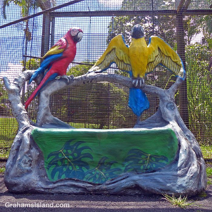
This week’s Sunday Stills challenge theme is ‘Indoor/Outdoor Decor.’ See more responses here.
I don’t have a lot of ‘decor’ photos, but I think this sort of fits the bill. It’s one of several fun benches at Pana’ewa Rainforest Zoo in Hilo. Probably less fun to sit in, but you can’t have everything!
Also posted in response to Becky’s October Squares challenge theme of ‘Past Squares – Blue/Bright.’ See more responses here.
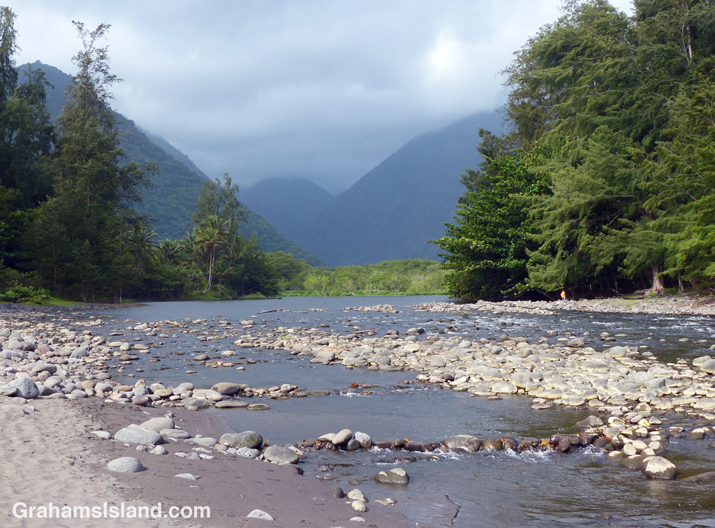
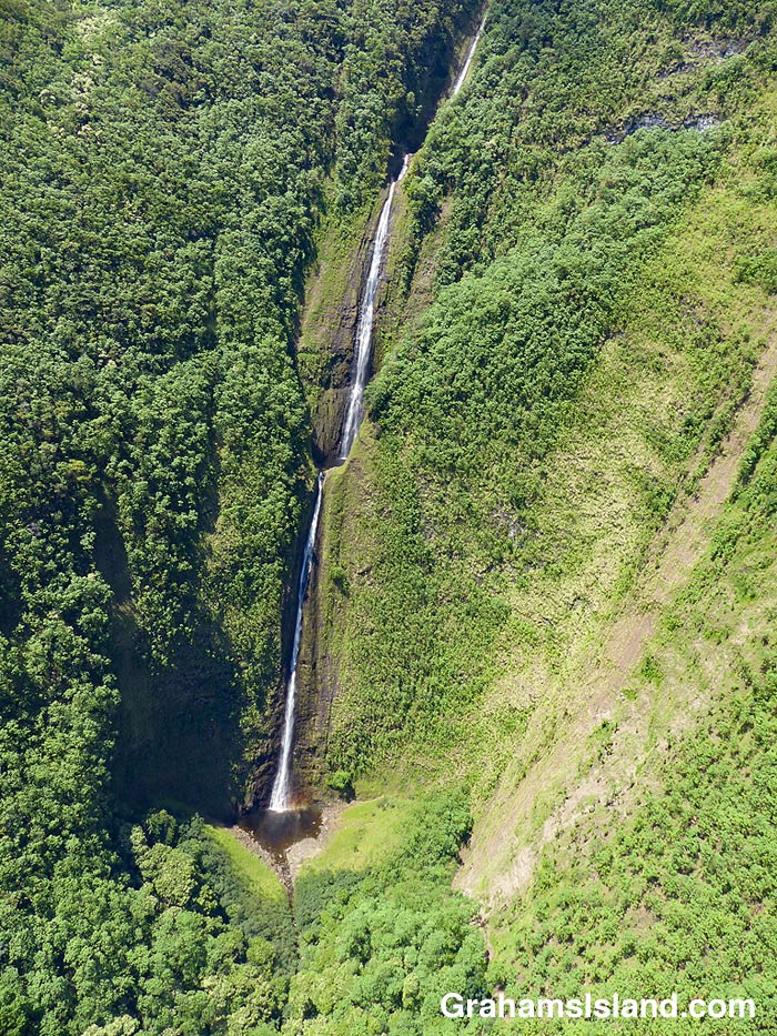
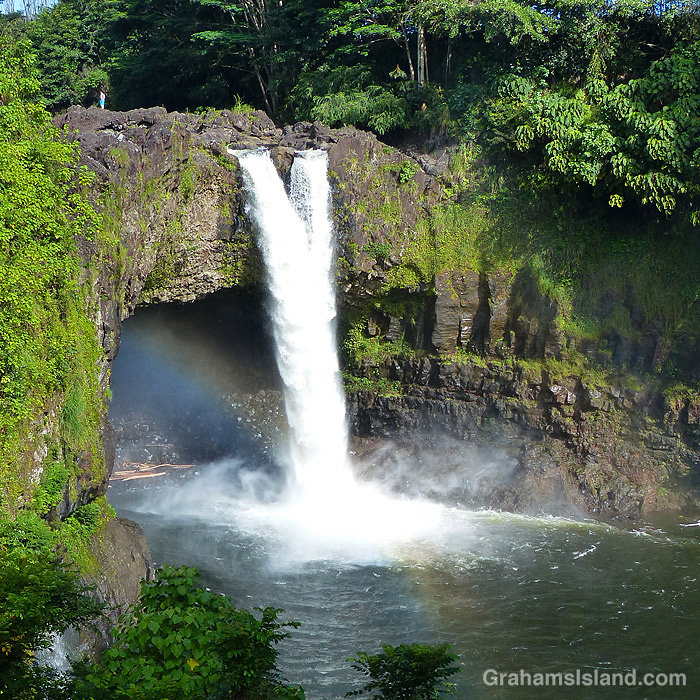
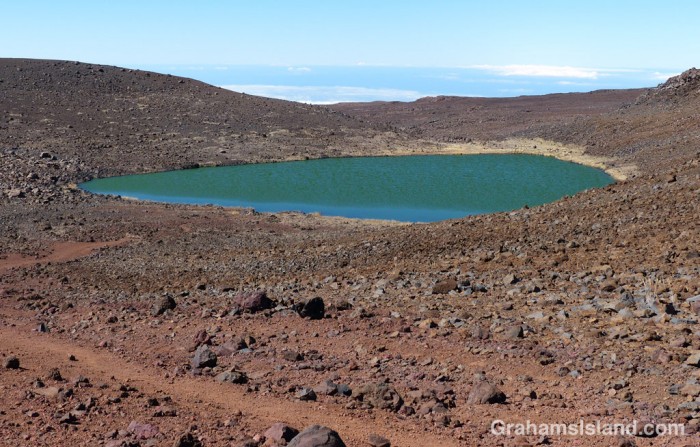
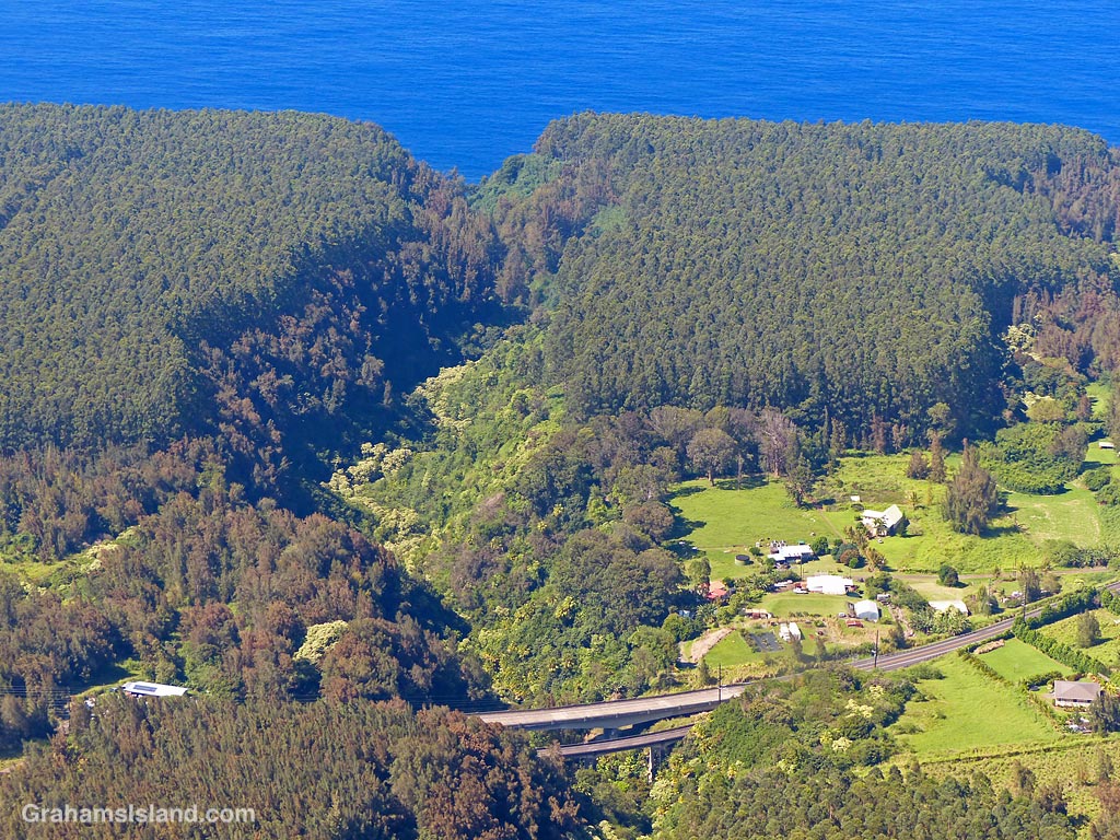
This week’s Sunday Stills challenge theme is ‘Bodies of Water.’ (See more responses here.) Last Sunday, I posted photos of the Kohala valleys. This week, I’m posting a bit about what goes on in them and elsewhere on the island.
The top photo is shows the mouth of the Waipi’o River looking back toward the cloud shrouded Kohala hills. The river, is fed by water passing over Hi’ilawe Falls and other waterfalls deep in the fingers of the valley. Like all water courses on the Big Island, its flow is greatly increased by the often heavy rainfall.
The second photo shows a waterfall, farther down the coast, cascading into a pool at the bottom before flowing out to the ocean. Some of these waterfalls drop more than a thousand feet. Some cascade into valleys, some directly into the ocean. During dry spells, the water flows are greatly reduced and many falls, those that are entirely rain fed, disappear for a while. When rains are heavy, the water flow is so great that some falls blend together to form a sheet of falling water.
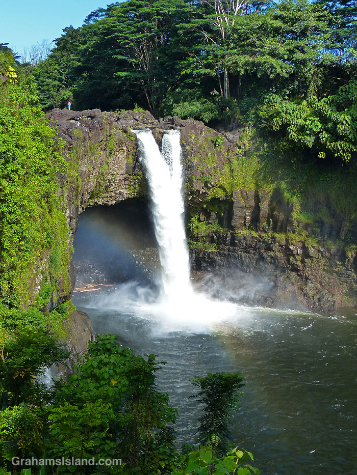
On the east side of the island is Wailuku River, the longest river on the island. This flows down to the ocean in Hilo, and on its way, tumbles over the aptly named Rainbow Falls (third photo). The falls and rainbows are best seen in the early morning. This stretch of the river is very dangerous with flash floods being common. People get swept away here every year.
Finally, the bottom photo shows the biggest lake on the island, which can be found at the top of Mauna Kea! Lake Waiau is fed by rainwater and snow melt, mostly in the winter. That it exists at all is something of a mystery. The ground on Mauna Kea is highly permeable, and it’s not fully understood what the layer is beneath Lake Waiau that enables it to retain water. Lake Waiau is not just the biggest lake on the island, it’s the only one. Green Lake, the biggest lake previously, disappeared during Kilauea’s 2018 eruption (photos and story here).
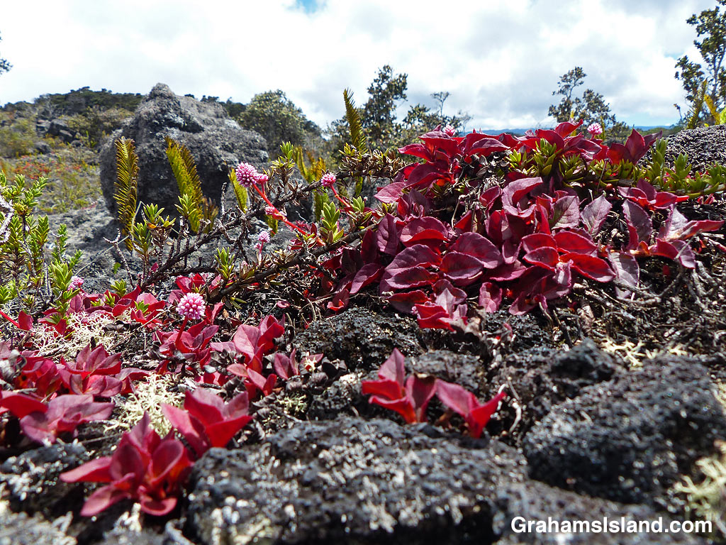
This week’s Friendly Friday challenge theme is ‘The Color Pink.’ See more responses here.
Pinkhead smartweed (Polygonum capitatum or Persicaria capitata) is a groundcover that hails from western China and the Himalayas. It’s variously known as pinkhead knotweed, pink knotweed, Japanese knotweed, pink-headed persicaria, or pink bubble persicaria. I use pinkhead smartweed for the very good reason that I like the name. It sounds like the name of someone pretentious, but slightly seedy, from the alleged upper crust of society.
In this bounty of names, a couple of elements stand out. One is ‘pink,’ the other is ‘weed.’ This is a very pink plant and, in Hawaii and elsewhere, an invasive weed. Drive eastbound over Saddle Road (officially Hawaii Route 200, the Daniel K. Inouye Highway) and, once you cross the saddle and begin your descent, this plant will become obvious very quickly. It lines the road on both sides for several miles with very little in the way of other plants competing for that space. This is because pinkhead smartweed will grow in poor ground and lava fields fit that description.
This is also a stretch of highway that, relatively recently, was converted from a narrow, winding road, that rental car companies routinely forbid their clients from driving on, to a wide, smooth thoroughfare, the only place on the island where you can legally go 60 mph, and where you can expect to receive a ticket if you go 80 mph like everybody else.
Redoing the road left verges of rock and gravel and very little else. Pinkhead smartweed was quick to move in and colonize this unpromising territory so that now the descent toward Hilo begins with pleasing pink borders.
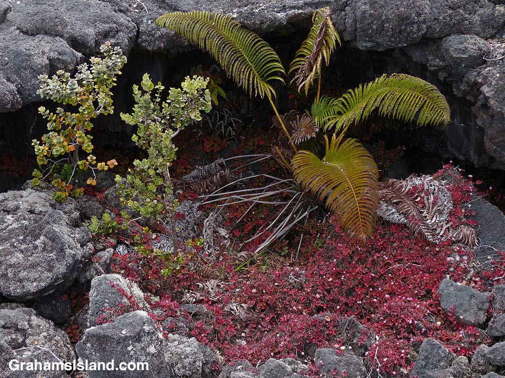
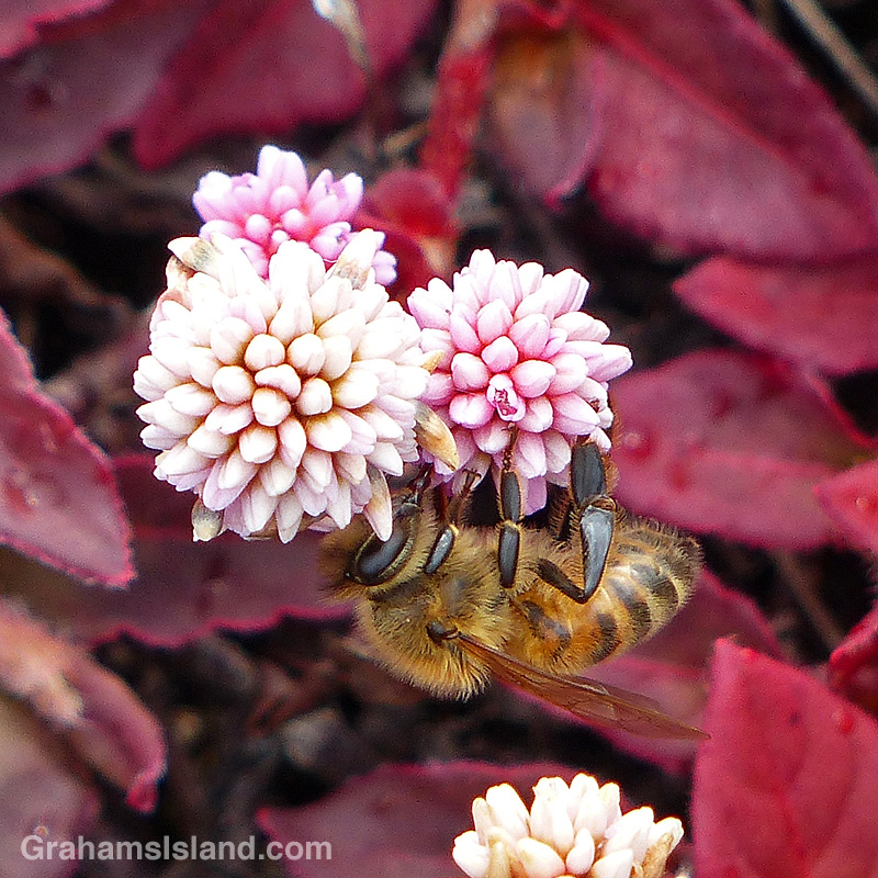
The top photo shows the rugged kind of ground pinkhead smartweed can grow in. To the right, bees appreciate the flowers of this plant growing at an elevation over 5,000 feet. Below, the collapse of a lava tube has left a shady hole where pinkhead smartweed, an endemic amaumau fern, and an ohia tree have established a good foothold.